1960s Maps of Dewey County, Oklahoma
Explore 11 historic maps of Dewey County from the 1960s. These maps offer a rare glimpse into what life looked like during the 1960s — showing old roads, neighborhoods, homes, and landmarks that have changed or disappeared over time.
Whether you're researching your family's past, planning a metal detecting trip, or studying how Dewey County's landscape evolved across the 1960s, these high-resolution maps are a powerful tool for exploring the history of this region.
- Focus on a specific era: All maps on this page are from the 1960s, giving you a focused view of this time period.
- See what’s changed: Compare century-old streets, trails, and buildings to today's modern landscape using overlays and satellite layers.
- Research with precision: Use these maps for genealogy, historical research, land use analysis, or educational projects.
- View, download, or print: Maps are fully viewable online in high resolution, and can be downloaded or printed for your own records.
Start exploring Dewey County's history through authentic maps from the 1960s. This is your window into the past.
Dewey County, OK maps
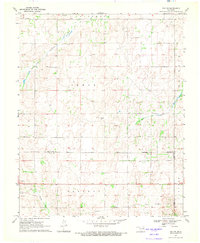
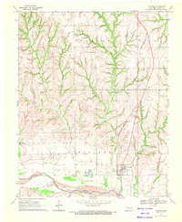
(11)- 1961 Map of Leedey, 1963 Print
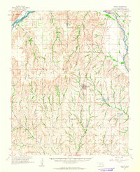 1961 Leedey1963 Print · USGSIn the early 1960s, Western Oklahoma's agrarian character was defined by the intersection of rail lines and quiet rural communities. Researchers can trace the legacy of early settlers through numerous landmarks like Evergreen Cem, Liberty Center Ch, and the winding Canadian River.2 unique versions available
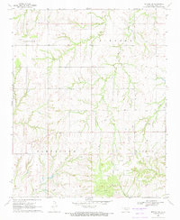
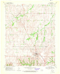
 - 1962 Map of Putnam, 1964 Print
 1962 Putnam1964 Print · USGSWestern Oklahoma’s canyonlands and rural townships are captured here in the early sixties as the energy industry began to dot the plains. Researchers can locate many family burial sites and country congregations like Fairview Cem, Liberty Cem, and Independence Ch.2 unique versions available
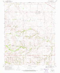
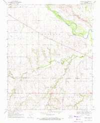
 - 1962 Map of Aledo, 1964 Print
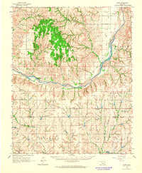 1962 Aledo1964 Print · USGSDewey County in the early sixties shows a landscape of braided riverbeds and prairie settlements centered on the Canadian River. Local historians can trace old community hubs like Webb and Aledo, or find rural landmarks like Prairie Bell Ch and Riverview Cem.
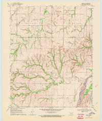
 - 1964 Map of Oakwood, 1965 Print
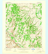 1964 Oakwood1965 Print · USGSWestern Oklahoma is captured here in the mid-1960s as a landscape of rural townships and developing oil fields. Researchers can trace family roots through several country churches and cemeteries like Mt Pleasant Ch, Mt Hope Cem, and the village of Eagle City.2 unique versions available
 - 1969 Map of Vici NW, 1971 Print
 1969 Vici NW1971 Print · USGSWestern Oklahoma’s ranching and oil country is captured here during the late sixties, where county lines follow the Old Indian Treaty Boundary. Researchers can trace the courses of North Persimmon Creek and Turkey Creek alongside landmarks like local Landing Strips and a Caliche Pit.
 - 1969 Map of Mutual SW, 1971 Print
 1969 Mutual SW1971 Print · USGSDewey County, Oklahoma, is captured here in the late sixties as the local oil industry began to shape the rural landscape. Genealogists and historians can trace family roots through landmarks like Bloomfield Cem, Cane Creek Ch, and the winding path of Kizer Creek.
 - 1969 Map of Mutual, 1972 Print
 1969 Mutual1972 Print · USGSMutual and the surrounding Woodward and Dewey County borderlands are captured here in the late sixties, showing a landscape defined by ranching and the nascent energy industry. Researchers can trace the Old Indian Treaty Boundary and locate family sites like Persimmon Cem, Sunny Side Cem, or the Church of the First Born.
 - 1969 Map of Lenora, 1972 Print
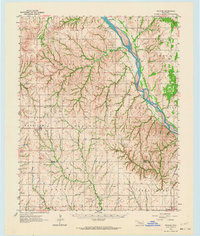
 1969 Lenora1972 Print · USGSDewey County at the end of the sixties reveals a rural landscape deeply marked by the energy industry and the winding Canadian River. Researchers can trace old family sites near Riley Cem or locate industrial landmarks like the sprawling GAS FIELD and early Oil Well sites.
 - 1969 Map of Camargo, 1972 Print
 1969 Camargo1972 Print · USGSThe town of Camargo and the surrounding Dewey County uplands are captured here in the late 1960s. Researchers can trace the Missouri-Kansas-Texas railroad line, locate the Camargo Cem, and find landmarks like the Cree Ranch Landing Strip.
 - 1969 Map of Vici, 1972 Print
 1969 Vici1972 Print · USGSDewey and Woodward Counties are captured in the late sixties as the agricultural and rail life of the Oklahoma plains centered on the town of Vici. Genealogists and historians can trace family locations near Vassar Cem, South Persimmon Ch, and the historic Old Indian Treaty Boundary.
 - 1969 Map of Mutual NE, 1972 Print
 1969 Mutual NE1972 Print · USGSThe Woodward and Dewey County line area in the late sixties reveals a landscape shaped by early territories and river hydrology. Researchers can locate the Old Indian Treaty Boundary and trace family sites near Dunlap Cem and the settlement of Cestos.
End of results
Showing maps 1-11 of 11
Top cities of Dewey County
- Seiling historical maps
- Vici historical maps
- Taloga historical maps
- Leedey historical maps
- Camargo historical maps
- Oakwood historical maps
See more
Frequently asked questions
- What are the different types of historical maps available for Dewey County?
- What is the oldest map of Dewey County?
- Where can I purchase historical maps of Dewey County for my home or office?
- Where can I download high-res historical maps of Dewey County?
- Are there historical topographic maps available for Dewey County?
- Is there historical aerial imagery available for Dewey County?
- Where are historical maps of Dewey County sourced from?