1980s Maps of Dewey County, Oklahoma
Explore 18 historic maps of Dewey County from the 1980s. These maps offer a rare glimpse into what life looked like during the 1980s — showing old roads, neighborhoods, homes, and landmarks that have changed or disappeared over time.
Whether you're researching your family's past, planning a metal detecting trip, or studying how Dewey County's landscape evolved across the 1980s, these high-resolution maps are a powerful tool for exploring the history of this region.
- Focus on a specific era: All maps on this page are from the 1980s, giving you a focused view of this time period.
- See what’s changed: Compare century-old streets, trails, and buildings to today's modern landscape using overlays and satellite layers.
- Research with precision: Use these maps for genealogy, historical research, land use analysis, or educational projects.
- View, download, or print: Maps are fully viewable online in high resolution, and can be downloaded or printed for your own records.
Start exploring Dewey County's history through authentic maps from the 1980s. This is your window into the past.
Dewey County, OK maps
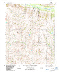
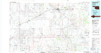
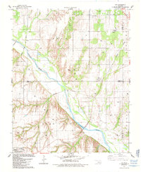
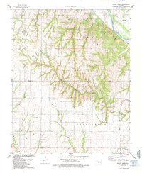
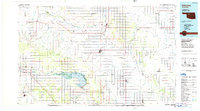
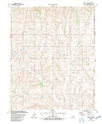
(18)- 1984 Map of Foss Reservoir
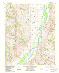
 1984 Foss Reservoir1984 Print · USGSWestern Oklahoma’s river valleys and prairie grasslands are captured here in the mid-eighties, a period of established reservoirs and active energy production. Researchers can trace rural lineages through local hubs like Cheyenne and Hammon or locate landmarks such as the Antelope Hills and Foss Reservoir.
 - 1984 Map of Rhea, 1985 Print
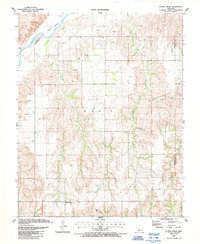
 1984 Rhea1985 Print · USGSThe rural landscape of Western Oklahoma is captured here in the mid-1980s as the regional energy economy expanded. Genealogists and local historians can trace family locations near the German Cem, the settlement of Rhea, and the Center Point Cem.
 - 1985 Map of Aledo
 1985 Aledo1985 Print · USGSWestern Oklahoma’s rolling plains were captured in the mid-1980s at a time of active energy exploration along the Canadian River. Genealogists and local historians can trace legacy sites like Aledo, Burmah, and the Prairie Bell Ch in this detailed rural survey.
 - 1985 Map of Watonga
 1985 Watonga1985 Print · USGSCentral Oklahoma in the mid-eighties shows a robust network of river-valley settlements and rural rail lines. Genealogists and historians can trace the footprint of Southwestern State College, the historic Fort Reno, and family-named landmarks like Dead Women Crossing.2 unique versions available
 - 1985 Map of Webb
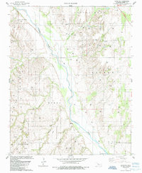
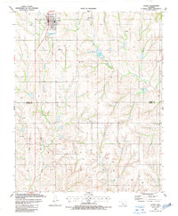
 1985 Webb1985 Print · USGSDewey County petroleum and ranching lands are documented here in the mid-1980s as they transition toward the Canadian River. Genealogists and local historians can trace family locations near Webb or investigate historic burials at Riverview Cem and Yake Cem.
 - 1985 Map of Putnam
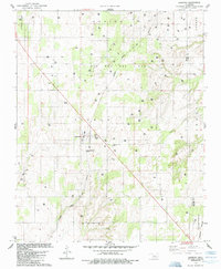
 1985 Putnam1985 Print · USGSIn the mid-1980s, the borderlands of Dewey and Custer Counties were a hub of energy production and rural agriculture. Genealogists can locate family sites near Putnam or trace records at Merck Cem, Liberty Cem, and the Independence Ch church.
 - 1985 Map of Aledo NE
 1985 Aledo NE1985 Print · USGSIn the mid-1980s, the Dewey County landscape was a hybrid of traditional Oklahoma ranching and intensive energy production. Genealogists and researchers can locate the Raymond Cem and trace the heavy concentration of industrial sites like the Gas Plant and Compressor Station.
 - 1985 Map of Oakwood
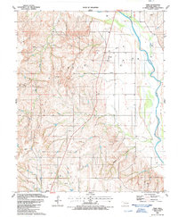
 1985 Oakwood1985 Print · USGSOakwood and the surrounding Dewey County plains are captured in the mid-1980s during a peak of regional energy production. Researchers can locate family sites near Oakwood Cem or trace the path of the Atchison Topeka and Santa Fe railroad.
 - 1985 Map of Parallel
 1985 Parallel1985 Print · USGSDewey County in the mid-eighties shows a landscape dominated by the energy industry and the wide sweep of the Canadian River. Genealogists and historians can locate several rural burial grounds like Little Robe Cem and trace the path of the Dawson Trail.
 - 1985 Map of Putnam NW
 1985 Putnam NW1985 Print · USGSMid-century Dewey County is captured here during a peak of energy production, showing a landscape defined by industry and rural roots. Researchers can trace the development of the Dawson Oil Field and Taloga Oil and Gas Field while locating local landmarks like Fairview Cemetery.
 - 1985 Map of Woodward
 1985 Woodward1985 Print · USGSNorthwest Oklahoma during the mid-eighties shows a landscape defined by cattle country, energy production, and historic rail towns. Researchers can trace the Old Indian Treaty Boundary and find local landmarks like Crystal Beach Lake and Boiling Springs State Park.2 unique versions available
 - 1985 Map of Fay
 1985 Fay1985 Print · USGSThe Canadian River valley in the mid-1980s reveals a landscape defined by deep-cut creeks and major rail infrastructure. Genealogists and historians can trace family plots at Mt Hope Cem or follow the paths of the Burlington Northern and Atchison Topeka and Santa Fe railroads through Fay and Nobscot.
 - 1985 Map of Rough Creek
 1985 Rough Creek1985 Print · USGSThe borderlands of Dewey and Custer counties come into focus in the mid-1980s, revealing a landscape where energy extraction meets traditional rail-line commerce. Researchers can locate the Bethel Cemetery, trace the Atchison Topeka and Santa Fe railroad into Thomas, and find numerous Gas Wells across the hills.
 - 1986 Map of Fairview
 1986 Fairview1986 Print · USGSMajor County and the Cimarron River valley are shown here in the mid-1980s as the rail networks of the Atchison Topeka and Santa Fe still linked the plains. Researchers can trace rural lineages through settlements like Cheyenne Valley, Bouse Junction, and the terrain surrounding Canton Lake.2 unique versions available
 - 1987 Map of Leedey SW
 1987 Leedey SW1987 Print · USGSRoger Mills and Dewey counties in the late 1980s reveal a landscape of deep-rooted rural communities and expanding energy infrastructure. Genealogists and historians can trace local family landmarks like the Dewey Cem, Red Star Ch, and the settlement of Angora.
 - 1987 Map of Flying Creek
 1987 Flying Creek1987 Print · USGSWestern Oklahoma in the late eighties reveals a landscape shaped by the energy industry and rural community life. Trace family history at Liberty Center or locate burial sites at Center Chapel Cem and Shirley Cem.
 - 1987 Map of Leedey
 1987 Leedey1987 Print · USGSWest Oklahoma's rural landscape is captured here in the late eighties, centered on the grid of Leedey and the surrounding energy fields. Researchers can trace the Old Railroad Grade and locate family burial sites at Evergreen Cem or New Hermon Cem.
 - 1987 Map of Trail
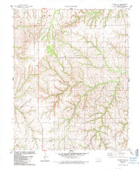
 1987 Trail1987 Print · USGSDewey County energy production and old transportation routes are well-documented in this late 1980s survey. Researchers can trace the Old Railroad Grade and locate family burial sites at Trail Cem among the active gas fields.
End of results
Showing maps 1-18 of 18
Top cities of Dewey County
- Seiling historical maps
- Vici historical maps
- Taloga historical maps
- Leedey historical maps
- Camargo historical maps
- Oakwood historical maps
See more
Frequently asked questions
- What are the different types of historical maps available for Dewey County?
- What is the oldest map of Dewey County?
- Where can I purchase historical maps of Dewey County for my home or office?
- Where can I download high-res historical maps of Dewey County?
- Are there historical topographic maps available for Dewey County?
- Is there historical aerial imagery available for Dewey County?
- Where are historical maps of Dewey County sourced from?