Old Maps of Dewey County, Oklahoma for Hiking & Exploration
Hike through history with 181 historic maps of Dewey County. Explore old trails, ghost towns, and forgotten backroads — perfect for outdoor adventurers and local explorers.
- Rediscover forgotten places: Map out old mining camps, roads, and footpaths that no longer exist on modern maps.
- Layer with modern tools: Combine with LiDAR or satellite views to plan hikes through historical terrain.
- Made for exploration: Popular among hikers, overlanders, and local history lovers.
Use these maps to find adventure and explore the hidden past of Dewey County.
Dewey County, OK maps
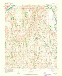
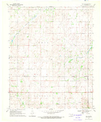
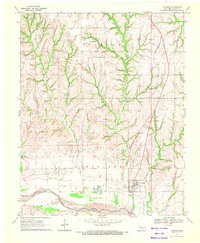
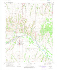
(181)- 1955 Map of Clinton, 1964 Print
 1955 Clinton1964 Print · USGSWestern Oklahoma during the mid-century transition shows a landscape of growing reservoirs and active military flight lines. Genealogists and historians can locate rural landmarks such as Mountain View Church, Berlin School, and the Riverside Indian School Reserve.3 unique versions available
 - 1955 Map of Woodward, 1967 Print
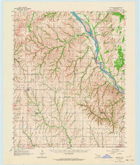
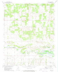
 1955 Woodward1967 Print · USGSNorthwest Oklahoma and the bordering plains are captured during the mid-sixties, showing a landscape defined by river valleys and massive water projects. Researchers can trace family roots in towns like Woodward and Alva or locate landmarks such as the Western Oklahoma State Hospital and Kegelman AF.3 unique versions available
 - 1957 Map of Clinton
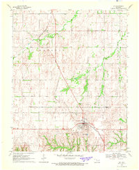
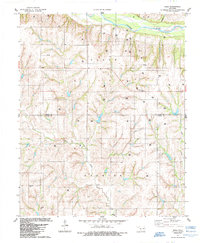
 1957 Clinton1957 Print · USGSWestern Oklahoma in the mid-fifties is captured here as a landscape of river-valley settlements and emerging energy fields. Genealogists can trace family roots through numerous rural landmarks like the Swapping Back Indian School, Hebron Church, and the Riverside Indian School Reserve.
 - 1958 Map of Woodward
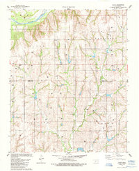
 1958 Woodward1958 Print · USGSNorthwest Oklahoma and the neighboring panhandle borders are shown here during a period of steady mid-century growth. Researchers can trace the rail networks of the Atchison Topeka and Santa Fe and locate landmarks like the Western Oklahoma State Hospital and Port Supply Reservoir.2 unique versions available
 - 1961 Map of Leedey, 1963 Print
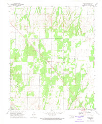
 1961 Leedey1963 Print · USGSIn the early 1960s, Western Oklahoma's agrarian character was defined by the intersection of rail lines and quiet rural communities. Researchers can trace the legacy of early settlers through numerous landmarks like Evergreen Cem, Liberty Center Ch, and the winding Canadian River.2 unique versions available
 - 1962 Map of Putnam, 1964 Print
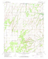
 1962 Putnam1964 Print · USGSWestern Oklahoma’s canyonlands and rural townships are captured here in the early sixties as the energy industry began to dot the plains. Researchers can locate many family burial sites and country congregations like Fairview Cem, Liberty Cem, and Independence Ch.2 unique versions available
 - 1962 Map of Aledo, 1964 Print
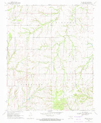
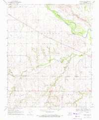
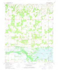
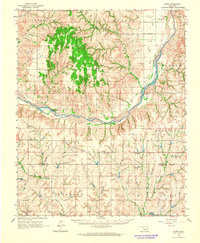 1962 Aledo1964 Print · USGSDewey County in the early sixties shows a landscape of braided riverbeds and prairie settlements centered on the Canadian River. Local historians can trace old community hubs like Webb and Aledo, or find rural landmarks like Prairie Bell Ch and Riverview Cem.
 - 1964 Map of Oakwood, 1965 Print
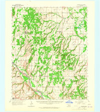 1964 Oakwood1965 Print · USGSWestern Oklahoma is captured here in the mid-1960s as a landscape of rural townships and developing oil fields. Researchers can trace family roots through several country churches and cemeteries like Mt Pleasant Ch, Mt Hope Cem, and the village of Eagle City.2 unique versions available
 - 1969 Map of Vici NW, 1971 Print
 1969 Vici NW1971 Print · USGSWestern Oklahoma’s ranching and oil country is captured here during the late sixties, where county lines follow the Old Indian Treaty Boundary. Researchers can trace the courses of North Persimmon Creek and Turkey Creek alongside landmarks like local Landing Strips and a Caliche Pit.
 - 1969 Map of Mutual SW, 1971 Print
 1969 Mutual SW1971 Print · USGSDewey County, Oklahoma, is captured here in the late sixties as the local oil industry began to shape the rural landscape. Genealogists and historians can trace family roots through landmarks like Bloomfield Cem, Cane Creek Ch, and the winding path of Kizer Creek.
 - 1969 Map of Mutual, 1972 Print
 1969 Mutual1972 Print · USGSMutual and the surrounding Woodward and Dewey County borderlands are captured here in the late sixties, showing a landscape defined by ranching and the nascent energy industry. Researchers can trace the Old Indian Treaty Boundary and locate family sites like Persimmon Cem, Sunny Side Cem, or the Church of the First Born.
 - 1969 Map of Lenora, 1972 Print
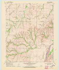 1969 Lenora1972 Print · USGSDewey County at the end of the sixties reveals a rural landscape deeply marked by the energy industry and the winding Canadian River. Researchers can trace old family sites near Riley Cem or locate industrial landmarks like the sprawling GAS FIELD and early Oil Well sites.
 - 1969 Map of Camargo, 1972 Print
 1969 Camargo1972 Print · USGSThe town of Camargo and the surrounding Dewey County uplands are captured here in the late 1960s. Researchers can trace the Missouri-Kansas-Texas railroad line, locate the Camargo Cem, and find landmarks like the Cree Ranch Landing Strip.
 - 1969 Map of Vici, 1972 Print
 1969 Vici1972 Print · USGSDewey and Woodward Counties are captured in the late sixties as the agricultural and rail life of the Oklahoma plains centered on the town of Vici. Genealogists and historians can trace family locations near Vassar Cem, South Persimmon Ch, and the historic Old Indian Treaty Boundary.
 - 1969 Map of Mutual NE, 1972 Print
 1969 Mutual NE1972 Print · USGSThe Woodward and Dewey County line area in the late sixties reveals a landscape shaped by early territories and river hydrology. Researchers can locate the Old Indian Treaty Boundary and trace family sites near Dunlap Cem and the settlement of Cestos.
 - 1970 Map of Vici SW, 1972 Print
 1970 Vici SW1972 Print · USGSThe borderlands of Ellis and Roger Mills counties are shown in the early 1970s as the high plains descend toward the river. Local researchers can trace family landmarks like Stone Cem and the Cree Ranch near the Canadian River.
 - 1972 Map of Canton NW, 1974 Print
 1972 Canton NW1974 Print · USGSThe rural landscapes of Major and Dewey Counties are captured here in the early 1970s, centered on the waters of Canton Lake. Genealogists and local historians can trace family locations near the Fern Cliff Cem, the settlement of Bado, and Midway Ch.
 - 1972 Map of Hucmac, 1974 Print
 1972 Hucmac1974 Print · USGSDewey County in the early seventies is a landscape of high plains and deep creek draws. Genealogists and local historians can trace the rural infrastructure around Hucmac, including the Monice Cemetery, the Church of Christ, and the banks of Little Robe Creek.2 unique versions available
 - 1972 Map of Canton SW, 1974 Print
 1972 Canton SW1974 Print · USGSNorthwestern Oklahoma in the early seventies shows a landscape where energy production meets public recreation along the Dewey County line. Researchers can trace the Atchison Topeka and Santa Fe rail line, locate Fountain Cem, and explore the Oil Field surrounding Canton Lake.
 - 1972 Map of Seiling, 1974 Print
 1972 Seiling1974 Print · USGSNorthwest Oklahoma's river valley comes alive in this early 1970s survey centered on the junction of Dewey, Major, and Woodward counties. Genealogists and local historians can locate Elm Grove Ch, Brumfield Cem, and the civic layout of Seiling and Chester.
 - 1972 Map of Taloga, 1974 Print
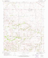
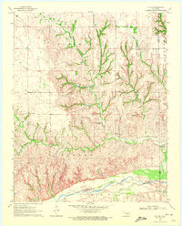
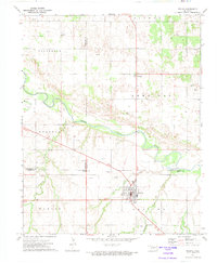
 1972 Taloga1974 Print · USGSThe Dewey County seat of Taloga is captured in the early 1970s, situated along the banks of the Canadian River. Genealogists and local researchers can locate the Taloga Cem and trace industrial activity at various Sandpits and the local Gas Field.
 - 1972 Map of Orion, 1974 Print
 1972 Orion1974 Print · USGSMajor and Dewey Counties are captured in the early 1970s, showcasing the winding North Canadian River valley and its surrounding farmland. Researchers can locate family landmarks like Orion Cem and Hope Cem, or trace the settlement at Orion.
 - 1984 Map of Foss Reservoir
 1984 Foss Reservoir1984 Print · USGSWestern Oklahoma’s river valleys and prairie grasslands are captured here in the mid-eighties, a period of established reservoirs and active energy production. Researchers can trace rural lineages through local hubs like Cheyenne and Hammon or locate landmarks such as the Antelope Hills and Foss Reservoir.
 - 1984 Map of Rhea, 1985 Print
 1984 Rhea1985 Print · USGSThe rural landscape of Western Oklahoma is captured here in the mid-1980s as the regional energy economy expanded. Genealogists and local historians can trace family locations near the German Cem, the settlement of Rhea, and the Center Point Cem.
 - 1985 Map of Aledo
 1985 Aledo1985 Print · USGSWestern Oklahoma’s rolling plains were captured in the mid-1980s at a time of active energy exploration along the Canadian River. Genealogists and local historians can trace legacy sites like Aledo, Burmah, and the Prairie Bell Ch in this detailed rural survey.
Showing maps 1-25 of 181
Top cities of Dewey County
- Seiling historical maps
- Vici historical maps
- Taloga historical maps
- Leedey historical maps
- Camargo historical maps
- Oakwood historical maps
See more
Frequently asked questions
- What are the different types of historical maps available for Dewey County?
- What is the oldest map of Dewey County?
- Where can I purchase historical maps of Dewey County for my home or office?
- Where can I download high-res historical maps of Dewey County?
- Are there historical topographic maps available for Dewey County?
- Is there historical aerial imagery available for Dewey County?
- Where are historical maps of Dewey County sourced from?