1970s Maps of Ellis County, Oklahoma
Explore 19 historic maps of Ellis County from the 1970s. These maps offer a rare glimpse into what life looked like during the 1970s — showing old roads, neighborhoods, homes, and landmarks that have changed or disappeared over time.
Whether you're researching your family's past, planning a metal detecting trip, or studying how Ellis County's landscape evolved across the 1970s, these high-resolution maps are a powerful tool for exploring the history of this region.
- Focus on a specific era: All maps on this page are from the 1970s, giving you a focused view of this time period.
- See what’s changed: Compare century-old streets, trails, and buildings to today's modern landscape using overlays and satellite layers.
- Research with precision: Use these maps for genealogy, historical research, land use analysis, or educational projects.
- View, download, or print: Maps are fully viewable online in high resolution, and can be downloaded or printed for your own records.
Start exploring Ellis County's history through authentic maps from the 1970s. This is your window into the past.
Ellis County, OK maps
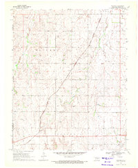
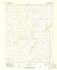
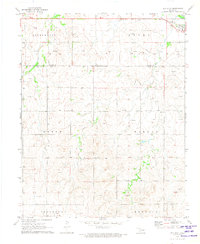
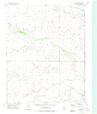
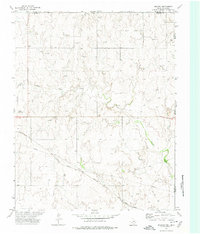
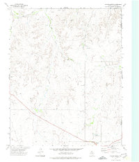
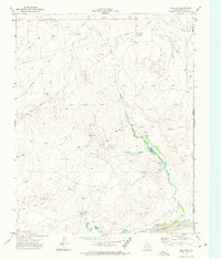
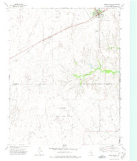
(19)- 1970 Map of Arnett, 1972 Print
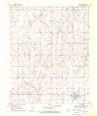 1970 Arnett1972 Print · USGSWestern Oklahoma’s high plains are documented here in the early seventies, centered on the county seat of Arnett. Genealogists and historians can trace the Old Indian Treaty Boundary and locate family sites at Debolt Cem or the Seventh-Day Adventist Cem.
 - 1970 Map of Harmon, 1972 Print
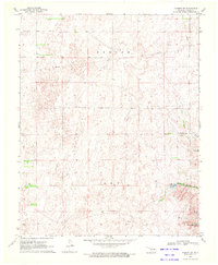
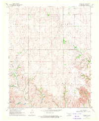
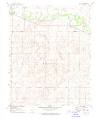
 1970 Harmon1972 Print · USGSNorthwestern Oklahoma in the early seventies reveals a landscape defined by ranching and the energy industry. Researchers can trace the Old Indian Treaty Boundary and locate local landmarks like the Harmon Cem and the Oil Refinery.2 unique versions available
 - 1970 Map of Arnett SE, 1972 Print
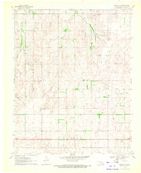
 1970 Arnett SE1972 Print · USGSThe rural borders of Ellis and Roger Mills counties are documented here in 1970, centered on the Canadian River valley. Researchers can locate the Grand Cem and trace the paths of Mosquito Creek and Commission Creek.
 - 1970 Map of Harmon SW, 1972 Print
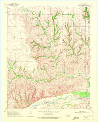
 1970 Harmon SW1972 Print · USGSEllis County's energy landscape is captured here in the early seventies during a period of active fossil fuel development. Researchers can trace the extent of the Benton Gas and Oil Field and locate water sources like Carlton Lake and Little Cottonwood Lake.
 - 1970 Map of Arnett SW, 1972 Print
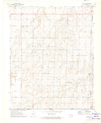
 1970 Arnett SW1972 Print · USGSThe Oklahoma-Texas border comes into focus in 1970, showing the high plains landscape of Ellis County during a period of steady resource extraction. You can trace the rural landscape from Allmon Cem to the waters of Lake Lloyd Vincent and the Little Robe drainage.
 - 1970 Map of Goodwin, 1972 Print
 1970 Goodwin1972 Print · USGSThe Oklahoma Panhandle borderlands are captured here in the early seventies as the cattle and rail economy shaped Ellis County. Genealogists and historians can trace the Atchison Topeka and Santa Fe rail line past Goodwin and the Old Indian Treaty Boundary.
 - 1970 Map of Harmon SE, 1972 Print
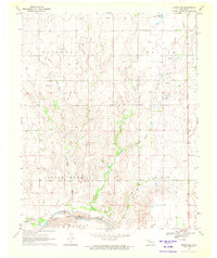
 1970 Harmon SE1972 Print · USGSEllis County ranchlands in the late sixties are captured here as a network of fence lines and winding creek beds. Genealogists and land historians can locate Lone Star Cem or trace property boundaries near Little Cottonwood Lake and South Turkey Creek.
 - 1970 Map of Harmon NW, 1972 Print
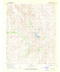
 1970 Harmon NW1972 Print · USGSNorthwestern Ellis County in the early seventies reveals a landscape shaped by historical boundaries and early energy infrastructure. Genealogists and researchers can trace the Old Indian Treaty Boundary and locate early Gas Wells or the Sandpit near Wolf Creek.
 - 1970 Map of Vici SW, 1972 Print
 1970 Vici SW1972 Print · USGSThe borderlands of Ellis and Roger Mills counties are shown in the early 1970s as the high plains descend toward the river. Local researchers can trace family landmarks like Stone Cem and the Cree Ranch near the Canadian River.
 - 1970 Map of Laverne SW, 1973 Print
 1970 Laverne SW1973 Print · USGSThe borderlands of Ellis and Harper Counties are captured here during the 1970s energy boom. Genealogists and historians can trace the rural township lines of Speermoore and Otter, locating landmarks like Speermoore Cem and the Caliche Pit.2 unique versions available
 - 1971 Map of May East, 1973 Print
 1971 May East1973 Print · USGSThe rural landscape of Ellis County is captured here in the early 1970s as energy production and rail transport shaped the plains. Researchers can locate the town of May, trace the Missouri - Kansas - Texas railroad, and find local landmarks like Mt Olive Ch.
 - 1971 Map of Fort Supply, 1973 Print
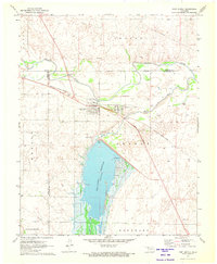 1971 Fort Supply1973 Print · USGSNorthwest Oklahoma’s landscape in the early seventies centers on the vital waters of the Fort Supply Reservoir. Local researchers can trace the Missouri - Kansas - Texas rail line or locate family sites near Fairlawn Cem and the Western State Hospital.
 - 1971 Map of Slapout, 1973 Print
 1971 Slapout1973 Print · USGSThe Oklahoma Panhandle near Slapout is documented in the early seventies during a period of significant energy development. Local historians can trace family ties at Poplar Grove Cem and Fairview Ch or map the growth of natural gas infrastructure through dozens of Gas Wells.
 - 1971 Map of May West, 1973 Print
 1971 May West1973 Print · USGSThe rural borderlands of Ellis and Harper Counties are captured in the early 1970s, during a period of active energy development. Genealogists and historians can trace local family landmarks and burial sites like May Cem near the town of May or follow the M-K-T rail line.
 - 1972 Map of Follett SE, 1974 Print
 1972 Follett SE1974 Print · USGSThe Texas Panhandle's high plains meet the Oklahoma border in the early seventies, showing a landscape defined by water and energy. Researchers can trace the paths of Mammoth Creek and Wolf Creek or locate industrial sites like the Gravel Pit and scattered Gas Wells.
 - 1972 Map of Magoun, 1974 Print
 1972 Magoun1974 Print · USGSThe High Plains borderlands of Texas and Oklahoma are captured here in the early 1970s, as energy production and rail transit defined the local economy. Researchers can locate Fairmont Cem, trace the ATCHISON TOPEKA AND SANTA FE railroad, and find the small settlement at Magoun.
 - 1972 Map of Higgins North, 1974 Print
 1972 Higgins North1974 Print · USGSThe Texas Panhandle meets the Oklahoma border in the early seventies, centered on the railroad town of Higgins. Researchers can trace the industrial landscape of the plains through numerous Gas Wells, the A T & S F tracks, and the local Cem.
 - 1972 Map of Dreyfoos, 1974 Print
 1972 Dreyfoos1974 Print · USGSHemphill County and the Oklahoma border are captured here in the early 1970s during a period of active oil exploration and ranching. Researchers can trace the network of oil wells around Dreyfoos or locate landmarks like Goettsche Lake and the McQuiddy Curves.
 - 1972 Map of Higgins South, 1974 Print
 1972 Higgins South1974 Print · USGSLipscomb County at the start of the 1970s shows a landscape defined by the Atchison Topeka and Santa Fe and the energy sector. Genealogists and researchers can trace the town of Higgins, its Municipal Airfield, and the Feldman Oil and Gas Field.
End of results
Showing maps 1-19 of 19
Top cities of Ellis County
Frequently asked questions
- What are the different types of historical maps available for Ellis County?
- What is the oldest map of Ellis County?
- Where can I purchase historical maps of Ellis County for my home or office?
- Where can I download high-res historical maps of Ellis County?
- Are there historical topographic maps available for Ellis County?
- Is there historical aerial imagery available for Ellis County?
- Where are historical maps of Ellis County sourced from?