
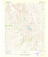
1970 Map of Goodwin
USGS Topo · Published 1972About this map
The Atchison Topeka and Santa Fe railroad cuts diagonally through this corner of Ellis County, anchoring the settlement of Goodwin. This high plains landscape is defined by its legal and territorial history, most notably the Old Indian Treaty Boundary that traverses the central portion of the quadrangle. The terrain is a network of intermittent drainages including Rock Creek, Wolf Creek, and Kiowa Creek, which have carved deep contours into the earth. Local life and history are marked by quiet landmarks like the Christ Lutheran Cem and Emmons Cem, alongside evidence of the region's resources such as several Caliche Pits and gas wells. The map also captures the transition from Texas to Oklahoma, with the state line forming the western edge of this surveyed area.
Find a feature on this map
22 named features on this map. Tap any name to fly to it.
Don’t see what you’re looking for? This feature index may not catch every label — zoom into the map to look around manually.
Map Details
Editions of this 1970 Goodwin Map
This is the sole edition of this map. No revisions or reprints were ever made.
Other maps of this area

1954 · Perryton
USGS Topo · 1:250,000

1955 · Woodward
USGS Topo · 1:250,000

1958 · Perryton
USGS Topo · 1:250,000

1958 · Woodward
USGS Topo · 1:250,000

1969 · Shattuck
USGS Topo · 1:24,000

1969 · Gage
USGS Topo · 1:24,000

1970 · Arnett
USGS Topo · 1:24,000

1970 · Arnett SE
USGS Topo · 1:24,000
1970 · Arnett SW
USGS Topo · 1:24,000

1972 · Follett SE
USGS Topo · 1:24,000