1900s (20th Century) Maps of Pauls Valley, Oklahoma
Explore 8 historic maps of Pauls Valley from the 1900s (20th Century). These maps offer a rare glimpse into what life looked like during the 1900s — showing old roads, neighborhoods, homes, and landmarks that have changed or disappeared over time.
Whether you're researching your family's past, planning a metal detecting trip, or studying how Pauls Valley's landscape evolved across the 1900s, these high-resolution maps are a powerful tool for exploring the history of this region.
- Focus on a specific era: All maps on this page are from the 1900s, giving you a focused view of this time period.
- See what’s changed: Compare century-old streets, trails, and buildings to today's modern landscape using overlays and satellite layers.
- Research with precision: Use these maps for genealogy, historical research, land use analysis, or educational projects.
- View, download, or print: Maps are fully viewable online in high resolution, and can be downloaded or printed for your own records.
Start exploring Pauls Valley's history through authentic maps from the 1900s. This is your window into the past.
Pauls Valley, OK maps
(8)- 1902 Map of Pauls Valley
 1902 Pauls Valley1902 Print · USGSThe Chickasaw Nation at the turn of the century shows a landscape of river-valley agriculture and burgeoning rail towns. Genealogists and historians can trace the early footprints of Pauls Valley, Wynnewood, and Whitebead before statehood.5 unique versions available
 - 1957 Map of Ardmore, 1968 Print
 1957 Ardmore1968 Print · USGSSouth-central Oklahoma in the late fifties was a landscape of rising reservoir waters and expanding rail lines. Genealogists and historians can trace the foundations of Ardmore and Duncan or locate early recreation sites at Platt National Park and Lake Murray State Park.3 unique versions available
 - 1963 Map of Ardmore
 1963 Ardmore1963 Print · USGSSouthern Oklahoma during the early sixties shows a landscape defined by the Arbuckle Mountains and a booming energy economy. Genealogists and historians can trace family-named sites across the Ardmore Oil Field, find old schools like Southeastern State College, or locate historic markers such as Boggy Depot State Park.2 unique versions available
 - 1965 Map of Byars SW, 1966 Print
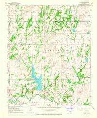 1965 Byars SW1966 Print · USGSGarvin County's river-and-rail landscape is captured here in the mid-1960s as oil production and water management reshaped the plains. Researchers can locate the Indian Meridian, the Pauls Valley Oil Field, and rural landmarks like Civit and Blue Branch Cem.3 unique versions available
 - 1965 Map of Pauls Valley, 1966 Print
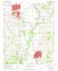 1965 Pauls Valley1966 Print · USGSGarvin County's river-and-rail corridor is captured here in the mid-sixties as the local economy balances agriculture with a thriving petroleum industry. Genealogists and historians can trace family-named landmarks including Mt Olive Cemetery, Oaklawn Cem, and the Hoover Oil Field.3 unique versions available
 - 1965 Map of Paoli, 1966 Print
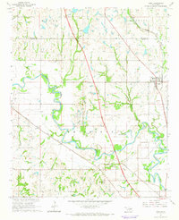 1965 Paoli1966 Print · USGSGarvin County's river valley and oil country are well-defined in the mid-sixties, showing the growth of Paoli and Whitebead. Researchers can trace the path of the Atchison Topeka and Santa Fe railroad or locate family sites like Florence Cem.2 unique versions available
 - 1969 Map of Elmore City NE, 1971 Print
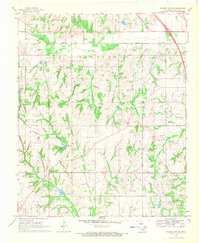 1969 Elmore City NE1971 Print · USGSGarvin County's rural landscape is captured here in the late sixties during a period of steady petroleum production. Genealogists and local historians can trace family roots at Klondike Cem or locate community centers like Love Ch and Fair Oak Ch.3 unique versions available
 - 1986 Map of Pauls Valley
 1986 Pauls Valley1986 Print · USGSGarvin County and its neighbors are shown in the mid-1980s during a period of steady growth along the Washita River. Researchers can trace the path of the Atchison Topeka and Santa Fe railroad through Pauls Valley or locate rural sites like Mt Olive Church and Erin Springs.2 unique versions available
End of results
Showing maps 1-8 of 8
Top cities near Pauls Valley
- Sulphur historical maps
- Wynnewood historical maps
- Maysville historical maps
- Elmore City historical maps
- Wayne historical maps
- Paoli historical maps
See more
Frequently asked questions
- What are the different types of historical maps available for Pauls Valley?
- What is the oldest map of Pauls Valley?
- Where can I purchase historical maps of Pauls Valley for my home or office?
- Where can I download high-res historical maps of Pauls Valley?
- Are there historical topographic maps available for Pauls Valley?
- Is there historical aerial imagery available for Pauls Valley?
- Where are historical maps of Pauls Valley sourced from?