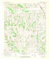
1969 Map of Elmore City NE
USGS Topo · Published 1971About this map
Rush Creek and Sandy Creek define the drainage of this central Oklahoma landscape as it appeared in the late 1960s. The region is marked by significant petroleum activity, evidenced by the extensive Oil Field, numerous Oil Wells, and a prominent Pipeline cutting through the terrain. The presence of the A T & S F railroad in the northeast corner highlights the area's connection to larger regional transport networks.
Find a feature on this map
15 named features on this map. Tap any name to fly to it.
Don’t see what you’re looking for? This feature index may not catch every label — zoom into the map to look around manually.
Map Details
Editions of this 1969 Elmore City NE Map
3 editions found
Other maps of this area

1898 · Pauls Valley
USGS Topo · 1:125,000

1902 · Pauls Valley
USGS Topo · 1:125,000

1957 · Ardmore
USGS Topo · 1:250,000

1963 · Ardmore
USGS Topo · 1:250,000

1965 · Byars SW
USGS Topo · 1:24,000

1965 · Pauls Valley
USGS Topo · 1:24,000

1965 · Maysville
USGS Topo · 1:24,000

1965 · Joy
USGS Topo · 1:24,000

1965 · Paoli
USGS Topo · 1:24,000

1969 · Hennepin
USGS Topo · 1:24,000