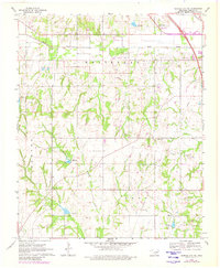
1969 Map of Elmore City NE
USGS Topo · Published 1980About this map
Rush Creek and Sandy Creek carve through this section of Garvin County, defining a landscape where agriculture and the petroleum industry coexist. The presence of numerous Oil Wells and a prominent Pipeline through the Brady and Whitebead districts illustrates the energy production era of the late 1960s. This survey is particularly valuable for its detail on rural community hubs, showing the Church of God, Fair Oak Ch, and Love Ch scattered across the countryside.
Find a feature on this map
20 named features on this map. Tap any name to fly to it.
Don’t see what you’re looking for? This feature index may not catch every label — zoom into the map to look around manually.
Map Details
Editions of this 1969 Elmore City NE Map
3 editions found
Other maps of this area

1898 · Pauls Valley
USGS Topo · 1:125,000

1902 · Pauls Valley
USGS Topo · 1:125,000

1957 · Ardmore
USGS Topo · 1:250,000

1963 · Ardmore
USGS Topo · 1:250,000

1965 · Byars SW
USGS Topo · 1:24,000

1965 · Pauls Valley
USGS Topo · 1:24,000

1965 · Maysville
USGS Topo · 1:24,000

1965 · Joy
USGS Topo · 1:24,000

1965 · Paoli
USGS Topo · 1:24,000

1969 · Hennepin
USGS Topo · 1:24,000