1960s Maps of Kiowa County, Oklahoma
Explore 11 historic maps of Kiowa County from the 1960s. These maps offer a rare glimpse into what life looked like during the 1960s — showing old roads, neighborhoods, homes, and landmarks that have changed or disappeared over time.
Whether you're researching your family's past, planning a metal detecting trip, or studying how Kiowa County's landscape evolved across the 1960s, these high-resolution maps are a powerful tool for exploring the history of this region.
- Focus on a specific era: All maps on this page are from the 1960s, giving you a focused view of this time period.
- See what’s changed: Compare century-old streets, trails, and buildings to today's modern landscape using overlays and satellite layers.
- Research with precision: Use these maps for genealogy, historical research, land use analysis, or educational projects.
- View, download, or print: Maps are fully viewable online in high resolution, and can be downloaded or printed for your own records.
Start exploring Kiowa County's history through authentic maps from the 1960s. This is your window into the past.
Kiowa County, OK maps
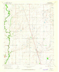
(11)- 1961 Map of Gotebo, 1962 Print
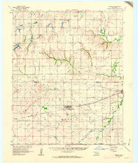 1961 Gotebo1962 Print · USGSKiowa and Washita County homesteads are mapped here in the early sixties, anchored by the rail corridor of the Chicago Rock Island and Pacific. Researchers can locate several rural landmarks including the Rainy Mountain Indian Mission Cemetery, Lone Wolf Chapel, and the Old Indian Boundary.2 unique versions available
 - 1961 Map of Hobart, 1962 Print
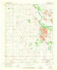
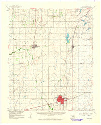 1961 Hobart1962 Print · USGSKiowa and Washita counties are shown here in the early 1960s as a bustling junction of major rail lines and rural agricultural life. Researchers can trace family history through sites like Huckaby Cem, Sentinel High Sch, and the Oil Field.2 unique versions available
 - 1961 Map of Carnegie, 1963 Print
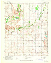
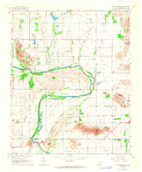
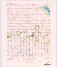 1961 Carnegie1963 Print · USGSThe Washita River valley in the early sixties serves as the focal point for this survey of Carnegie and Mountain View. Genealogists can trace family names at Indian Mission, Cedar Creek Cem, or the Old Indian Treaty Boundary.
 - 1961 Map of Retrop, 1963 Print
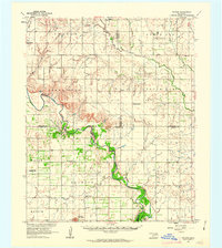 1961 Retrop1963 Print · USGSSouthwestern Oklahoma at the start of the sixties reveals a landscape shaped by river bends and rural oil fields. Genealogists can locate family landmarks like Poarch Cem, Port Sch, and the community of Retrop, all before modern development shifted the countryside.2 unique versions available
 - 1963 Map of Babbs, 1965 Print
 1963 Babbs1965 Print · USGSKiowa County in the early sixties is captured here as a landscape of prairie creeks and early petroleum extraction. Researchers can trace the St Louis-San Francisco line through Babbs or locate landmarks like Camelback Mountain.2 unique versions available
 - 1964 Map of Tipton SE, 1965 Print
 1964 Tipton SE1965 Print · USGSTillman County and the Red River forks are mapped here during the mid-sixties, capturing the rural community life of the Oklahoma plains. Genealogists and researchers can locate the Center View Cem, Mt Gillian Ch, and the Pleasant Valley Ch.2 unique versions available
 - 1964 Map of Lone Wolf, 1965 Print
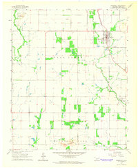
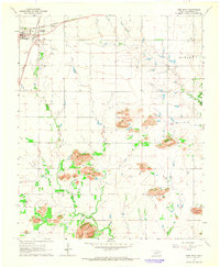 1964 Lone Wolf1965 Print · USGSLone Wolf and the surrounding Kiowa County landscape are captured here in the mid-1960s at a peak of rail-driven connectivity. Genealogists and local historians can trace the intersection of two major railroads and locate rural landmarks like Mt Tepee Ch, Bartons Store, and the Hohman Landing Strip.2 unique versions available
 - 1964 Map of Warren, 1965 Print
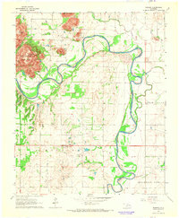 1964 Warren1965 Print · USGSJackson and Kiowa counties meet along the winding river in the mid-1960s, a time of quiet rural life and heavy industry. Researchers can trace land boundaries in Warren or locate family sites near the Cem and Quartz Mountain State Park.2 unique versions available
 - 1964 Map of Headrick, 1965 Print
 1964 Headrick1965 Print · USGSSouthwestern Oklahoma in the mid-sixties reveals a land of river-bend settlements and mountain-shadowed farms. Genealogists and local historians can trace the legacy of Headrick and Friendship, locating the Navajo Cem and the route of the St Louis - San Francisco railroad.
 - 1964 Map of Roosevelt, 1965 Print
 1964 Roosevelt1965 Print · USGSOklahoma's Kiowa County prairie is documented here in the mid-1960s as a landscape of rail-centered towns and isolated granite rises. Genealogists can locate family sites near the Roosevelt Cem or trace the old St Louis - San Francisco line through Roosevelt and Cold Springs.
 - 1964 Map of Long Mountain, 1965 Print
 1964 Long Mountain1965 Print · USGSSouthwestern Oklahoma's river valley and granite peaks are meticulously captured during the mid-1960s. Genealogists and historians can trace the paths of the St Louis - San Francisco railroad and locate rural landmarks like Headrick Cem and Centerville.2 unique versions available
End of results
Showing maps 1-11 of 11
Top cities of Kiowa County
- Hobart historical maps
- Snyder historical maps
- Mountain View historical maps
- Lone Wolf historical maps
- Mountain Park historical maps
- Roosevelt historical maps
See more
Frequently asked questions
- What are the different types of historical maps available for Kiowa County?
- What is the oldest map of Kiowa County?
- Where can I purchase historical maps of Kiowa County for my home or office?
- Where can I download high-res historical maps of Kiowa County?
- Are there historical topographic maps available for Kiowa County?
- Is there historical aerial imagery available for Kiowa County?
- Where are historical maps of Kiowa County sourced from?