1990s Maps of Kiowa County, Oklahoma
Explore 12 historic maps of Kiowa County from the 1990s. These maps offer a rare glimpse into what life looked like during the 1990s — showing old roads, neighborhoods, homes, and landmarks that have changed or disappeared over time.
Whether you're researching your family's past, planning a metal detecting trip, or studying how Kiowa County's landscape evolved across the 1990s, these high-resolution maps are a powerful tool for exploring the history of this region.
- Focus on a specific era: All maps on this page are from the 1990s, giving you a focused view of this time period.
- See what’s changed: Compare century-old streets, trails, and buildings to today's modern landscape using overlays and satellite layers.
- Research with precision: Use these maps for genealogy, historical research, land use analysis, or educational projects.
- View, download, or print: Maps are fully viewable online in high resolution, and can be downloaded or printed for your own records.
Start exploring Kiowa County's history through authentic maps from the 1990s. This is your window into the past.
Kiowa County, OK maps
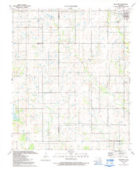
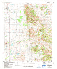
(12)- 1991 Map of Unap Mountain, 1992 Print
 1991 Unap Mountain1992 Print · USGSOklahoma’s Kiowa County landscape is captured here in the early nineties, showing a mix of rugged peaks and vast ranchlands. Researchers can find the Union Dale Cem, the settlement of Sedan, and the remote Sugar Creek Ranch Landing Field.
 - 1991 Map of Indiahoma, 1992 Print
 1991 Indiahoma1992 Print · USGSIndiahoma and the surrounding ranchlands at the intersection of three counties are detailed in this early nineties survey. Genealogists can trace family roots at Post Oak Cem, Indiahoma IOOF Cem, and Peace Congregational Ch.
 - 1991 Map of Glen Mountains, 1992 Print
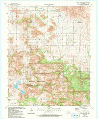
 1991 Glen Mountains1992 Print · USGSThe Oklahoma landscape in the early nineties is defined here by the waters of the Tom Steed Reservoir. Researchers can trace the development of Great Plains State Park and locate a Mine (Abandoned) or Quarry within the Glen Mountains.
 - 1991 Map of Meers, 1992 Print
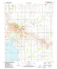
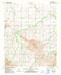
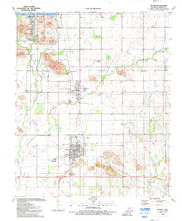
 1991 Meers1992 Print · USGSThe Wichita Mountains foothills come into focus in the early nineties, centered on the community of Meers. Local historians can trace tribal roots at the Mount Scott Kiowa Mission and Mountain Scott Tribal Center near Lake Lawtonka.2 unique versions available
 - 1991 Map of Bally Mountain, 1992 Print
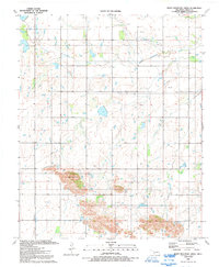
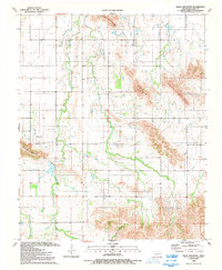 1991 Bally Mountain1992 Print · USGSThe Wichita Mountains of Kiowa County are captured here in the early nineties, showing a landscape of high ridges and isolated ranch lands. Researchers can locate the Green Valley Cem and trace the rugged elevations of Bally Mountain and Longhorn Mountain.
 - 1991 Map of Rainy Mountain Creek, 1992 Print
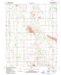
 1991 Rainy Mountain Creek1992 Print · USGSKiowa County, Oklahoma, is shown in the late eighties as a landscape shaped by petroleum production and natural relief. Genealogists and historians can trace the paths of Rainy Mountain Creek and locate specific sites like Blue Mountain and numerous Oil Well markers.
 - 1991 Map of Manitou, 1992 Print
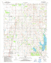 1991 Manitou1992 Print · USGSThe southwestern Oklahoma plains near the Kiowa and Tillman county line are captured here in the early nineties. Genealogists and local historians can trace the town grid of Manitou, locate the North Deep Red Cem, or explore the shoreline of Lake Frederick.
 - 1991 Map of Alden, 1992 Print
 1991 Alden1992 Print · USGSCaddo County in the early nineties shows a landscape of active oil production and established rural faith communities. Researchers can trace the layout of the Oil Field and find family landmarks like Greenfield Ch, Cache Indian Mission, and Camp George Thomas.
 - 1991 Map of Saddle Mountain, 1992 Print
 1991 Saddle Mountain1992 Print · USGSThe Wichita Mountains in the early nineties show a landscape defined by protected wilderness and the intersection of Kiowa and Comanche counties. Researchers can trace land markers like Saddle Mountain Cem, Geronimo Ridge, and Gray Wolf Crossing.2 unique versions available
 - 1991 Map of Cooperton, 1992 Print
 1991 Cooperton1992 Print · USGSThe Kiowa and Comanche county line area comes into focus in the early 1990s, where agricultural plains meet the granite peaks of the southwest. Researchers can locate the Springhill Cem, trace the waters of Cut Throat Lake, and explore the high ground of Mount Pinchot.
 - 1991 Map of Snyder, 1992 Print
 1991 Snyder1992 Print · USGSSnyder and Mountain Park appear here in the early nineties, framed by the waters of the Great Plains. Researchers can locate family landmarks like Mountain Park Cem, Southside Ch, and the small settlement of Svoboda.
 - 1991 Map of Odetta, 1992 Print
 1991 Odetta1992 Print · USGSComanche and Kiowa counties meet here in the early nineties, where the high plains break into the dramatic Wichita Mountains. Trace the rural settlement of Odetta or locate water sources like Cottonwood Spring and Deep Red Creek among the geologic peaks.
End of results
Showing maps 1-12 of 12
Top cities of Kiowa County
- Hobart historical maps
- Snyder historical maps
- Mountain View historical maps
- Lone Wolf historical maps
- Mountain Park historical maps
- Roosevelt historical maps
See more
Frequently asked questions
- What are the different types of historical maps available for Kiowa County?
- What is the oldest map of Kiowa County?
- Where can I purchase historical maps of Kiowa County for my home or office?
- Where can I download high-res historical maps of Kiowa County?
- Are there historical topographic maps available for Kiowa County?
- Is there historical aerial imagery available for Kiowa County?
- Where are historical maps of Kiowa County sourced from?