Old Maps of Kiowa County, Oklahoma for Academic Research
Study the evolution of Kiowa County with 203 high-resolution historic maps. Whether you're teaching, researching, or modeling changes in land use, these maps provide essential visual documentation of urban, environmental, and geographic change.
- Analyze long-term change: Track patterns in development, transportation, and natural features.
- Ideal for environmental or urban studies: Support academic projects with primary historical map data.
- Use in the classroom or lab: Educators and researchers rely on these maps to bring historical context to life.
These maps are a powerful tool for teaching, research, and visualizing how Kiowa County has changed over the decades.
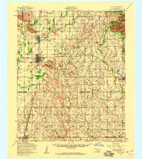
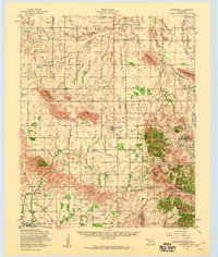
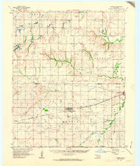
Kiowa County, OK maps
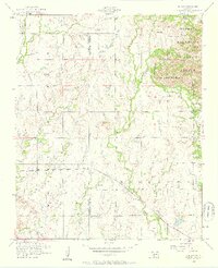
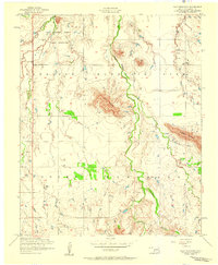
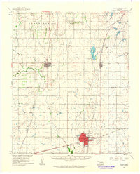
(203)- 1949 Map of Cooperton, 1953 Print
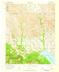
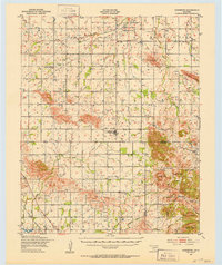 1949 Cooperton1953 Print · USGSKiowa and Comanche counties at the close of the 1940s reveal a landscape defined by the Rainy Mountain Indian School Reservation and the rising Wichita Mountains. Genealogists and researchers can trace rural life through the Gold Mine (Abandoned), Union Dale Cem, and the village of Cooperton.2 unique versions available
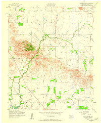
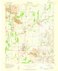
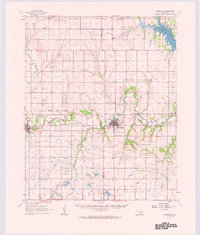
 - 1950 Map of Snyder, 1953 Print
 1950 Snyder1953 Print · USGSKiowa and Tillman Counties come into focus during the early fifties, showing a landscape where the granite peaks of the Wichita Mountains meet the Oklahoma prairie. Genealogists can locate numerous rural landmarks like Richland Sch, Maple Grove Ch, and the Oklahoma Cem.2 unique versions available
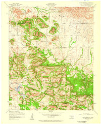
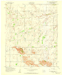
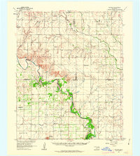
 - 1950 Map of Saddle Mountain, 1953 Print
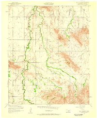
 1950 Saddle Mountain1953 Print · USGSSouthwestern Oklahoma in the early fifties shows a landscape where high granite peaks meet missionary history and early wildlife conservation. Researchers can trace rural school locations like Dixie Sch or find the remote Saddle Mountain Indian Mission and Kiowa Mission tucked among the foothills.2 unique versions available
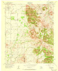
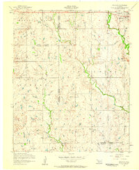
 - 1955 Map of Lawton, 1958 Print
 1955 Lawton1958 Print · USGSSouthwestern Oklahoma and North Texas are shown here in the mid-fifties, dominated by the Wichita Mountains and the vital Red River watershed. Genealogists and historians can trace the foundations of Lawton alongside rural landmarks like Rainy Mountain Church and Pleasant Hill School.5 unique versions available
 - 1955 Map of Clinton, 1964 Print
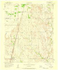
 1955 Clinton1964 Print · USGSWestern Oklahoma during the mid-century transition shows a landscape of growing reservoirs and active military flight lines. Genealogists and historians can locate rural landmarks such as Mountain View Church, Berlin School, and the Riverside Indian School Reserve.3 unique versions available
 - 1956 Map of Glen Mountains, 1959 Print
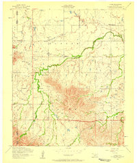
 1956 Glen Mountains1959 Print · USGSKiowa County, Oklahoma, is captured here in the mid-1950s as a landscape of rocky ridges and emerging infrastructure. Researchers can trace the St Louis San Francisco rail line or locate the Gold Mine (Abandoned) near Glen Creek.2 unique versions available
 - 1956 Map of Saddle Mountain, 1959 Print
 1956 Saddle Mountain1959 Print · USGSThe Wichita Mountains in the mid-1950s are presented here in high detail at the junction of Kiowa and Comanche counties. Genealogists and researchers can locate the Saddle Mountain Indian Mission or trace the rugged Geronimo Ridge near Comanche Lake.3 unique versions available
 - 1956 Map of Cooperton, 1959 Print
 1956 Cooperton1959 Print · USGSThe Oklahoma plains meet the Wichita Mountains in the mid-1950s, showing a landscape of isolated peaks and rural church communities. Researchers can trace local history at Springhill Cemetery or explore landmarks like Cut Throat Lake and Baker Peak.2 unique versions available
 - 1956 Map of Odetta, 1959 Print
 1956 Odetta1959 Print · USGSThe granite peaks of the Wichita Mountains met the Oklahoma plains in the mid-1950s, creating a varied landscape of wildlife habitat and military grounds. Researchers can trace the St Louis San Francisco railroad line through Odetta or locate landmarks like Cottonwood Spring and Sunset Peak.3 unique versions available
 - 1956 Map of Alden, 1959 Print
 1956 Alden1959 Print · USGSCaddo County's agricultural prairies meet the rising slopes of the Wichita Mountains during the mid-fifties. Researchers can locate family landmarks like the Alden School, Cache Indian Mission, and the Greenfield Church near East Cache Creek.2 unique versions available
 - 1956 Map of Manitou, 1959 Print
 1956 Manitou1959 Print · USGSIn the Oklahoma plains during the mid-fifties, Manitou stood as a key rail stop along the St Louis San Francisco line. Genealogists and local historians can trace the rural landscape across the Kiowa and Tillman County line to find Deep Red Cemetery and the winding course of Deep Red Creek.
 - 1956 Map of Bally Mountain, 1959 Print
 1956 Bally Mountain1959 Print · USGSKiowa County, Oklahoma, is shown in the mid-1950s as a landscape of isolated peaks and small community hubs. Local historians can trace family roots at Green Valley Cemetery or locate the rural gathering places of Spring Valley Church and Saddle Mountain Church.2 unique versions available
 - 1956 Map of Unap Mountain, 1959 Print
 1956 Unap Mountain1959 Print · USGSKiowa County, Oklahoma, is shown in the mid-1950s at a time when institutional landmarks and rural townships defined the landscape. Genealogists can trace the Rainy Mountain Indian School Reservation and the Union Dale Cemetery, or locate the community of Sedan.2 unique versions available
 - 1956 Map of Snyder, 1959 Print
 1956 Snyder1959 Print · USGSSnyder and Mountain Park appear here during the mid-1950s as essential rail and water hubs in Kiowa County. Genealogists and researchers can locate the Snyder Cemetery, the path of the St Louis San Francisco railroad, and infrastructure like the Pumping station at Snyder Lake.2 unique versions available
 - 1956 Map of Indiahoma, 1959 Print
 1956 Indiahoma1959 Print · USGSIndiahoma and the surrounding southwestern Oklahoma prairies are captured here in the mid-1950s, a landscape defined by seasonal creeks and rural community centers. Genealogists can trace family roots through the Indiahoma IOOF Cemetery, Post Oak Mission School, and North Deep Red Church.2 unique versions available
 - 1956 Map of Rainy Mountain Creek, 1959 Print
 1956 Rainy Mountain Creek1959 Print · USGSKiowa County, Oklahoma, was undergoing a shift toward petroleum development in the mid-1950s. Genealogists and historians can trace the local landscape around Rainy Mountain Church and identify mid-century industry via Oil wells and the Slush tank.
 - 1956 Map of Meers, 1959 Print
 1956 Meers1959 Print · USGSOklahoma's Wichita Mountains meet the plains in the mid-1950s as the small community of Meers anchors the local landscape. Genealogists and historians can trace sites like the Meers Cemetery, the Mount Scott Kiowa Mission, and the shores of Lake Lawtonka.2 unique versions available
 - 1956 Map of Snyder, 1960 Print
 1956 Snyder1960 Print · USGSSouthwestern Oklahoma's agricultural and mountain landscapes meet in the mid-1950s as the rail lines connect growing prairie towns. Researchers can locate family sites at Sopefield Cemetery, Oak Mission School, or the rural Pilgrim Church.
 - 1956 Map of Saddle Mountain, 1960 Print
 1956 Saddle Mountain1960 Print · USGSThe Wichita Mountains and surrounding plains are captured in the mid-fifties, featuring the Wichita Mountains Wildlife Refuge and its dramatic peaks. Genealogy researchers can trace community roots at the Cache Indian Mission, Alden School, and Meers Cemetery.
 - 1956 Map of Cooperton, 1960 Print
 1956 Cooperton1960 Print · USGSThe Kiowa County plains meet the granite peaks of the Wichita Mountains during the mid-1950s. Genealogists and historians can trace the Rainy Mountain Indian Reservation, find rural landmarks like Richland Union Church, or locate the Abandoned gold mine.2 unique versions available
 - 1957 Map of Clinton
 1957 Clinton1957 Print · USGSWestern Oklahoma in the mid-fifties is captured here as a landscape of river-valley settlements and emerging energy fields. Genealogists can trace family roots through numerous rural landmarks like the Swapping Back Indian School, Hebron Church, and the Riverside Indian School Reserve.
 - 1961 Map of Gotebo, 1962 Print
 1961 Gotebo1962 Print · USGSKiowa and Washita County homesteads are mapped here in the early sixties, anchored by the rail corridor of the Chicago Rock Island and Pacific. Researchers can locate several rural landmarks including the Rainy Mountain Indian Mission Cemetery, Lone Wolf Chapel, and the Old Indian Boundary.2 unique versions available
 - 1961 Map of Hobart, 1962 Print
 1961 Hobart1962 Print · USGSKiowa and Washita counties are shown here in the early 1960s as a bustling junction of major rail lines and rural agricultural life. Researchers can trace family history through sites like Huckaby Cem, Sentinel High Sch, and the Oil Field.2 unique versions available
 - 1961 Map of Carnegie, 1963 Print
 1961 Carnegie1963 Print · USGSThe Washita River valley in the early sixties serves as the focal point for this survey of Carnegie and Mountain View. Genealogists can trace family names at Indian Mission, Cedar Creek Cem, or the Old Indian Treaty Boundary.
 - 1961 Map of Retrop, 1963 Print
 1961 Retrop1963 Print · USGSSouthwestern Oklahoma at the start of the sixties reveals a landscape shaped by river bends and rural oil fields. Genealogists can locate family landmarks like Poarch Cem, Port Sch, and the community of Retrop, all before modern development shifted the countryside.2 unique versions available
Showing maps 1-25 of 203
Top cities of Kiowa County
- Hobart historical maps
- Snyder historical maps
- Mountain View historical maps
- Lone Wolf historical maps
- Mountain Park historical maps
- Roosevelt historical maps
See more
Frequently asked questions
- What are the different types of historical maps available for Kiowa County?
- What is the oldest map of Kiowa County?
- Where can I purchase historical maps of Kiowa County for my home or office?
- Where can I download high-res historical maps of Kiowa County?
- Are there historical topographic maps available for Kiowa County?
- Is there historical aerial imagery available for Kiowa County?
- Where are historical maps of Kiowa County sourced from?