Old Maps of LeFlore County, Oklahoma for Academic Research
Study the evolution of LeFlore County with 276 high-resolution historic maps. Whether you're teaching, researching, or modeling changes in land use, these maps provide essential visual documentation of urban, environmental, and geographic change.
- Analyze long-term change: Track patterns in development, transportation, and natural features.
- Ideal for environmental or urban studies: Support academic projects with primary historical map data.
- Use in the classroom or lab: Educators and researchers rely on these maps to bring historical context to life.
These maps are a powerful tool for teaching, research, and visualizing how LeFlore County has changed over the decades.
LeFlore County, OK maps
(276)- 1879 Map of Fort Smith
 1879 Fort Smith1879 Print · USGSFort Smith and Van Buren stand at the edge of the frontier in the late eighteen-seventies, just as the railroads began to reshape the Arkansas River valley. Trace the early town plats and find rural community anchors like Zenobia P.O., Lillie, and the Ferry crossings.
 - 1887 Map of Van Buren
 1887 Van Buren1887 Print · USGSThe Arkansas frontier meets the Indian Territory in the late nineteenth century, centered on the growing river hubs of Fort Smith and Van Buren. Genealogists and researchers can locate old post offices like Cavanaugh P.O. and trace the early routes of the Ft. Smith & Southern R. R.
 - 1887 Map of Poteau Mountain #2
 1887 Poteau Mountain #21887 Print · USGSWestern Arkansas in the late nineteenth century was a land of high ridges and isolated river valleys. You can trace the early footprints of Scott County through settlements like Cauthron and Gipson or follow the waters of the Poteau River.
 - 1887 Map of Greenwood
 1887 Greenwood1887 Print · USGSSebastian County was undergoing a period of rapid development in the 1880s as the rail network expanded through its ridge-and-valley terrain. Genealogists can trace the early layouts of Greenwood and Hackett City or find family sites near Jenny Lind and Sugar Loaf Mountain.
 - 1890 Map of Fort Smith
 1890 Fort Smith1890 Print · USGSThe Arkansas-Indian Territory border was a landscape of rapid transition in the late nineteenth century. Genealogists and historians can trace early post offices like Jenny Lind P.O. and Oak Bower (Lavaca P.O.) or follow the path of the St. Louis and San Francisco Railroad.7 unique versions available
 - 1890 Map of Poteau Mountain
 1890 Poteau Mountain1890 Print · USGSWestern Arkansas and the Indian Territory border are mapped in the late 1880s as the frontier gives way to established settlements. Genealogists can trace early homesteads and post offices like Waldron, Dallas, and Cherry Hill, or locate the historic Toll Gate and Talihina Trail.2 unique versions available
 - 1899 Map of Poteau Mountain
 1899 Poteau Mountain1899 Print · USGSThe Arkansas borderlands and the Choctaw Nation frontier are captured here just before the turn of the century. Local historians can trace old homesteads and post offices near Waldron, Dallas, and the remote Cherry Hill (Egger P.O.) along the upper Ouachita.6 unique versions available
 - 1900 Map of Sallisaw
 1900 Sallisaw1900 Print · USGSThe Cherokee and Choctaw Nations are divided by the winding Arkansas River at the turn of the century. Genealogists can trace early tribal-era settlements like Bokoshe, Tamaha, and Oak Lodge along the routes of the Kansas City Southern R. R.2 unique versions available
 - 1900 Map of Winding Stair
 1900 Winding Stair1900 Print · USGSThe Choctaw Nation at the turn of the century shows a frontier landscape shaped by the Ouachita Mountains and new rail lines. Genealogists can locate early settlements like Summerfield and Heavener or trace the Woods Trail across the Kiamichi Mountain range.2 unique versions available
 - 1901 Map of Tuskahoma
 1901 Tuskahoma1901 Print · USGSThe Choctaw Nation in the Indian Territory is captured here during its transition to statehood, showing a landscape of tribal centers and early railroad expansion. Genealogists and historians can locate the Council House and rural outposts like Bengal, Ola, and Damon.
 - 1908 Map of Tuskahoma, 1964 Print
 1908 Tuskahoma1964 Print · USGSOklahoma's Choctaw Nation territory at the start of the twentieth century shows a landscape shaped by ridge-top boundaries and the arrival of the steam engine. Researchers can locate early landmarks like the Choctaw Council House, Peachland Chapel, and mining era towns like Wilburton.
 - 1909 Map of Tuskahoma
 1909 Tuskahoma1909 Print · USGSSoutheastern Oklahoma’s rugged mountain corridors and Choctaw Nation landmarks are documented here at the end of the territorial era. Genealogists and historians can trace rail-town development and find remote sites like the Choctaw Council House, Bunchtown, and Thessalonica Church.3 unique versions available
 - 1909 Map of Winding Stair
 1909 Winding Stair1909 Print · USGSSoutheastern Oklahoma’s early statehood era is defined here by the intersection of major rail corridors and high mountain ridges. Researchers can trace the development of transit hubs like Heavener and Wister, or locate remote valley settlements such as Whitesboro and Muse.4 unique versions available
 - 1911 Map of Sallisaw
 1911 Sallisaw1911 Print · USGSEastern Oklahoma at the turn of the century was a land of expanding railroads and ancient river crossings along the Arkansas River. Genealogists and historians can trace the early settlement of the region through dozens of landmarks like Foreman Ferry, McCurtain, and the Badger Lee School.3 unique versions available
 - 1940 Map of Red Oak, 1971 Print
 1940 Red Oak1971 Print · USGSThe Ouachita Mountains of southeastern Oklahoma are captured here in the years just before the mid-century, showing a landscape of timbered ridges and railroad towns. Genealogists can trace family footprints at rural landmarks like Baldwin Cem, the Salonia Sch, and the State Sanitorium near Talihina.2 unique versions available
 - 1943 Map of Fort Smith
 1943 Fort Smith1943 Print · USGSFort Smith and the Arkansas River valley are shown here during the height of the Second World War as the region became a major military hub. Genealogists and researchers can locate several rural schools and churches, such as St Marys School and Pleasant Ridge Church and Cem, alongside industrial sites like the Strip Mine and Smelter.
 - 1943 Map of Red Oak
 1943 Red Oak1943 Print · USGSLatimer and Le Flore counties are captured here in the early 1940s as the railroad and timber economy shaped the Ouachita foothills. Genealogists and local historians can locate early landmarks like Baldwin Cem, Salonia Sch, and the State Sanatorium near Talihina.2 unique versions available
 - 1946 Map of Fort Smith
 1946 Fort Smith1946 Print · USGSThe Arkansas-Oklahoma borderlands appear here in the mid-forties, as new reservoirs began to transform the river valleys. Genealogists and historians can trace rail-served towns from Muskogee to Fort Smith and locate landmarks like Camp Chaffee.
 - 1947 Map of Van Buren, 1954 Print
 1947 Van Buren1954 Print · USGSThe riverfront cities of Fort Smith and Van Buren are shown in the late 1940s, just as the regional industrial footprint was expanding. Researchers can trace the rail lines of the Missouri Pacific or locate local landmarks like St Scholastica Academy and the Zinc Smelter.
 - 1947 Map of Greenwood, 1954 Print
 1947 Greenwood1954 Print · USGSThe Arkansas-Oklahoma border region thrived on coal and rail just after the war. Researchers can trace family ties at Old Jenny Lind and locate industrial landmarks like the Frazier Mine or the Midland Valley railroad.
 - 1947 Map of Fort Smith, 1966 Print
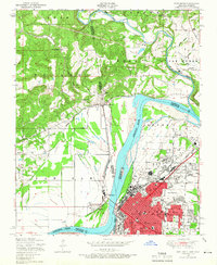 1947 Fort Smith1966 Print · USGSPost-war Arkansas and Oklahoma meet at the river bend during this era of urban expansion and rail dominance. Researchers can trace the development of FORT SMITH neighborhoods and identify local landmarks like St Boniface Church and School and Twin City Hospital.4 unique versions available
 - 1947 Map of Hartford, 1969 Print
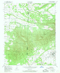 1947 Hartford1969 Print · USGSThe Arkansas-Oklahoma borderlands come alive in this post-war survey of the coal country surrounding Hartford. Genealogists and historians can trace old mining sites marked as Coal, find rural settlements like Slaytonville, and map the rugged slopes of Sugar Loaf Mountain.3 unique versions available
 - 1948 Map of Hackett, 1963 Print
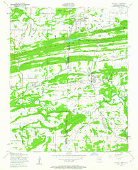 1948 Hackett1963 Print · USGSThe Arkansas-Oklahoma borderlands come alive in this post-war survey, documenting a landscape shaped by coal mining and ridge-top settlements. Researchers can trace the industrial footprint of strip mines near Hackett or locate family sites like Old Union Church and Mt View Cemetery.3 unique versions available
 - 1948 Map of South Fort Smith, 1967 Print
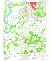 1948 South Fort Smith1967 Print · USGSThe borderlands of the Arkansas-Oklahoma line are captured here in the late 1940s as industry and recreation expanded beyond the city limits. Genealogists and historians can locate family landmarks such as St Scholastica Academy, Oak Cemetery, and the Dunbar School.3 unique versions available
 - 1950 Map of Mcalester
 1950 Mcalester1950 Print · USGSThe Ouachita Mountains and the coal country of Southeast Oklahoma are shown here in the late 1940s. Genealogists and historians can trace the rail-driven growth of McAlester, Wilburton, and Antlers alongside the rugged terrain of Kiamichi Mountain.2 unique versions available
Showing maps 1-25 of 276
Top cities of LeFlore County
- Poteau historical maps
- Pocola historical maps
- Heavener historical maps
- Spiro historical maps
- Arkoma historical maps
- Panama historical maps
See more
Frequently asked questions
- What are the different types of historical maps available for LeFlore County?
- What is the oldest map of LeFlore County?
- Where can I purchase historical maps of LeFlore County for my home or office?
- Where can I download high-res historical maps of LeFlore County?
- Are there historical topographic maps available for LeFlore County?
- Is there historical aerial imagery available for LeFlore County?
- Where are historical maps of LeFlore County sourced from?