Old Maps of Major County, Oklahoma for Genealogy
Trace your family roots with 164 historic maps of Major County. These high-res maps reveal old neighborhoods, homesites, landmarks, and streets — helping you uncover where your ancestors lived and how the area evolved over time.
- Explore historic neighborhoods: Identify where your relatives may have lived in the 1800s or 1900s.
- Compare maps over time: Trace the changes in streets, buildings, and landmarks for multi-generational research.
- Perfect for genealogy & ancestry research: Used by family historians and researchers to map out lineage and migration.
These maps are an incredible resource for exploring your personal connection to Major County's past.
Major County, OK maps
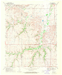
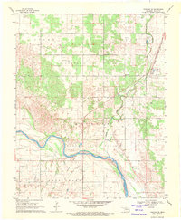
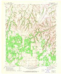
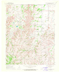
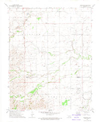
(164)- 1893 Map of Ames
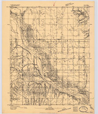 1893 Ames1893 Print · USGSOklahoma territory is captured here during the early surveying era, showing the river-dominated landscape of Major and Kingfisher counties. Local historians can trace early settlement patterns at Lacey and Parvin or locate the historic Washburns Crossing on the Cimarron River.2 unique versions available
 - 1955 Map of Woodward, 1967 Print
 1955 Woodward1967 Print · USGSNorthwest Oklahoma and the bordering plains are captured during the mid-sixties, showing a landscape defined by river valleys and massive water projects. Researchers can trace family roots in towns like Woodward and Alva or locate landmarks such as the Western Oklahoma State Hospital and Kegelman AF.3 unique versions available
 - 1956 Map of Ames, 1957 Print
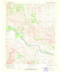
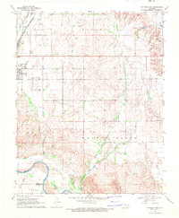
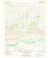
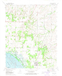
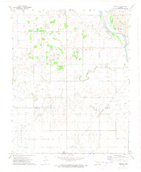
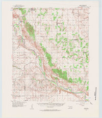 1956 Ames1957 Print · USGSMajor and Garfield counties are captured here in the mid-1950s, centered on the railroad town of Ames and the Cimarron River. Genealogists can trace rural life through landmarks like Antioch Ch, Mound Ridge Sch, and the Cimarron Valley Cem.2 unique versions available
 - 1956 Map of Ringwood, 1957 Print
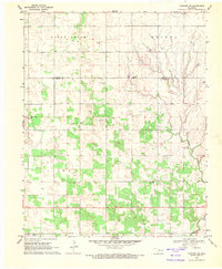
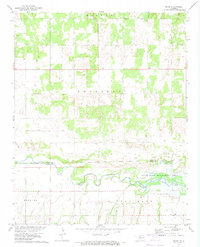
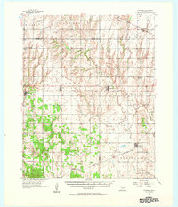 1956 Ringwood1957 Print · USGSNorthern Oklahoma in the mid-fifties presents a landscape of prairie townships and vital rail hubs. Researchers can trace family roots through numerous rural sites like Pleasant Hill Cem, Parker Ch, and the Vernon Sch (Abandoned).
 - 1958 Map of Woodward
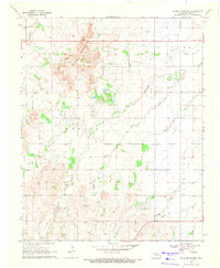
 1958 Woodward1958 Print · USGSNorthwest Oklahoma and the neighboring panhandle borders are shown here during a period of steady mid-century growth. Researchers can trace the rail networks of the Atchison Topeka and Santa Fe and locate landmarks like the Western Oklahoma State Hospital and Port Supply Reservoir.2 unique versions available
 - 1969 Map of Phroso, 1971 Print
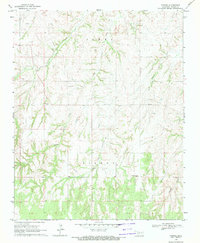 1969 Phroso1971 Print · USGSThe rural landscape of Major County in the late sixties shows the intersection of ranching and the energy industry. Genealogists and researchers can trace family landmarks like Mt Zion Cem or the settlement at Phroso near Griever Creek.
 - 1969 Map of Belva, 1971 Print
 1969 Belva1971 Print · USGSMajor County in the late sixties shows a landscape in transition from ranching to an energy-producing economy. Genealogists and researchers can trace the Atchison Topeka and Santa Fe Railroad Grade or locate landmarks like Belva and Bat Cave.
 - 1969 Map of Glass Mountains NW, 1971 Print
 1969 Glass Mountains NW1971 Print · USGSOklahoma's Glass Mountains region comes into focus during the late sixties as the riverbed defines the county line. Researchers can trace land ownership through labels like Jones and Crowell, or locate the historic Galena Cem near the Cimarron River.2 unique versions available
 - 1969 Map of Fairview NE, 1971 Print
 1969 Fairview NE1971 Print · USGSMajor and Alfalfa counties appear in the late sixties as a landscape of rural homesteads and emerging energy production. Researchers can trace local lineage through several sites like Square Cedar Cem, Wildwood Ch, and the small settlement of Carwile.
 - 1969 Map of Glass Mountains, 1971 Print
 1969 Glass Mountains1971 Print · USGSMajor County at the close of the sixties reveals a landscape shaped by the energy industry and agricultural settlement. Researchers can locate remote burial sites like Roscoe Cem and Cheyenne Valley Cem or trace the drainage paths of Skunk Creek.2 unique versions available
 - 1969 Map of Fairview SE, 1971 Print
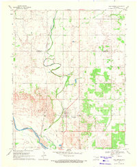
 1969 Fairview SE1971 Print · USGSMajor County was defined by its energy and rail economy in the late 1960s. Genealogists and historians can trace family locations near New Hope Ch, the Sorge Cem, and the massive network of wells across the Ringwood Oil Field.
 - 1969 Map of Fairview, 1971 Print
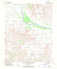
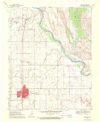 1969 Fairview1971 Print · USGSMajor County at the end of the sixties shows a landscape shaped by the Cimarron River and the railroad. Genealogists can trace family sites at Saron Cem and Rusk Cem or locate the old Chamberlain Sch.2 unique versions available
 - 1969 Map of Cleo Springs, 1971 Print
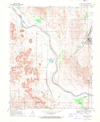
 1969 Cleo Springs1971 Print · USGSMajor and Alfalfa counties in the late sixties show a landscape balancing traditional agriculture with a growing petroleum industry. Researchers can trace the Atchison Topeka and Santa Fe rail line, locate Cleo Springs Cemetery, and explore the banks of the Cimarron River.
 - 1969 Map of Waynoka East, 1971 Print
 1969 Waynoka East1971 Print · USGSWoods County in the late sixties is revealed here as a landscape of rail transit and river boundaries. Genealogists and local historians can trace family ties to landmarks like Walnut Grove Cem, Rose Valley Sch, and the busy Waynoka rail corridor.
 - 1969 Map of Cedardale, 1971 Print
 1969 Cedardale1971 Print · USGSMajor and Woodward counties meet in this late 1960s survey of the Oklahoma plains during a period of active petroleum development. Genealogists and local historians can locate Cedardale Cem, Liberty Cem, and the small settlement of Cedardale.
 - 1969 Map of Glass Mountains NE, 1971 Print
 1969 Glass Mountains NE1971 Print · USGSNorthwestern Oklahoma’s prairie and river lowlands are captured here in the late sixties, showing the rural communities of Woods and Major counties. Genealogists and historians can locate Pleasant Ridge Cem, Oakdale Ch, and early energy sites like the Southwest Oakdale Gas Field.
 - 1969 Map of Togo, 1971 Print
 1969 Togo1971 Print · USGSMajor County during the late 1960s shows a landscape defined by the shifting Cimarron River and active energy exploration. Genealogists can locate the settlement of Togo and trace family sites near Lone Star Cem and Connor Cem.
 - 1969 Map of Waynoka West, 1971 Print
 1969 Waynoka West1971 Print · USGSWoods County in the late sixties reveals a landscape defined by the winding Cimarron River and the bustling rail operations in Waynoka. Genealogists and historians can trace the rail corridor through Heman or locate the early layout of the Little Sahara State Recreation Area.2 unique versions available
 - 1969 Map of Glass Mountains SW, 1971 Print
 1969 Glass Mountains SW1971 Print · USGSMajor County at the end of the 1960s shows a landscape shaped by the energy industry and rural traditions. Genealogists and researchers can trace the Northeast Cheyenne Valley Field alongside local landmarks like Lone Star Cem and Tepee Mountain.2 unique versions available
 - 1972 Map of Longdale, 1974 Print
 1972 Longdale1974 Print · USGSBlaine County's rural landscape is captured here in the early seventies as the region balanced its agricultural roots with a growing energy sector. Researchers can trace the Atchison Topeka and Santa Fe rail line past Longdale or locate family sites at Bethel Cem and Cedar Springs.
 - 1972 Map of Canton NW, 1974 Print
 1972 Canton NW1974 Print · USGSThe rural landscapes of Major and Dewey Counties are captured here in the early 1970s, centered on the waters of Canton Lake. Genealogists and local historians can trace family locations near the Fern Cliff Cem, the settlement of Bado, and Midway Ch.
 - 1972 Map of Seiling, 1974 Print
 1972 Seiling1974 Print · USGSNorthwest Oklahoma's river valley comes alive in this early 1970s survey centered on the junction of Dewey, Major, and Woodward counties. Genealogists and local historians can locate Elm Grove Ch, Brumfield Cem, and the civic layout of Seiling and Chester.
 - 1972 Map of Homestead, 1974 Print
 1972 Homestead1974 Print · USGSNorthwestern Oklahoma’s rural landscape is captured here in the early seventies, showing a region where rail transit and the gas industry shaped local life. Genealogists and historians can trace local families through Cedar Cemetery, Mennonite Cemetery, and the Homestead settlement.
 - 1972 Map of Isabella, 1974 Print
 1972 Isabella1974 Print · USGSNorthwest Oklahoma prairie life is captured here in the early 1970s as energy production and railroads defined the landscape. Genealogists can trace family footprints at Isabella Cem or Bierig Cem and follow the path of the St Louis San Francisco railroad.
 - 1972 Map of Orion, 1974 Print
 1972 Orion1974 Print · USGSMajor and Dewey Counties are captured in the early 1970s, showcasing the winding North Canadian River valley and its surrounding farmland. Researchers can locate family landmarks like Orion Cem and Hope Cem, or trace the settlement at Orion.
Showing maps 1-25 of 164
Top cities of Major County
- Fairview historical maps
- Ringwood historical maps
- Cleo Springs historical maps
- Ames historical maps
- Meno historical maps
Frequently asked questions
- What are the different types of historical maps available for Major County?
- What is the oldest map of Major County?
- Where can I purchase historical maps of Major County for my home or office?
- Where can I download high-res historical maps of Major County?
- Are there historical topographic maps available for Major County?
- Is there historical aerial imagery available for Major County?
- Where are historical maps of Major County sourced from?