1960s Maps of Marshall County, Oklahoma
Explore 9 historic maps of Marshall County from the 1960s. These maps offer a rare glimpse into what life looked like during the 1960s — showing old roads, neighborhoods, homes, and landmarks that have changed or disappeared over time.
Whether you're researching your family's past, planning a metal detecting trip, or studying how Marshall County's landscape evolved across the 1960s, these high-resolution maps are a powerful tool for exploring the history of this region.
- Focus on a specific era: All maps on this page are from the 1960s, giving you a focused view of this time period.
- See what’s changed: Compare century-old streets, trails, and buildings to today's modern landscape using overlays and satellite layers.
- Research with precision: Use these maps for genealogy, historical research, land use analysis, or educational projects.
- View, download, or print: Maps are fully viewable online in high resolution, and can be downloaded or printed for your own records.
Start exploring Marshall County's history through authentic maps from the 1960s. This is your window into the past.
Marshall County, OK maps
(9)- 1963 Map of Ardmore
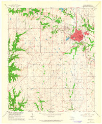
 1963 Ardmore1963 Print · USGSSouthern Oklahoma during the early sixties shows a landscape defined by the Arbuckle Mountains and a booming energy economy. Genealogists and historians can trace family-named sites across the Ardmore Oil Field, find old schools like Southeastern State College, or locate historic markers such as Boggy Depot State Park.2 unique versions available
 - 1963 Map of Madill, 1964 Print
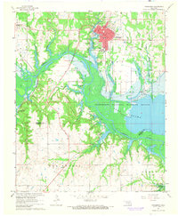
 1963 Madill1964 Print · USGSMadill and Oakland are captured in the early sixties as they expanded along the St Louis - San Francisco line and the shores of City Lake. Genealogists can locate family sites at Oakland-Madill Cem and trace the street-level detail of Will Rogers Sch.2 unique versions available
 - 1963 Map of Mannsville, 1964 Print
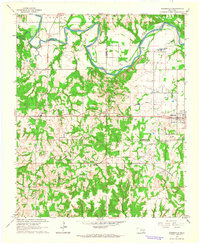 1963 Mannsville1964 Print · USGSSouthern Oklahoma's river valleys and rail corridors are documented here in the early sixties, centered on the community of Mannsville. Researchers can trace old family sites and rural landmarks like Durwood Sch, Nelda Cem, and the St Louis - San Francisco line.2 unique versions available
 - 1963 Map of Ravia, 1964 Print
 1963 Ravia1964 Print · USGSJohnston County at the start of the 1960s shows a landscape of river meanders and growing infrastructure along the Washita River. Researchers can locate family landmarks like Cedar Hill Cem, trace the St Louis-San Francisco line, or explore the small settlement of Russett.2 unique versions available
 - 1963 Map of Mc Millan, 1964 Print
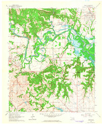
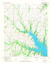
 1963 Mc Millan1964 Print · USGSThe rural landscape of Marshall County is shown in the early sixties as Lake Texoma reached into the surrounding creek valleys. Researchers can trace family roots through sites like McMillan Cem, Pickens Ch, and the settlement of Enyille.2 unique versions available
 - 1967 Map of Tishomingo SW, 1968 Print
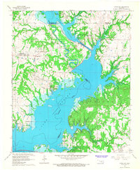
 1967 Tishomingo SW1968 Print · USGSThe Marshall County shoreline of Lake Texoma comes alive in this late 1960s survey of the Kingston and Aylesworth area. Genealogists and historians can trace local landmarks like Grantham Ch, Cliff Cem, and the path of the St Louis - San Francisco railroad.2 unique versions available
 - 1967 Map of Tishomingo, 1968 Print
 1967 Tishomingo1968 Print · USGSTishomingo and the Washita River valley are captured in the late sixties as the local landscape transitioned toward recreation and conservation. Genealogists and researchers can locate Teller Cem, Murray State College, and traces of the St Louis-San Francisco Railroad.
 - 1967 Map of Little City, 1968 Print
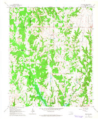
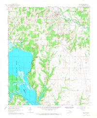
 1967 Little City1968 Print · USGSThe northern reaches of Lake Texoma are captured here in the late sixties, where the Washita River was engineered to protect local industry. Researchers can find Fort Washita, the Confederate Cem, and the rerouted Old Channel near Cumberland.
 - 1967 Map of Milburn, 1968 Print
 1967 Milburn1968 Print · USGSThe Oklahoma heartland meets the northern reaches of the reservoir during the late sixties. Genealogists and local historians can trace rural burial sites like Condon Grove Cem and follow the Old Railroad Grade near Milburn.
End of results
Showing maps 1-9 of 9
Top cities of Marshall County
Frequently asked questions
- What are the different types of historical maps available for Marshall County?
- What is the oldest map of Marshall County?
- Where can I purchase historical maps of Marshall County for my home or office?
- Where can I download high-res historical maps of Marshall County?
- Are there historical topographic maps available for Marshall County?
- Is there historical aerial imagery available for Marshall County?
- Where are historical maps of Marshall County sourced from?