1980s Maps of Oklahoma City, Oklahoma
Explore 9 historic maps of Oklahoma City from the 1980s. These maps offer a rare glimpse into what life looked like during the 1980s — showing old roads, neighborhoods, homes, and landmarks that have changed or disappeared over time.
Whether you're researching your family's past, planning a metal detecting trip, or studying how Oklahoma City's landscape evolved across the 1980s, these high-resolution maps are a powerful tool for exploring the history of this region.
- Focus on a specific era: All maps on this page are from the 1980s, giving you a focused view of this time period.
- See what’s changed: Compare century-old streets, trails, and buildings to today's modern landscape using overlays and satellite layers.
- Research with precision: Use these maps for genealogy, historical research, land use analysis, or educational projects.
- View, download, or print: Maps are fully viewable online in high resolution, and can be downloaded or printed for your own records.
Start exploring Oklahoma City's history through authentic maps from the 1980s. This is your window into the past.
Oklahoma City, OK maps
(9)- 1985 Map of Oklahoma City South
 1985 Oklahoma City South1985 Print · USGSOklahoma City and its southern neighbors show a period of significant growth during the mid-eighties as suburban expansion met rural county lines. Researchers can trace the development of Tinker Air Force Base and locate smaller communities like Goldsby, Stella, and Woody Chapel.2 unique versions available
 - 1986 Map of Spencer
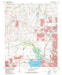
 1986 Spencer1986 Print · USGSOklahoma City and Edmond undergo significant expansion during the mid-eighties as new reservoirs and highways reshape the suburban landscape. Genealogists and historians can trace numerous sites like Memorial Park Cemetery, Lake Aluma, and the Cowboy Hall of Fame.
 - 1986 Map of Moore
 1986 Moore1986 Print · USGSMoore and Norman were rapidly expanding during the mid-eighties as suburban growth reshaped the Oklahoma landscape. Researchers can trace the development of the Atchison Topeka and Santa Fe Railway corridor or locate family sites at Smith Cem and Hollywood Corners.
 - 1986 Map of Oklahoma City SE
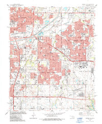
 1986 Oklahoma City SE1986 Print · USGSOklahoma City and its southern neighbors show significant suburban growth in the mid-1980s as the urban footprint expands toward the Canadian River. Researchers can trace the development of local neighborhoods through school sites like Sky Ranch Sch and Meadowbrook Sch or locate family plots in Moore Cem and Emmanuel Cem.2 unique versions available
 - 1986 Map of Britton, 1987 Print
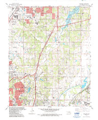
 1986 Britton1987 Print · USGSOklahoma City's northern suburbs reached a period of rapid residential and commercial expansion during the mid-eighties. Researchers can trace the layout of Nichols Hills and The Village, locating landmarks like Rose Hill Burial Park and the historic rails of Britton.
 - 1986 Map of Oklahoma City, 1987 Print
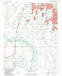
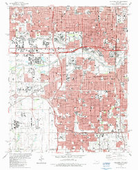 1986 Oklahoma City1987 Print · USGSOklahoma City in the mid-eighties shows a bustling state capital where major rail lines and modern expressways intersect historic residential cores. Genealogists and historians can trace neighborhood development near Fairlawn Cemetery, the Stockyards, and the State Fairground.
 - 1986 Map of Mustang, 1987 Print
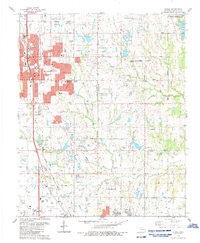
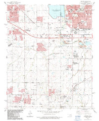 1986 Mustang1987 Print · USGSGreater Oklahoma City was rapidly evolving in the 1980s as suburban life and industrial development integrated with the existing rural landscape. Researchers can trace the layout of growing neighborhoods near Lake Overholser or locate historical sites like Wheatland and the Pleasant Valley Cem.
 - 1986 Map of Midwest City, 1987 Print
 1986 Midwest City1987 Print · USGSMid-century suburban growth and military aviation define the Oklahoma City corridor during the mid-eighties. Researchers can trace the development of Tinker Air Force Base and locate neighborhood landmarks like Sunnyland Cemetery and Douglass High School.
 - 1986 Map of Bethany, 1987 Print
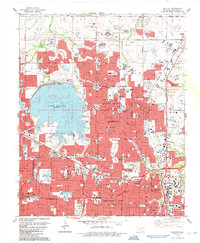
 1986 Bethany1987 Print · USGSOklahoma City and its neighbors were expanding rapidly in the mid-eighties as suburban developments began to flank the North Canadian River. Genealogists and local historians can trace the foundations of BETHANY and WARR ACRES alongside sites like Bethany College and St Joseph Cem.
End of results
Showing maps 1-9 of 9
Top cities near Oklahoma City
- Norman historical maps
- Edmond historical maps
- Midwest City historical maps
- Moore historical maps
- Del City historical maps
- Bethany historical maps
See more
Top neighborhoods of Oklahoma City
- Witcher historical maps
- Green Pastures historical maps
- Flynn historical maps
- Wheatland historical maps
- Poole historical maps
- Stella historical maps
See more
Frequently asked questions
- What are the different types of historical maps available for Oklahoma City?
- What is the oldest map of Oklahoma City?
- Where can I purchase historical maps of Oklahoma City for my home or office?
- Where can I download high-res historical maps of Oklahoma City?
- Are there historical topographic maps available for Oklahoma City?
- Is there historical aerial imagery available for Oklahoma City?
- Where are historical maps of Oklahoma City sourced from?