1930s Maps of Oklahoma City, Oklahoma
Explore 6 historic maps of Oklahoma City from the 1930s. These maps offer a rare glimpse into what life looked like during the 1930s — showing old roads, neighborhoods, homes, and landmarks that have changed or disappeared over time.
Whether you're researching your family's past, planning a metal detecting trip, or studying how Oklahoma City's landscape evolved across the 1930s, these high-resolution maps are a powerful tool for exploring the history of this region.
- Focus on a specific era: All maps on this page are from the 1930s, giving you a focused view of this time period.
- See what’s changed: Compare century-old streets, trails, and buildings to today's modern landscape using overlays and satellite layers.
- Research with precision: Use these maps for genealogy, historical research, land use analysis, or educational projects.
- View, download, or print: Maps are fully viewable online in high resolution, and can be downloaded or printed for your own records.
Start exploring Oklahoma City's history through authentic maps from the 1930s. This is your window into the past.
Oklahoma City, OK maps
(6)- 1930 Map of McLoud
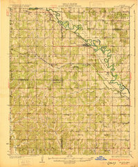 1930 McLoud1930 Print · USGSCentral Oklahoma is captured in the late 1920s as a landscape of rural school districts and river crossings. Researchers can trace early settlements and family landmarks like the Kickapoo Mission, Sweeney Bridge, and the Moore & Nordin Gin.2 unique versions available
 - 1934 Map of Crutcho Creek
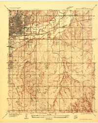 1934 Crutcho Creek1934 Print · USGSOklahoma City and its eastern fringes are captured in the mid-1930s as industrial sites and schools began to dot the landscape. Genealogists can locate family names and sites like Sunny Lane Cemetery, Foster High Sch, and the Oklahoma County Farm.
 - 1934 Map of Moore, 1959 Print
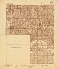
 1934 Moore1959 Print · USGSOklahoma City and its surrounding rural townships are shown in the mid-thirties just as the region’s oil and rail economy was maturing. Genealogists can locate family landmarks like Sunnylane Cemetery or rural community hubs such as Nicoma Park and Hollywood Corners.
 - 1935 Map of Spencer
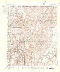 1935 Spencer1935 Print · USGSOklahoma County in the mid-1930s shows a landscape of small rural settlements and schoolhouse districts before the post-war expansion. Researchers can trace family sites near Spencer or locate early landmarks like Harrison Sch (Colored) and the Oklahoma Electric Highway.
 - 1935 Map of Edmond
 1935 Edmond1935 Print · USGSEdmond and its surrounding townships are captured in the mid-1930s as a vital transportation hub for central Oklahoma. Genealogists and historians can trace the early path of U S Highway No 66 and locate numerous rural landmarks like Wagner Cem and Mount Zion Sch.2 unique versions available
 - 1938 Map of Moore
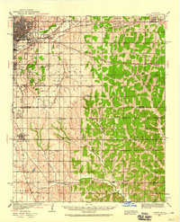
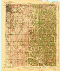 1938 Moore1938 Print · USGSOklahoma City and its southern neighbors were at a rail and oil crossroads in the 1930s. Genealogists can trace early rural life through a dense network of country schools like Foster High Sch and family-named sites such as Burk Burnett Cem.2 unique versions available
End of results
Showing maps 1-6 of 6
Top cities near Oklahoma City
- Norman historical maps
- Edmond historical maps
- Midwest City historical maps
- Moore historical maps
- Del City historical maps
- Bethany historical maps
See more
Top neighborhoods of Oklahoma City
- Witcher historical maps
- Green Pastures historical maps
- Flynn historical maps
- Wheatland historical maps
- Poole historical maps
- Stella historical maps
See more
Frequently asked questions
- What are the different types of historical maps available for Oklahoma City?
- What is the oldest map of Oklahoma City?
- Where can I purchase historical maps of Oklahoma City for my home or office?
- Where can I download high-res historical maps of Oklahoma City?
- Are there historical topographic maps available for Oklahoma City?
- Is there historical aerial imagery available for Oklahoma City?
- Where are historical maps of Oklahoma City sourced from?