Old Maps of Seminole County, Oklahoma for Metal Detecting
Plan your next treasure hunt with 148 historic maps of Seminole County. Find old homesites, ghost towns, trails, and gathering spots that may be lost to time — perfect for identifying promising metal detecting locations.
- Locate forgotten sites: Uncover places like long-lost settlements, abandoned rail lines, or gathering spots.
- Plan better hunts: Use map overlays combined with LiDAR or satellite views to narrow in on historically rich areas.
- Made for detectorists: Thousands of hobbyists use these maps to discover relics, coins, and hidden history.
Use these historic maps to boost your research and find new opportunities beneath the surface of Seminole County.
Seminole County, OK maps
(148)- 1896 Map of Seminole and Prague
 1896 Seminole and Prague1896 Print · USGSOklahoma Territory and tribal nations meet in the mid-1890s along the North Fork Canadian River. Researchers can trace early tribal boundaries and find vanished locations like Mekosukey, Heliswa, and the Seminole Creek Nation Boundary.
 - 1896 Map of Coalgate, 1957 Print
 1896 Coalgate1957 Print · USGSIndian Territory in the mid-1890s shows a landscape of tribal boundaries and nascent rail towns just before the turn of the century. Genealogists and historians can trace the early foundations of Coalgate and Calvin or locate family-named features along Muddy Boggy Creek.
 - 1899 Map of Coalgate
 1899 Coalgate1899 Print · USGSIndian Territory at the close of the nineteenth century is captured here as the coal industry transformed the landscape. Genealogists can trace family roots in the Seminole Nation or search for early mining-era homesites in Coalgate and Phillips.
 - 1900 Map of Wewoka
 1900 Wewoka1900 Print · USGSIndian Territory at the turn of the century shows a landscape defined by tribal nations and the early expansion of the railway. Genealogists can trace family homesteads near Wewoka and Holdenville, or locate remote landmarks like Marks Store and the Baptist Mission.4 unique versions available
 - 1900 Map of Coalgate
 1900 Coalgate1900 Print · USGSIndian Territory at the turn of the century shows a land of tribal boundaries and emerging coal towns. Researchers can trace the early rail corridors of the M. K. and T. R. R. and locate vanished communities like Guertie, Citra, and Legal.3 unique versions available
 - 1901 Map of Stonewall
 1901 Stonewall1901 Print · USGSBefore Oklahoma statehood, this late-century survey captures the Chickasaw Nation and Seminole Nation borderlands in high detail. Researchers can locate early schools like Collins Institute and trace the paths between settlements such as Stonewall, Ada, and Fitzhugh.4 unique versions available
 - 1907 Map of Maud, 1957 Print
 1907 Maud1957 Print · USGSPottawatomie County at the dawn of statehood shows a landscape of emerging rail towns and scattered country schoolhouses. Researchers can trace the early footprints of Maud and Pearson or locate family landmarks like Sacred Heart P O Georgetown and New Paradise School.
 - 1908 Map of Maud
 1908 Maud1908 Print · USGSCentral Oklahoma at the time of statehood shows a landscape of emerging rail towns and rural school districts. Genealogists can trace family roots through sites like Sacred Heart P.O. and Maud, or find vanished schoolhouses such as New Paradise School and Antioch Schools.3 unique versions available
 - 1909 Map of Shawnee
 1909 Shawnee1909 Print · USGSPottawatomie County thrives as a booming rail and agricultural center in the first years of Oklahoma statehood. Genealogists can trace the early grids of Shawnee and Tecumseh or find rural landmarks like Shawnee Mission and Econtuchka.3 unique versions available
 - 1954 Map of Oklahoma City
 1954 Oklahoma City1954 Print · USGSOklahoma City and its surrounding counties are captured here in the early fifties during a period of significant postwar growth. Researchers can trace the development of the Turner Turnpike and locate aviation hubs like Tinker Field or Will Rogers Field.
 - 1957 Map of Ardmore, 1968 Print
 1957 Ardmore1968 Print · USGSSouth-central Oklahoma in the late fifties was a landscape of rising reservoir waters and expanding rail lines. Genealogists and historians can trace the foundations of Ardmore and Duncan or locate early recreation sites at Platt National Park and Lake Murray State Park.3 unique versions available
 - 1957 Map of Oklahoma City, 1969 Print
 1957 Oklahoma City1969 Print · USGSCentral Oklahoma is captured here in a period of significant mid-century growth and industrialization. Researchers can trace family roots through numerous rural markers like Memory Lane Cem, New Hope School, and the sprawling grounds of Tinker Air Force Base.3 unique versions available
 - 1958 Map of Sasakwa, 1959 Print
 1958 Sasakwa1959 Print · USGSThe borderlands of Seminole and Pontotoc counties are captured here in the late fifties, defined by the winding Canadian River and the St Louis San Francisco railroad. Researchers can locate many family-named landmarks and historical sites like Old Mission Cem, Gully Sch, and Sasakwa.3 unique versions available
 - 1958 Map of Francis, 1959 Print
 1958 Francis1959 Print · USGSOklahoma's petroleum and rail history intersect here in the late fifties, centered on the railroad hub at Francis. Genealogists and local historians can trace family roots through numerous sites like Oakman Cem, Lovelady Ch, and Homer.3 unique versions available
 - 1958 Map of Ada, 1959 Print
 1958 Ada1959 Print · USGSOklahoma’s Pontotoc County in the late fifties shows the city of Ada as a bustling junction for three major railroads. Researchers can find numerous local institutions, from East Central State College to rural landmarks like Egypt Cemetery and Latta Sch.6 unique versions available
 - 1958 Map of Vamoosa, 1959 Print
 1958 Vamoosa1959 Print · USGSSeminole and Pontotoc Counties are captured here in the late fifties, showing a rural landscape defined by the Canadian River. Genealogists can trace family history through sites like Tiger Cem, Konawa, and the Summers Chapel Sch.4 unique versions available
 - 1958 Map of Konawa, 1959 Print
 1958 Konawa1959 Print · USGSCentrally located in Oklahoma during the late fifties, this area showcases the intersection of oil exploration and rural settlement. Genealogists can trace family roots through sites like Sacred Heart, Antioch Ch, and the Vista Cem.3 unique versions available
 - 1963 Map of Ardmore
 1963 Ardmore1963 Print · USGSSouthern Oklahoma during the early sixties shows a landscape defined by the Arbuckle Mountains and a booming energy economy. Genealogists and historians can trace family-named sites across the Ardmore Oil Field, find old schools like Southeastern State College, or locate historic markers such as Boggy Depot State Park.2 unique versions available
 - 1963 Map of Oklahoma City
 1963 Oklahoma City1963 Print · USGSCentral Oklahoma in the early sixties showcases a landscape of rapid suburban growth and established oil production. Researchers can trace historic rail lines like the Chicago Rock Island and Pacific RR or locate rural landmarks such as Mayflower School and Bethel Church.
 - 1967 Map of Cromwell, 1968 Print
 1967 Cromwell1968 Print · USGSMid-century Oklahoma energy production and rural community life meet in this 1960s survey of the Seminole County borderlands. Genealogists and historians can locate the Childrens Home, Quarsarty Ch, and legacy family sites at Bearden Cem or Butner.
 - 1967 Map of Prague SW, 1968 Print
 1967 Prague SW1968 Print · USGSSeminole and its neighboring oil fields are documented here in the mid-1960s as the local petroleum economy shaped the rural landscape. Researchers can locate long-standing community landmarks like the Prairie Valley Sch, Payne Cem, and Jarvis Ch.2 unique versions available
 - 1967 Map of Earlsboro, 1968 Print
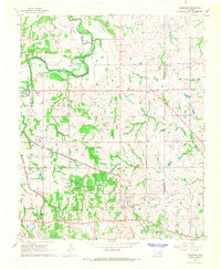 1967 Earlsboro1968 Print · USGSOklahoma's oil country is captured here in the late sixties as the energy industry and agriculture shared the landscape. Genealogists can trace family roots at Neal Cem, Resthaven Cemetery, and local landmarks like South Rock Creek Sch.
 - 1967 Map of Prague NE, 1968 Print
 1967 Prague NE1968 Print · USGSOkfuskee and Seminole counties meet along the winding river loops of central Oklahoma in the late sixties. Genealogists and local historians can locate rural landmarks such as Vanzant Ch, Shady Grove Cem, and the prominent Red Mound.
 - 1967 Map of Allen, 1968 Print
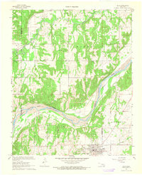 1967 Allen1968 Print · USGSThe tri-county border of Pontotoc, Hughes, and Seminole counties comes alive in this late 1960s survey during the region's oil-producing era. Genealogists and historians can locate the Old Indian Treaty Boundary alongside rural landmarks like Greenleaf Sch and the extensive Allen Oil Field.2 unique versions available
 - 1967 Map of Prague SE, 1968 Print
 1967 Prague SE1968 Print · USGSThe borderlands of Lincoln and Seminole counties in the late sixties reveal an active petroleum landscape and a close-knit rural community. Researchers can locate family landmarks like Strother Sch, Tallahasee Ch, and the East Sylvian Oil Field.
Showing maps 1-25 of 148
Top cities of Seminole County
- Seminole historical maps
- Wewoka historical maps
- Konawa historical maps
- Bowlegs historical maps
- Cromwell historical maps
- Sasakwa historical maps
See more
Frequently asked questions
- What are the different types of historical maps available for Seminole County?
- What is the oldest map of Seminole County?
- Where can I purchase historical maps of Seminole County for my home or office?
- Where can I download high-res historical maps of Seminole County?
- Are there historical topographic maps available for Seminole County?
- Is there historical aerial imagery available for Seminole County?
- Where are historical maps of Seminole County sourced from?