
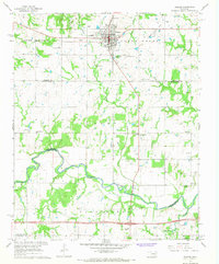
1967 Map of Prague SE
USGS Topo · Published 1968About this map
Red Mound rises as a prominent landmark in this mid-1960s landscape, positioned north of the county line separating Lincoln and Seminole counties. The area reflects a rural economy defined by petroleum extraction and local community centers, with the East Sylvian Oil Field and North Bethel Oil Field dominating the eastern sections. Networks of pipelines crisscross the terrain, weaving between numerous gravel pits and quarries that dot the countryside.
Find a feature on this map
26 named features on this map. Tap any name to fly to it.
Don’t see what you’re looking for? This feature index may not catch every label — zoom into the map to look around manually.
Map Details
Editions of this 1967 Prague SE Map
This is the sole edition of this map. No revisions or reprints were ever made.
Other maps of this area

1896 · Seminole and Prague
USGS Topo · 1:125,000

1900 · Wewoka
USGS Topo · 1:125,000

1954 · Oklahoma City
USGS Topo · 1:250,000

1957 · Oklahoma City
USGS Topo · 1:250,000

1963 · Oklahoma City
USGS Topo · 1:250,000

1967 · Cromwell
USGS Topo · 1:24,000

1967 · Prague SW
USGS Topo · 1:24,000

1967 · Prague NE
USGS Topo · 1:24,000

1967 · Boley
USGS Topo · 1:24,000
1967 · Prague
USGS Topo · 1:24,000