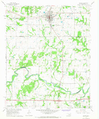
1967 Map of Prague
USGS Topo · Published 1968About this map
Prague serves as the primary hub of this central Oklahoma landscape during the late 1960s, reflecting its Czech heritage through landmarks like St Wenceslaus Cem and the Czech National Cem. The town's mid-century infrastructure is well-defined, featuring the Prague Municipal Airport, a High Sch, and a Drive-in Theater west of the main settlement. The surrounding terrain is a mosaic of agricultural fields and active energy production, notably within the West Prague Oil Field and the North Earlsboro Oil Field at the southern margin.
Find a feature on this map
44 named features on this map. Tap any name to fly to it.
Don’t see what you’re looking for? This feature index may not catch every label — zoom into the map to look around manually.
Map Details
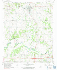
Editions of this 1967 Prague Map
2 editions found
Other maps of this area

1896 · Seminole and Prague
USGS Topo · 1:125,000

1905 · Chandler
USGS Topo · 1:62,500

1907 · Chandler
USGS Topo · 1:62,500

1909 · Shawnee
USGS Topo · 1:62,500

1929 · Stroud
USGS Topo · 1:62,500

1932 · Stroud
USGS Topo · 1:62,500

1954 · Oklahoma City
USGS Topo · 1:250,000

1957 · Oklahoma City
USGS Topo · 1:250,000

1963 · Oklahoma City
USGS Topo · 1:250,000

1967 · Prague SW
USGS Topo · 1:24,000