1900s (20th Century) Maps of Baker County, Oregon
Explore 138 historic maps of Baker County from the 1900s (20th Century). These maps offer a rare glimpse into what life looked like during the 1900s — showing old roads, neighborhoods, homes, and landmarks that have changed or disappeared over time.
Whether you're researching your family's past, planning a metal detecting trip, or studying how Baker County's landscape evolved across the 1900s, these high-resolution maps are a powerful tool for exploring the history of this region.
- Focus on a specific era: All maps on this page are from the 1900s, giving you a focused view of this time period.
- See what’s changed: Compare century-old streets, trails, and buildings to today's modern landscape using overlays and satellite layers.
- Research with precision: Use these maps for genealogy, historical research, land use analysis, or educational projects.
- View, download, or print: Maps are fully viewable online in high resolution, and can be downloaded or printed for your own records.
Start exploring Baker County's history through authentic maps from the 1900s. This is your window into the past.
Baker County, OR maps
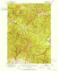
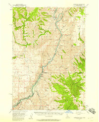
(138)- 1901 Map of Baker City
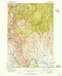
 1901 Baker City1901 Print · USGSBaker County at the close of the century was a landscape of bustling rail hubs and active mining districts. Genealogists and historians can trace early settlements like Auburn, follow the Sumpter Valley Railroad line, or locate specific operations like the Flagstaff Mine.4 unique versions available
 - 1901 Map of Sumpter
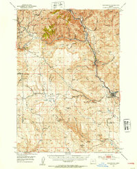
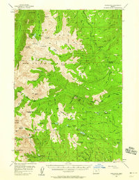
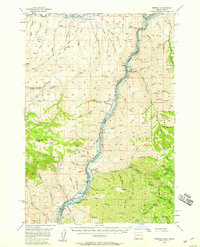
 1901 Sumpter1901 Print · USGSThe Oregon gold boom is at its peak in this turn-of-the-century survey of the high Elkhorn Range. Miners and genealogists can trace the early rail corridor of the Sumpter Valley River and locate historic camps like Bourne, Belleview, and French Diggings.4 unique versions available
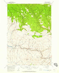
 - 1906 Map of Telocaset
 1906 Telocaset1906 Print · USGSEastern Oregon at the peak of its railroad and ranching era features a landscape of thriving valley towns and high forest reserves. Genealogists and local historians can trace early settlements like Union and Cove, or locate long-standing landmarks such as Hot Lake and Medical Springs.3 unique versions available
 - 1908 Map of Ironside Mountain
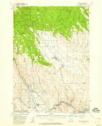
 1908 Ironside Mountain1908 Print · USGSEastern Oregon ranching and timber frontiers come alive in this survey of the Blue Mountains region at the turn of the century. Researchers can trace early family holdings like Tureman's Ranch and Hunter's Ranch, or locate the historic Otis Sawmill.2 unique versions available
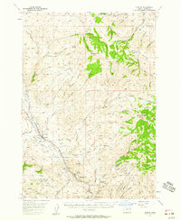
 - 1915 Map of Pine
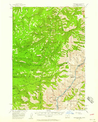
 1915 Pine1915 Print · USGSEastern Oregon was a hub of gold mining and river commerce in the early twentieth century. Researchers can trace the legacy of pioneer families and industry at the Sanger Mine, follow the old Oregon-Washington Railroad, or locate the Mineral P O along the river.3 unique versions available
 - 1951 Map of Bates, 1953 Print
 1951 Bates1953 Print · USGSThe high country of Grant and Baker counties is captured here in the early fifties during a period of active mountain forestry and mining. Genealogists and historians can trace old claims like the Ben Harrison Mine and Standard Mine or locate the settlement at Bates.3 unique versions available
 - 1951 Map of Huntington, 1953 Print
 1951 Huntington1953 Print · USGSEastern Oregon in the early fifties shows a landscape shaped by the Union Pacific and the historic Oregon Trail. Researchers can trace the river-and-rail economy through the Placer Mines of Dixie Creek and the industrial works at Lime.3 unique versions available
 - 1952 Map of Olds Ferry NW, 1954 Print
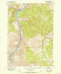 1952 Olds Ferry NW1954 Print · USGSThe Snake River canyon at the Idaho-Oregon border is captured here in the early 1950s, showing the intersection of river navigation and rail transport. Genealogists and historians can trace the remote Hibbard Creek School, the settlement at Prevost, and hazardous river crossings like Shoofly Rapids.4 unique versions available
 - 1952 Map of Olds Ferry, 1954 Print
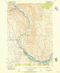 1952 Olds Ferry1954 Print · USGSThe Snake River crossing at the Idaho-Oregon border was a vital transit point for pioneers and early rail travelers during the mid-twentieth century. Trace the path of the Old Oregon Trail Highway past the Original Site Olds Ferry and the Coal Mine near Indian Head Mtn.3 unique versions available
 - 1952 Map of Olds Ferry, 1956 Print
 1952 Olds Ferry1956 Print · USGSThe Snake River canyon and the historic Oregon-Idaho borderlands are captured here in the early fifties, showing the region's transition from pioneer routes to modern infrastructure. Researchers can trace the Oregon Trail, locate early crossing points like Olds Ferry (Site), and find defunct rural schoolhouses such as Eaton Sch (Aband).3 unique versions available
 - 1953 Map of Pendleton, 1957 Print
 1953 Pendleton1957 Print · USGSNortheastern Oregon and the Columbia River frontier are captured here in the early fifties, a time of massive federal infrastructure projects. Researchers can trace the historic route of The Old Oregon Trail as it passes near the Umatilla Ordnance Depot and the new McNary Dam.4 unique versions available
 - 1954 Map of Cornucopia, 1958 Print
 1954 Cornucopia1958 Print · USGSThe Wallowa Mountains are shown in the mid-1950s during a peak era for high-country mining and forest administration. Researchers can locate the Cornucopia Mines, trace the trails to Nebo Lookout, and find remote outposts like Fish Lake Guard Sta.4 unique versions available
 - 1954 Map of Eagle Cap, 1958 Print
 1954 Eagle Cap1958 Print · USGSThe Wallowa Mountains are captured here in the mid-fifties, showing a landscape of alpine lakes and high-country outposts. You can trace early trails and mining sites like the Basin Mine, or locate backcountry landmarks such as Boulder Park Resort and the Two Color Guard Sta.4 unique versions available
 - 1955 Map of Baker, 1964 Print
 1955 Baker1964 Print · USGSThe Oregon-Idaho borderlands are captured here in the mid-fifties as the Snake River underwent massive changes from dam construction. Trace the Oregon Trail Memorial Monument near Baker, find early mines like Virtue Mine, and follow the Union Pacific Railroad through Huntington.4 unique versions available
 - 1955 Map of Grangeville, 1964 Print
 1955 Grangeville1964 Print · USGSThe high country of the Idaho-Oregon border comes alive in the mid-1950s, showing the deep river canyons and mountain peaks. Trace the Union Pacific RR through the valleys or locate settlements like Grangeville, Joseph, and the shoreline of Wallowa Lake.4 unique versions available
 - 1955 Map of Canyon City, 1966 Print
 1955 Canyon City1966 Print · USGSCentral Oregon's high desert and timber country are captured here in the mid-fifties, showing the rugged ranching and logging landscape. Trace the path of the Sumpter Valley Ry or locate remote settlements like Izee, Whitney, and Ritter.4 unique versions available
 - 1956 Map of Pendleton
 1956 Pendleton1956 Print · USGSNortheastern Oregon’s high plateau and timbered peaks appear here in the mid-fifties, during a time of major military and hydroelectric development. Trace the path of The Old Oregon Trail alongside modern landmarks like McNary Dam and the Umatilla Ordnance Depot.
 - 1957 Map of Halfway, 1958 Print
 1957 Halfway1958 Print · USGSEagle Valley and the surrounding Whitman National Forest are shown in the late fifties, just before the landscape was altered by hydroelectric development. Researchers can trace the original site of Robinette before it was submerged, alongside local landmarks like Union HS and Mehlhorn Mill.2 unique versions available
 - 1957 Map of Homestead, 1958 Print
 1957 Homestead1958 Print · USGSThe Snake River canyon and the high Wallowa wilderness are captured in the late 1950s as a landscape of isolated outposts and steep timberlands. Local historians can trace the remote Homestead settlement, the winding Kleinschmidt Grade, and the Coverdale Guard Station.3 unique versions available
 - 1957 Map of Copperfield, 1958 Print
 1957 Copperfield1958 Print · USGSThe Snake River canyon was on the verge of total transformation in the late fifties as hydroelectric projects began to reshape the Idaho-Oregon border. Researchers can trace the original river course and landmarks like Brownlee Dam, Copperfield, and the Oxbow Sch before water levels rose.3 unique versions available
 - 1957 Map of Sparta, 1958 Print
 1957 Sparta1958 Print · USGSThe high timber and mining country of eastern Oregon is shown here in the late fifties, during a period of active resource extraction. Researchers can locate numerous historic workings including the Gem Mine, Del Monte Mine, and the rail-connected Colvard Station.2 unique versions available
 - 1957 Map of Durkee, 1959 Print
 1957 Durkee1959 Print · USGSThe Burnt River Valley in the late fifties is captured here as a critical corridor for both pioneer history and modern transport. You can trace the historic Oregon Trail alongside the Union Pacific Railroad, locating Plano School, Gold Ridge Mine, and the settlement of Durkee.2 unique versions available
 - 1957 Map of Mineral, 1959 Print
 1957 Mineral1959 Print · USGSThe Snake River canyon at the Oregon and Idaho border was a landscape of remote mining camps and rail sidings in the late fifties. Genealogists and historians can trace the Union Pacific line to old sites like Mineral and the Connor Creek Mine.
 - 1959 Map of Baker
 1959 Baker1959 Print · USGSThe Oregon and Idaho borderlands come alive in the late fifties, showing the rugged corridor along the Snake River and the high peaks of the Wallowa Mountains. Researchers can trace the legacy of the Union Pacific railroad or locate historic mining sites like the Flagstaff Mine and Virtue Mine.2 unique versions available
 - 1959 Map of Grangeville
 1959 Grangeville1959 Print · USGSThe high alpine peaks and deep river canyons of the Idaho-Oregon borderlands are captured in the late fifties. Researchers can trace the Union Pacific RR through the valleys to settlements like Enterprise, Union, and Grangeville.2 unique versions available
Showing maps 1-25 of 138
Top cities of Baker County
- Baker City historical maps
- Huntington historical maps
- Haines historical maps
- Halfway historical maps
- Richland historical maps
- Sumpter historical maps
See more
Frequently asked questions
- What are the different types of historical maps available for Baker County?
- What is the oldest map of Baker County?
- Where can I purchase historical maps of Baker County for my home or office?
- Where can I download high-res historical maps of Baker County?
- Are there historical topographic maps available for Baker County?
- Is there historical aerial imagery available for Baker County?
- Where are historical maps of Baker County sourced from?