1960s Maps of Baker County, Oregon
Explore 23 historic maps of Baker County from the 1960s. These maps offer a rare glimpse into what life looked like during the 1960s — showing old roads, neighborhoods, homes, and landmarks that have changed or disappeared over time.
Whether you're researching your family's past, planning a metal detecting trip, or studying how Baker County's landscape evolved across the 1960s, these high-resolution maps are a powerful tool for exploring the history of this region.
- Focus on a specific era: All maps on this page are from the 1960s, giving you a focused view of this time period.
- See what’s changed: Compare century-old streets, trails, and buildings to today's modern landscape using overlays and satellite layers.
- Research with precision: Use these maps for genealogy, historical research, land use analysis, or educational projects.
- View, download, or print: Maps are fully viewable online in high resolution, and can be downloaded or printed for your own records.
Start exploring Baker County's history through authentic maps from the 1960s. This is your window into the past.
Baker County, OR maps
(23)- 1961 Map of Whitney, 1976 Print
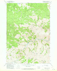
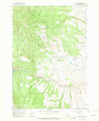
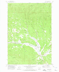 1961 Whitney1976 Print · USGSBaker County's timber and mining heritage is on display in the early 1970s, focused on the high-elevation valley of the North Fork Burnt River. Genealogists and historians can trace the Sumpter Valley Railroad, the Whitney townsite, and old mining operations like the Ranes & Borger Mine.
 - 1964 Map of Bridgeport, 1966 Print
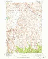
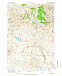 1964 Bridgeport1966 Print · USGSEastern Oregon gold country comes into sharp focus during the mid-1960s, showing a landscape shaped by early mining and water management. Researchers can trace the ruins of Malheur City and Eldorado or locate specific workings like the Humboldt Mine and Iron Door Mine.2 unique versions available
 - 1964 Map of Ironside, 1966 Print
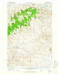 1964 Ironside1966 Print · USGSIronside and the surrounding high country of the Oregon borderlands are captured here in the mid-sixties. Genealogists and historians can trace the foundations of this ranching community through the Ironside Sch, the Golden Eagle Mine, and the historic Treaty Boundary.
 - 1965 Map of Anthony Butte, 1967 Print
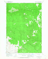
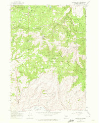
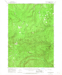 1965 Anthony Butte1967 Print · USGSThe high divide of the Whitman National Forest in the mid-1960s is preserved here at the intersection of Union and Baker Counties. Trace the remote mountain geography through the site of the Indiana Mine, the Porcupine Guard Station, and high-altitude landmarks like Anthony Butte.3 unique versions available
 - 1965 Map of Flagstaff Butte, 1967 Print
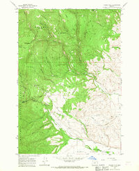
 1965 Flagstaff Butte1967 Print · USGSThe high Oregon backcountry near the Union and Baker county line is captured here in the mid-1960s. Researchers can locate remote landmarks like Taylor Green, the Gaging Station, and the distinctively named Sufferin Smith Spring among the winding trails of the Eagle Cap Wilderness.2 unique versions available
 - 1965 Map of Tucker Flat, 1967 Print
 1965 Tucker Flat1967 Print · USGSThe Oregon backcountry between Union and Baker counties was a land of timber and water management in the mid-sixties. Researchers can trace the legacy of resource use through sites like China Diggings and the intricate network of the flume and ditch systems near Tucker Flat.2 unique versions available
 - 1965 Map of North Powder, 1967 Print
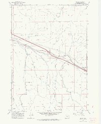
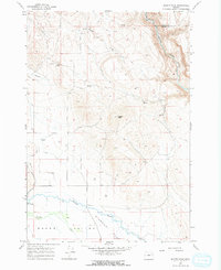
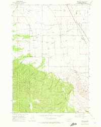
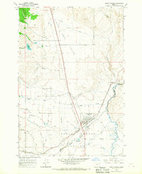 1965 North Powder1967 Print · USGSNorth Powder thrived along the Union Pacific rail corridor in the mid-sixties, serving as an agricultural hub between the Powder River and the valley slopes. Genealogists and historians can trace local landmarks like the Dorion Historical Marker, the town Cemetery, and extensive irrigation works including the Shaw Brant Ditch.
 - 1965 Map of Telocaset, 1967 Print
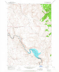 1965 Telocaset1967 Print · USGSSettlement and transit follow the rail and river through Union County in the mid-1960s. Genealogists and historians can trace the Union Pacific line as it passes Telocaset and Sago, or locate the waters of the Thief Valley Reservoir.2 unique versions available
 - 1967 Map of Sawtooth Ridge, 1971 Print
 1967 Sawtooth Ridge1971 Print · USGSThe high timber and river lowlands of eastern Oregon meet in the late sixties along the Union and Baker County line. Researchers can trace old mountain routes like Jeep Trails and locate historical mining signs such as the prospect sites near Clover Creek.2 unique versions available
 - 1967 Map of Virtue Flat, 1971 Print
 1967 Virtue Flat1971 Print · USGSEastern Oregon gold country is captured here in the late sixties, where the historic Oregon Trail meets a landscape defined by mining. Trace the routes to old workings like the Virtue Mine, Flagstaff Mine, and Columbia Mine near the Oregon Trail Historical Monument.2 unique versions available
 - 1967 Map of Encina, 1971 Print
 1967 Encina1971 Print · USGSBaker County's mining and transit history is on full display in the late sixties as the rail corridor shapes the landscape. Trace the legacy of old workings at the White Swan Mine and Brazos Mine, or locate the rural Cem near Dogtown Creek.4 unique versions available
 - 1967 Map of Baker, 1971 Print
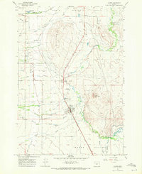
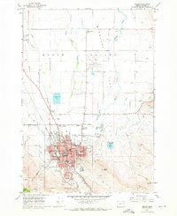 1967 Baker1971 Print · USGSBaker emerges as a bustling hub in the late sixties, balancing its pioneer heritage with modern aviation and education. Genealogists can locate family landmarks like Mt Hope Cemetery, Pocahontas, and several neighborhood schools including Brooklyn Sch.2 unique versions available
 - 1967 Map of Keating, 1971 Print
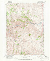
 1967 Keating1971 Print · USGSBaker County ranching and water rights take center stage in the late sixties along the winding Powder River. Genealogists and historians can trace irrigation heritage and local landmarks like the Grange Hall, Middle Bridge, and Love Reservoir.
 - 1967 Map of Keating NW, 1971 Print
 1967 Keating NW1971 Print · USGSThe high desert canyons and valleys of Baker County are seen here in the late sixties, highlighting the vital role of the Powder River in eastern Oregon. Researchers can trace historic irrigation systems like Emele Ditch and find local landmarks such as the Blue Mountain Sch.2 unique versions available
 - 1967 Map of French Gulch, 1971 Print
 1967 French Gulch1971 Print · USGSBaker County's high-elevation forest and river canyons are captured here in the late sixties, showing the transition from the mountains to the valley floor. Researchers can trace resource development and water rights through features like the Gaging Station, several Mines, and Bennett Reservoir.3 unique versions available
 - 1967 Map of Dooley Mtn, 1971 Print
 1967 Dooley Mtn1971 Print · USGSThe high country of Baker, Oregon, is captured here in the late sixties, showcasing the high-elevation water sources and timberlands of the Whitman National Forest. Researchers can trace the old paths around Dooley Mtn, locating remote points like Moonshine Spring and Rooster Rock Spring.2 unique versions available
 - 1967 Map of Lost Basin, 1971 Print
 1967 Lost Basin1971 Print · USGSBaker County's high desert terrain is captured here in the late sixties, showcasing a landscape of isolated mines and vital water improvements. Genealogists and local historians can trace the paths of old irrigation projects like Banks Ditch and explore named sites such as Sheep Mountain and Lost Basin.2 unique versions available
 - 1967 Map of Haines, 1971 Print
 1967 Haines1971 Print · USGSBaker Valley ranching and rail life are centered around Haines in the late sixties, where the valley floor is etched with intricate sloughs and ditches. Genealogists and local historians can trace family-named landmarks like Christensen Slough and Rock Creek Cem.
 - 1967 Map of Magpie Peak, 1971 Print
 1967 Magpie Peak1971 Print · USGSBaker County in the late sixties shows a transition from high-elevation peaks to the irrigated agriculture of the Baker Valley. Researchers can trace early water rights and ranching through landmarks like Colton Dam, Swinger Ditch, and Foley Spring.2 unique versions available
 - 1967 Map of Blue Canyon, 1972 Print
 1967 Blue Canyon1972 Print · USGSThe high country of the Whitman National Forest comes into view during the late sixties, highlighting the remnants of the region's mining heritage. Local historians can trace the Auburn (Site), locate the Molloy Cabin (Ruin), and find the isolated Cem near the head of Blue Canyon.3 unique versions available
 - 1967 Map of Bowen Valley, 1972 Print
 1967 Bowen Valley1972 Print · USGSIn the late 1960s, the Powder River landscape near Salisbury was a network of high-desert ranchlands and mountain timber. Researchers can trace the legacy of rural education and water rights at the Stewart Sch, Licklider Reservoir, and along the Union Pacific line.3 unique versions available
 - 1967 Map of Wingville, 1972 Print
 1967 Wingville1972 Print · USGSBaker Valley and the foothills of the Blue Mountains are captured here in the late sixties as the region's ranching and mining heritage remained clearly visible. Genealogists and historians can trace the Wingville community and its Wingville Cem, alongside industrial sites like the Young America Mine and the Union Pacific railroad.2 unique versions available
 - 1967 Map of Brannan Gulch, 1972 Print
 1967 Brannan Gulch1972 Print · USGSBaker County's high forest country and mining claims are captured here in the late sixties, just before the turn of the decade. Researchers can trace historic prospecting sites like the Elliot Mine or locate high-altitude landmarks such as Bald Mtn Lookout.3 unique versions available
End of results
Showing maps 1-23 of 23
Top cities of Baker County
- Baker City historical maps
- Huntington historical maps
- Haines historical maps
- Halfway historical maps
- Richland historical maps
- Sumpter historical maps
See more
Frequently asked questions
- What are the different types of historical maps available for Baker County?
- What is the oldest map of Baker County?
- Where can I purchase historical maps of Baker County for my home or office?
- Where can I download high-res historical maps of Baker County?
- Are there historical topographic maps available for Baker County?
- Is there historical aerial imagery available for Baker County?
- Where are historical maps of Baker County sourced from?