Old Maps of Clatsop County, Oregon for Metal Detecting
Plan your next treasure hunt with 230 historic maps of Clatsop County. Find old homesites, ghost towns, trails, and gathering spots that may be lost to time — perfect for identifying promising metal detecting locations.
- Locate forgotten sites: Uncover places like long-lost settlements, abandoned rail lines, or gathering spots.
- Plan better hunts: Use map overlays combined with LiDAR or satellite views to narrow in on historically rich areas.
- Made for detectorists: Thousands of hobbyists use these maps to discover relics, coins, and hidden history.
Use these historic maps to boost your research and find new opportunities beneath the surface of Clatsop County.
Clatsop County, OR maps
(230)- 1919 Map of Astoria, 1928 Print
 1919 Astoria1928 Print · USGSCoastal Oregon at the end of the Great War reveals a busy network of military posts, rail lines, and river commerce. Genealogists and historians can trace the early footprints of Astoria and Warrenton or locate specific sites like Fort Stevens and Cullaby Lake.
 - 1938 Map of Cape Disappointment
 1938 Cape Disappointment1938 Print · USGSThe Long Beach Peninsula in the late 1930s was a bustling landscape of oyster docks, coastal ranches, and military outposts. Genealogists can trace family holdings like the Loomis Ranch or find local landmarks including the Moby Dick Hotel and Fort Canby.
 - 1938 Map of Fort Columbia, 1957 Print
 1938 Fort Columbia1957 Print · USGSCoastal Washington and the Columbia River estuary appear in the late 1930s, showing a landscape of maritime defense and family-run ranches. Trace historic local landmarks like the Fort Columbia Military Reservation, the Peaceful Hill Cem, and the U S Quarantine Station.2 unique versions available
 - 1939 Map of Astoria
 1939 Astoria1939 Print · USGSThe Columbia River mouth and Oregon coast appear here just before the Second World War, showing a landscape of maritime defense and timber industry. Genealogists can locate family-named landmarks and rural hubs like Netel Grange, Soldiers Cem, and Youngs River Falls Sch.
 - 1939 Map of Saddle Mountain, 1941 Print
 1939 Saddle Mountain1941 Print · USGSCoastal Oregon at the end of the 1930s is a landscape of dense timber and remote outposts. Genealogists and historians can trace the early road networks connecting Jewell and Elsie, or locate the C C C Camp Jewell and the Lewis and Clark GS deep in the hills.
 - 1940 Map of Svensen
 1940 Svensen1940 Print · USGSCoastal Clatsop County at the start of the 1940s reveals a complex network of river channels and small rail-side settlements. Genealogists and historians can locate old landmarks like Ivy Station, the CCC Camp, and several rural schoolhouses including Olney Sch.
 - 1940 Map of Brookfield
 1940 Brookfield1940 Print · USGSPacific and Wahkiakum Counties are shown in detail during the early 1940s, highlighting the heavy industrial presence along the Columbia River shoreline. Researchers can locate salmon canneries, logging camps, and family holdings such as the Pillar Rock Cannery, Old Camp Brix Logging Co, and Maki Ranch.
 - 1940 Map of Cape Falcon
 1940 Cape Falcon1940 Print · USGSCoastal Clatsop County is captured just before the war, showing the development of Seaside and Cannon Beach along the Pacific. Researchers can trace early logging operations at the Markham Callow Logging Camp or locate the Ferndale Sch and Henderson Ranch.
 - 1941 Map of Keasey
 1941 Keasey1941 Print · USGSThe timber and rail economy of northwest Oregon is captured here just before the war. Trace the path of the Oregon American Lumber Co railroad and locate family landmarks like A W Nelsons Farm and the Winema Sch.
 - 1941 Map of Skamokawa
 1941 Skamokawa1941 Print · USGSWahkiakum County's timber and river culture is captured here during the early 1940s, showing the intersection of logging camps and Columbia River fisheries. Researchers can locate family landmarks like the Oatfield Ranch, trace the Crown Willamette Headquarters Camp, or find the Fern Hill Cemetery.
 - 1941 Map of Cathlamet
 1941 Cathlamet1941 Print · USGSThe Lower Columbia River reaches its widest breadth here during the early 1940s, connecting riverside timber and milling hubs. Researchers can trace the family names of early settlers on Puget Island or find riverfront landmarks like Ankeny Landing and Clifton.
 - 1943 Map of Fort Columbia
 1943 Fort Columbia1943 Print · USGSThe coastal defense and river economy of Pacific County are captured here during the wartime era. Genealogists and historians can locate numerous family-named landmarks like Gile Ranch or Kyle Ranch alongside the Naselle State Salmon Hatchery and Fort Columbia.
 - 1943 Map of Keasey
 1943 Keasey1943 Print · USGSThe timber country of the northern Oregon Coast Range comes alive in the early 1940s as loggers worked the Nehalem River basin. Researchers can trace the industrial footprint of the Oregon American Lumber Company and find small outposts like Birkenfeld, Keasey, and Neverstill.
 - 1943 Map of Saddle Mtn.
 1943 Saddle Mtn.1943 Print · USGSCoastal Oregon timberlands and the upper Nehalem River valley are captured in detail during the early forties. Researchers can trace the development of riverside settlements like Jewell and Tideport, or locate landmarks such as Vinemaple Sch and the Rector Lookout.
 - 1943 Map of Copalis Beach
 1943 Copalis Beach1943 Print · USGSThe Washington coast in the 1940s is detailed here from the Olympic Peninsula to the Columbia River. Trace old beach settlements like Moclips and Copalis Beach alongside landmarks like the Willapa Bay Lighthouse.
 - 1948 Map of Vancouver, 1957 Print
 1948 Vancouver1957 Print · USGSPost-war growth transforms the river valleys of the Pacific Northwest as the timber and rail economy thrives. Trace family roots in Tillamook or Oregon City, and locate vanished landmarks like the spit at Bayocean or the Skamania Mine.
 - 1949 Map of Astoria
 1949 Astoria1949 Print · USGSThe mouth of the Columbia River comes to life in this mid-century survey, showing the busy maritime hub of Astoria and its surrounding riverbanks. Genealogists and historians can trace the development of Navy Heights, find the Astor Column, and locate early schools like School No 26.4 unique versions available
 - 1949 Map of Chinook, 1954 Print
 1949 Chinook1954 Print · USGSThe mouth of the Columbia River and the rugged Pacific County coastline are captured here in the mid-twentieth century. Genealogists and local historians can trace family landholdings like Goulter Ranch and Beeker Ranch alongside landmarks like Stringtown and Fort Columbia Military Reservation.4 unique versions available
 - 1949 Map of Knappton, 1954 Print
 1949 Knappton1954 Print · USGSThe Columbia River shoreline and the timberlands of Pacific County are captured here just after the war. Discover the locations of the Quarantine Sta, the Old Railroad Grade, and small riverfront landings like Frankfort and Knappton.5 unique versions available
 - 1949 Map of Cathlamet Bay, 1955 Print
 1949 Cathlamet Bay1955 Print · USGSClatsop County shorelines and the Columbia River islands appear here during the late 1940s. Researchers can trace the rail-and-road corridor through Svensen, locate family sites near Fern Hill Sch, and see early land reclamation at Mott Island.4 unique versions available
 - 1949 Map of Tillamook Head, 1955 Print
 1949 Tillamook Head1955 Print · USGSThe Oregon coast at the end of the 1940s reveals a landscape of growing seaside resorts and deep timbered headlands. You can trace early transit corridors like the Old Railroad Grade or locate local landmarks including Central Sch and the monolith at Haystack Rock.3 unique versions available
 - 1949 Map of Green Mountain, 1955 Print
 1949 Green Mountain1955 Print · USGSCoastal Oregon's timber country is captured here in the late 1940s, highlighting the transition from rail-based logging to forest road networks. Genealogists and researchers can trace the old Nehalem North Fork Klaskanine RR and early grades like Glazers Grade near the Klaskanine Fish Hatchery.2 unique versions available
 - 1949 Map of Gearhart, 1955 Print
 1949 Gearhart1955 Print · USGSThe Clatsop County coastline in the late 1940s reveals a landscape of military training grounds and quiet seaside resort towns. Trace the early footprints of Gearhart and Seaside alongside the Spokane Portland and Seattle Railway and the Clatsop Plains Sch.5 unique versions available
 - 1949 Map of Rosburg, 1955 Print
 1949 Rosburg1955 Print · USGSCoastal Wahkiakum County is depicted here in the late 1940s as a landscape of tidewater sloughs and river landings. Genealogists and historians can trace riverside settlements at Rosburg, Altoona, and Oneida, or locate landmarks like Old Camp Brix and the Rosburg Sch.3 unique versions available
 - 1949 Map of Cape Disappointment, 1955 Print
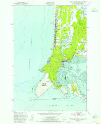 1949 Cape Disappointment1955 Print · USGSThe Washington coast at the mouth of the Columbia River comes alive in this mid-century survey of the Long Beach Peninsula. Genealogists and local historians can trace family properties like Christorf Ranch, visit the Lone Fir Cem, or locate the historic Fort Canby military grounds.4 unique versions available
Showing maps 1-25 of 230
Top cities of Clatsop County
- Astoria historical maps
- Seaside historical maps
- Warrenton historical maps
- Cannon Beach historical maps
- Gearhart historical maps
Frequently asked questions
- What are the different types of historical maps available for Clatsop County?
- What is the oldest map of Clatsop County?
- Where can I purchase historical maps of Clatsop County for my home or office?
- Where can I download high-res historical maps of Clatsop County?
- Are there historical topographic maps available for Clatsop County?
- Is there historical aerial imagery available for Clatsop County?
- Where are historical maps of Clatsop County sourced from?