1980s Maps of Clatsop County, Oregon
Explore 18 historic maps of Clatsop County from the 1980s. These maps offer a rare glimpse into what life looked like during the 1980s — showing old roads, neighborhoods, homes, and landmarks that have changed or disappeared over time.
Whether you're researching your family's past, planning a metal detecting trip, or studying how Clatsop County's landscape evolved across the 1980s, these high-resolution maps are a powerful tool for exploring the history of this region.
- Focus on a specific era: All maps on this page are from the 1980s, giving you a focused view of this time period.
- See what’s changed: Compare century-old streets, trails, and buildings to today's modern landscape using overlays and satellite layers.
- Research with precision: Use these maps for genealogy, historical research, land use analysis, or educational projects.
- View, download, or print: Maps are fully viewable online in high resolution, and can be downloaded or printed for your own records.
Start exploring Clatsop County's history through authentic maps from the 1980s. This is your window into the past.
Clatsop County, OR maps
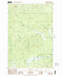
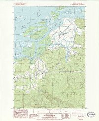
(18)- 1980 Map of Ilwaco, 1989 Print
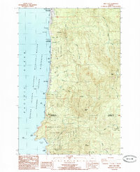
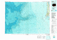 1980 Ilwaco1989 Print · USGSThe Washington-Oregon borderlands come into focus during the 1980s, revealing the coastal communities of the North Beach Peninsula and the mouth of the Columbia. Researchers can trace historical sites like Fort Canby State Park, locate the North Head Lighthouse, and explore the shoreline from Ocean Park to Ilwaco.
 - 1981 Map of Astoria, 1982 Print
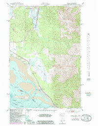
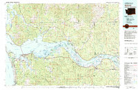 1981 Astoria1982 Print · USGSThe Oregon and Washington borderlands meet at the Columbia River estuary in the early eighties, a time of active timber transport and maritime trade. Researchers can trace the river's many islands, the grounds of Fort Stevens, and riverside towns like Cathlamet and Westport.3 unique versions available
 - 1984 Map of Hamlet
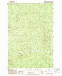
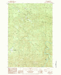 1984 Hamlet1984 Print · USGSCoastal Oregon timberlands and river valleys are captured here in the mid-eighties as the state forests matured. Local historians can trace the remote Hamlet settlement and river landmarks like Beaver Eddy or the strangely named Helloff terrain.2 unique versions available
 - 1984 Map of Elsie
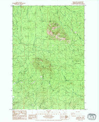
 1984 Elsie1984 Print · USGSCoastal Oregon timber country is recorded here in the mid-1980s, centered on the river settlements of the northern Coast Range. Researchers can trace the winding Nehalem River past Elsie and Jewell Junction or locate the historic Camp Olsen (Site) near the Salmonberry River.
 - 1984 Map of Saddle Mtn
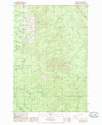
 1984 Saddle Mtn1984 Print · USGSThe northern Oregon Coast Range is captured here in the early 1980s, showcasing a landscape of timber management and recreation. Researchers can trace forest hydrology along the Nehalem River or locate historic extraction sites like the various Quarry and Borrow Pit locations.
 - 1984 Map of Vinemaple
 1984 Vinemaple1984 Print · USGSCoastal Oregon's timberlands and river valleys are captured here during the 1980s, documenting the rural character of the Clatsop area. Researchers can trace historical sites like Grand Rapids (Site) and small settlements including Vinemaple and Jewell.2 unique versions available
 - 1984 Map of Chinook, 1985 Print
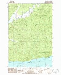
 1984 Chinook1985 Print · USGSThe Washington coast met the Columbia River in the mid-1980s as a land of tide-influenced marshes and family-run ranches. Researchers can trace land holdings at Kyle Ranch and Beeker Ranch or locate the shoreline lights at Sand Island.
 - 1985 Map of Soapstone Lake
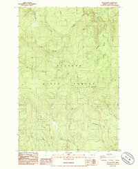
 1985 Soapstone Lake1985 Print · USGSCoastal Oregon timberlands and river valleys are captured here during the mid-eighties, showing the intersection of two state forests. Researchers can locate the small settlements of Aldervale and Acey or trace the course of the Nehalem River through Gods Valley.
 - 1985 Map of Marshland
 1985 Marshland1985 Print · USGSCoastal Oregon timberlands and river valleys are captured here in the mid-eighties as industry and topography intersect. Trace the legacy of rural life and logging through landmarks like Fishhawk Cem, Horseshoe Camp, and the Burlington Northern line.
 - 1985 Map of Nassa Point
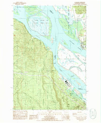
 1985 Nassa Point1985 Print · USGSThe Columbia River shoreline near the Washington and Oregon border comes alive in this mid-eighties survey. Researchers can trace the waterfront geography of Cathlamet and Westport, or explore the complex sloughs around Puget Island and Wallace Island.
 - 1985 Map of Wickiup Mtn
 1985 Wickiup Mtn1985 Print · USGSClatsop County timberlands and municipal water resources are detailed in the mid-1980s before modern logging changes. Researchers can trace the protected City of Astoria Watershed and locate landmarks like Wickiup Mtn and the Radio Facility.
 - 1985 Map of Shamokawa
 1985 Shamokawa1985 Print · USGSSkamokawa and the surrounding river valleys are captured here in the mid-1980s as the Columbia River shoreline transitioned toward conservation and recreation. Researchers can trace the legacy of the area through Fern Hill Hill Cem, the riverfront at Skamokawa Vista Park, and the quiet corners of Sleepy Hollow.
 - 1985 Map of Nicolai Mtn
 1985 Nicolai Mtn1985 Print · USGSClatsop County's timberlands are captured here in the mid-1980s, centered on the high ridges of the Oregon Coast Range. Researchers can trace forestry infrastructure and early routes like Shingle Mill Road, the Lookout Tower on Nicolai Mtn, and the remote Lost Lake.
 - 1985 Map of Arch Cape
 1985 Arch Cape1985 Print · USGSThe northern Oregon coast in the mid-1980s reveals a landscape of protected state parks and rugged headlands between the Clatsop and Tillamook county lines. Researchers can trace the boundaries of Oswald D West State Park and locate coastal features like Smuggler Cove, Devils Cauldron, and Arch Cape.2 unique versions available
 - 1985 Map of Necanicum Junction, 1986 Print
 1985 Necanicum Junction1986 Print · USGSCoastal Oregon at the mid-eighties shows a landscape deeply tied to the timber and river networks of the Coast Range. Researchers can trace the winding course of the Lewis and Clark River and locate local landmarks such as Necanicum Junction and the heights of Twin Peaks.
 - 1985 Map of Grays River, 1986 Print
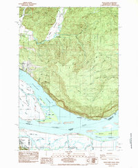
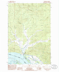
 1985 Grays River1986 Print · USGSThe northern banks of the Columbia River are captured in the mid-1980s, showcasing the transition from tidal flats to timbered ridges. Genealogists and historians can locate the Grays River Cem, the historical Covered Bridge, and the small river settlements of Brookfield and Dahlia.
 - 1985 Map of Cathlamet, 1986 Print
 1985 Cathlamet1986 Print · USGSThe Lower Columbia River islands and Washington-Oregon borderlands are mapped here in the mid-eighties, showing a mix of industrial river sites and wildlife conservation. Genealogists and researchers can trace the roads of Puget Island and find landmarks like Greenwood Cemetery and the Gnat Creek Fish Hatchery.
 - 1986 Map of Knappa
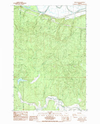
 1986 Knappa1986 Print · USGSThe Columbia River tidelands and Clatsop timberlands meet in the mid-1980s, revealing a landscape of protective levees and riverfront settlements. Genealogists and locals can trace family sites at Maplewood Cem, find the Covered Bridge near Brownsmead, or locate the Knappa High Sch.2 unique versions available
End of results
Showing maps 1-18 of 18
Top cities of Clatsop County
- Astoria historical maps
- Seaside historical maps
- Warrenton historical maps
- Cannon Beach historical maps
- Gearhart historical maps
Frequently asked questions
- What are the different types of historical maps available for Clatsop County?
- What is the oldest map of Clatsop County?
- Where can I purchase historical maps of Clatsop County for my home or office?
- Where can I download high-res historical maps of Clatsop County?
- Are there historical topographic maps available for Clatsop County?
- Is there historical aerial imagery available for Clatsop County?
- Where are historical maps of Clatsop County sourced from?