Old Maps of Myrtle Point, Oregon for Academic Research
Study the evolution of Myrtle Point with 18 high-resolution historic maps. Whether you're teaching, researching, or modeling changes in land use, these maps provide essential visual documentation of urban, environmental, and geographic change.
- Analyze long-term change: Track patterns in development, transportation, and natural features.
- Ideal for environmental or urban studies: Support academic projects with primary historical map data.
- Use in the classroom or lab: Educators and researchers rely on these maps to bring historical context to life.
These maps are a powerful tool for teaching, research, and visualizing how Myrtle Point has changed over the decades.
Myrtle Point, OR maps
(18)- 1896 Map of Coos Bay
 1896 Coos Bay1896 Print · USGSCoastal Oregon at the turn of the century was a world defined by its waterways and timber ports. Trace the early layout of Marshfield, locate coal-era sites like Beaver Hill and Coaledo, or find riverfront landings at Prosper and Parkersburg along the Coquille River.
 - 1898 Map of Coos Bay
 1898 Coos Bay1898 Print · USGSThe Oregon coast at the end of the nineteenth century is defined here by the bustling maritime hubs of Coos Bay and the Coquille River. Genealogists and historians can trace early port towns like Marshfield, Empire, and Bandon alongside the timber-and-coal infrastructure of Beaver Hill.
 - 1900 Map of Coos Bay
 1900 Coos Bay1900 Print · USGSThe Oregon coast at the turn of the century was a landscape of tide-water towns and river commerce centered on the massive Coos Bay inlet. Genealogists and local historians can trace early settlements like Marshfield, follow the Randolph Trail, and locate forgotten landings along Isthmus Slough.7 unique versions available
 - 1942 Map of Coquille, 1960 Print
 1942 Coquille1960 Print · USGSCoastal Coos County during the early war years reveals a landscape of river-dependent towns and upland coal mines. Genealogists and researchers can trace local landmarks like the County Farm, the Southern Pacific Railroad, and rural schoolhouses including Coaledo Sch and Norway Sch.3 unique versions available
 - 1945 Map of Coquille
 1945 Coquille1945 Print · USGSCoastal Oregon at the height of the war years reveals a landscape defined by the winding Coquille River and a dense network of logging and mining outposts. Researchers can trace the legacy of small-town life through labels like the Overland Coal Mine, the County Farm, and Twin Oaks Sch.
 - 1954 Map of Coos Bay
 1954 Coos Bay1954 Print · USGSCoastal Oregon at mid-century shows a landscape of timber and tides, from the river ports to the edge of the Pacific. Researchers can trace family roots through coastal schools like Beachview School or follow the Southern Pacific RR through Reedsport and Coos Bay.
 - 1958 Map of Coos Bay, 1974 Print
 1958 Coos Bay1974 Print · USGSThe Southern Oregon coastline at mid-century reveals a bustling maritime and timber economy centered on Coos Bay and North Bend. Researchers can trace the legacy of coastal settlements from Bandon to Brookings, including rail lines of the Southern Pacific RR and the rugged reaches of the Siuslaw National Forest.
 - 1962 Map of Coos Bay
 1962 Coos Bay1962 Print · USGSThe Oregon coast at the end of the fifties reveals a landscape of timber ports and fishing villages connected by U.S. Highway 101. Researchers can trace the rail infrastructure of the Southern Pacific RR and locate early settlements from Florence down to Brookings.2 unique versions available
 - 1971 Map of Bridge, 1973 Print
 1971 Bridge1973 Print · USGSCoos County river valleys thrived in the early seventies at the meeting of the three forks of the Coquille. Researchers can trace the timber and transit history of Gravel Ford and Bridge via the Logging Railroad, Gravel Ford Cem, and the Aqueduct.
 - 1971 Map of Myrtle Point, 1973 Print
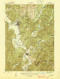
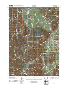
 1971 Myrtle Point1973 Print · USGSCoastal Oregon timber country and river valleys are documented here in the early seventies. Genealogists can trace family roots through several rural burial sites like Upper Fishtrap Cem and Warner Cem, or locate landmarks such as the County Fairgrounds.
 - 1993 Map of Coos Bay
 1993 Coos Bay1993 Print · USGSCoastal Oregon at the start of the nineties reveals a complex landscape of maritime trade, timber forests, and riverside hamlets. Researchers can trace the legacy of the Southern Pacific railroad and find localized landmarks like Parkersburg, Prosper, and Bunker Hill.
 - 2011 Map of Myrtle Point, 2011 Print
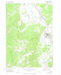
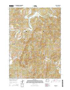
 2011 Myrtle Point2011 Print · USGSCovers Myrtle Point, including Broadbent, Arago, and other nearby areas
 - 2011 Map of Bridge, 2011 Print
 2011 Bridge2011 Print · USGSCovers Myrtle Point, including Bridge, Coos County, and other nearby areas
 - 2014 Map of Bridge, 2014 Print
 2014 Bridge2014 Print · USGSCovers Myrtle Point, including Bridge, Coos County, and other nearby areas
 - 2020 Map of Bridge, 2020 Print
 2020 Bridge2020 Print · USGSCovers Myrtle Point, including Bridge, Coos County, and other nearby areas
 - 2020 Map of Myrtle Point, 2020 Print
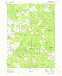
 2020 Myrtle Point2020 Print · USGSCovers Myrtle Point, including Broadbent, Arago, and other nearby areas
 - 2023 Map of Bridge, 2023 Print
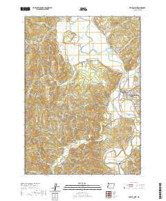
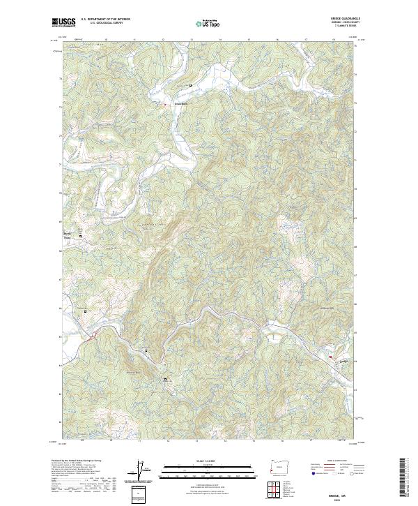 2023 Bridge2023 Print · USGSThe forks of the Coquille River meet in this corner of Coos County during the early 2020s, revealing a landscape of winding river valleys and timbered ridges. Genealogists can locate several family burial sites, including Garrett Cem, Brack Cem, and the Gravelvford Cem.
 - 2023 Map of Myrtle Point, 2023 Print
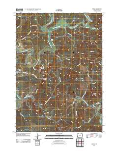
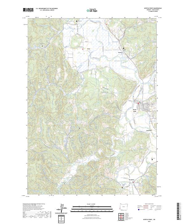 2023 Myrtle Point2023 Print · USGSCoastal Oregon river valleys and timberlands are well-documented here in the early twenty-first century. Genealogists and local historians can trace family sites at Norway Cem and Warner Cem, or explore the rail and river geography near Myrtle Point and Broadbent.
End of results
Showing maps 1-18 of 18
Top cities near Myrtle Point
Frequently asked questions
- What are the different types of historical maps available for Myrtle Point?
- What is the oldest map of Myrtle Point?
- Where can I purchase historical maps of Myrtle Point for my home or office?
- Where can I download high-res historical maps of Myrtle Point?
- Are there historical topographic maps available for Myrtle Point?
- Is there historical aerial imagery available for Myrtle Point?
- Where are historical maps of Myrtle Point sourced from?