1980s Maps of Curry County, Oregon
Explore 49 historic maps of Curry County from the 1980s. These maps offer a rare glimpse into what life looked like during the 1980s — showing old roads, neighborhoods, homes, and landmarks that have changed or disappeared over time.
Whether you're researching your family's past, planning a metal detecting trip, or studying how Curry County's landscape evolved across the 1980s, these high-resolution maps are a powerful tool for exploring the history of this region.
- Focus on a specific era: All maps on this page are from the 1980s, giving you a focused view of this time period.
- See what’s changed: Compare century-old streets, trails, and buildings to today's modern landscape using overlays and satellite layers.
- Research with precision: Use these maps for genealogy, historical research, land use analysis, or educational projects.
- View, download, or print: Maps are fully viewable online in high resolution, and can be downloaded or printed for your own records.
Start exploring Curry County's history through authentic maps from the 1980s. This is your window into the past.
Curry County, OR maps
(49)- 1982 Map of High Plateau Mtn.
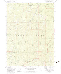
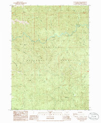
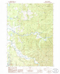
 1982 High Plateau Mtn.1982 Print · USGSThe high country along the California-Oregon border is documented here in the early 1980s, showcasing a landscape defined by forestry and mineral exploration. Researchers can find precise locations for several mountain operations, including the Cleopatra Mine, Browns Mine, and a named Mill Site near High Plateau Mountain.
 - 1982 Map of Shelly Creek Ridge, 1983 Print
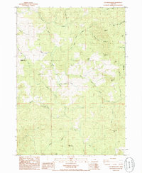
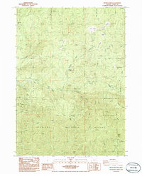
 1982 Shelly Creek Ridge1983 Print · USGSThe Oregon and California borderlands come into focus in the early 1980s, where mining history and forest management meet along the Middle Fork Smith River. Researchers can trace the legacy of remote mountain industry at the Holiday Mine, the Monumental (Site), and along the winding Wimer Road.2 unique versions available
 - 1983 Map of Crescent City
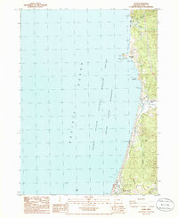
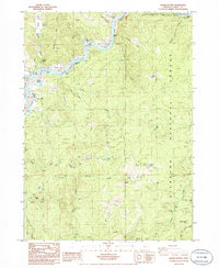
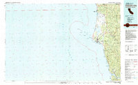 1983 Crescent City1983 Print · USGSThe Del Norte coast in the early eighties shows a transition between industrial mining and the expansion of massive redwood parks. Genealogists and local researchers can locate coastal landmarks from McNamara Field to the Alta Mine and the riverfront settlement of Requa.
 - 1983 Map of Happy Camp, 1984 Print
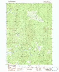
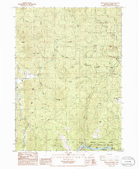
 1983 Happy Camp1984 Print · USGSThe Northern California borderlands and the Klamath River corridor are documented here in the early eighties as a hub of mining and forestry. Researchers can trace historical extraction at the High Plateau Mine and Independence Mine or locate the remote riverside community of Scott Bar.
 - 1985 Map of Mack Point, 1986 Print
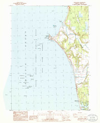
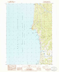
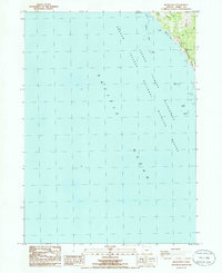 1985 Mack Point1986 Print · USGSCoastal Curry County remains largely a sanctuary for wildlife and nature lovers during the mid-eighties. Researchers can trace the rugged shoreline from Mack Point to Burnt Hill, identifying sea landmarks like Mack Arch and Yellow Rock.
 - 1985 Map of Calf Ranch Mtn, 1986 Print
 1985 Calf Ranch Mtn1986 Print · USGSCoastal range highlands in Curry County are captured here in the 1980s, showing a rugged network of timberlands and creek drainages. Genealogists and researchers can locate remote landmarks like Camp Fir Croft, White Elephant Bridge, and Calf Ranch Mtn.
 - 1986 Map of Carpenterville
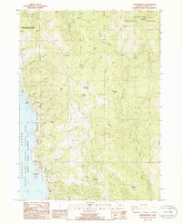 1986 Carpenterville1986 Print · USGSThe high ridges and jagged coastline of Curry County are captured here in the mid-1980s. Researchers can locate remote sites like Joe Hostler Camp and Carpenterville, or trace the coastal topography of Natural Bridges and Whaleshead Island.
 - 1986 Map of Langlois
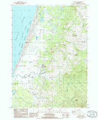 1986 Langlois1986 Print · USGSCoastal Curry County at the mid-eighties shows a unique landscape of maritime wilderness and specialized cranberry farming. Researchers can trace family roots at Denmark Cem or explore the rural layout of Langlois and Denmark near the New River.
 - 1986 Map of Floras Lake
 1986 Floras Lake1986 Print · USGSCoastal Curry County in the mid-eighties shows a landscape of protected wilderness and shoreline recreation. Researchers can trace the boundaries of Floras Lake State Park or locate the Boise Cascade County Park near the edge of Floras Lake.
 - 1986 Map of Brookings
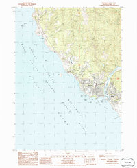 1986 Brookings1986 Print · USGSThe Oregon coast at Brookings and Harbor comes alive in this mid-1980s survey during a period of steady Pacific Northwest growth. Researchers can trace local landmarks like Azalea State Park, the Brookings Airport, and the Cemetery near the Chetco River.
 - 1986 Map of Father Mountain
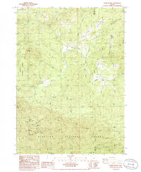
 1986 Father Mountain1986 Print · USGSThe Oregon backcountry of Curry County comes to life in this mid-1980s survey of the Siskiyou National Forest. Researchers can trace the rugged drainage of the Elk River or locate remote sites like Mountain Well and Panther Creek Campground.
 - 1986 Map of Ophir
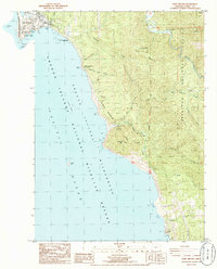
 1986 Ophir1986 Print · USGSThe Curry County coastline in the mid-eighties shows a rugged landscape of seaside settlements and offshore wilderness. You can trace early local history at Frankport (Site) and Fox Hill Cemetery, or locate landmarks like Arizona Beach and Sister Rocks.
 - 1986 Map of Sundown Mtn
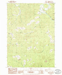
 1986 Sundown Mtn1986 Print · USGSThe Oregon backcountry of Curry County in the 1980s reveals a landscape of high ridges and timber access. Researchers can locate remote sites like Gardner Ranch, the West Mine, and a specific Grave near the headwaters of Hunter Creek.
 - 1986 Map of Cape Blanco
 1986 Cape Blanco1986 Print · USGSThe Oregon coast at the mid-eighties reveals a landscape of lighthouse navigation, cranberry farming, and river mouths. Researchers can trace the grounds of the Lighthouse at Cape Blanco, locate the Cem near the cliffs, and map the early layout of Port Orford by Garrison Lake.
 - 1986 Map of Cape Sebastian
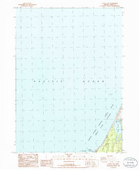
 1986 Cape Sebastian1986 Print · USGSThe Oregon coast at the mouth of the Pistol River is documented here during the mid-1980s. Researchers can trace local landmarks like the Cem and PO, or explore the limits of Cape Sebastian State Park and Crook Point.
 - 1986 Map of Barklow Mountain
 1986 Barklow Mountain1986 Print · USGSRemote ranching outposts and timber ridges define this part of the Siskiyou National Forest in the 1980s. Genealogists and historians can locate early high-country sites like Dement Ranch, a secluded Cem near Huckleberry Knoll, and Calf Ranch Prairie.
 - 1986 Map of Port Orford
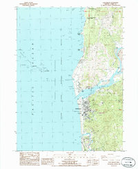
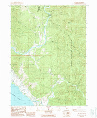
 1986 Port Orford1986 Print · USGSCoastal Oregon life in the mid-eighties centered on the harbor at Port Orford and the dramatic shoreline of the Pacific Ocean. Trace local landmarks from the US Coast Guard Station to the Elk River State Fish Hatchery and the peaks of Humbug Mountain.
 - 1986 Map of Gold Beach
 1986 Gold Beach1986 Print · USGSThe Oregon coast at the mouth of the Rogue River is shown here in the mid-1980s, revealing a landscape defined by maritime heritage and coastal geography. Researchers can trace the river's path through Ferry Hole Bar or locate the historic Miners Fort (Site) and Geisel Monument Wayside.2 unique versions available
 - 1986 Map of Sixes
 1986 Sixes1986 Print · USGSCoastal Curry County is documented here in the mid-eighties, where the Sixes River meets the Pacific near rural timberlands. Researchers can locate the Pacific High Sch, the sprawling Cranberry Bogs, and the Port Orford Cedar Forest State Wayside.
 - 1986 Map of Mount Butler
 1986 Mount Butler1986 Print · USGSThe coastal mountains of Curry County come into focus in the mid-1980s, showcasing a landscape of national forest land and river drainages. Researchers can locate the Taylor Ranch (Site), track the Sixes River, and identify high-elevation landmarks like the Lookout Tower and China Peak.
 - 1986 Map of Signal Buttes
 1986 Signal Buttes1986 Print · USGSThe Rogue River corridor near Jerrys Flat appears in high detail during the mid-1980s, revealing a landscape of remote prairies and river bars. Researchers can locate the McKinley Mine, trace the Pickle Ranch, or explore landmarks like Signal Buttes.
 - 1986 Map of Brushy Bald Mountain
 1986 Brushy Bald Mountain1986 Print · USGSCoastal mountains and river riffles define this Curry County landscape in the mid-eighties. You can trace early land use and river access at Sherman Ranch, the Lobster Creek Recreation Site, and rapids like Jennings Riffle.
 - 1986 Map of Dement Creek
 1986 Dement Creek1986 Print · USGSCoastal Oregon timber and river country are mapped in the mid-1980s at the junction of Coos and Curry counties. Genealogists and hikers can locate the Dement Cemetery and trace old landmarks like Bone Camp, Bills Prairie, and Butler.
 - 1989 Map of Mt. Emily
 1989 Mt. Emily1989 Print · USGSThe Oregon coast and Siskiyou backcountry meet in the late eighties as the Chetco River winds toward the sea. Local historians can trace the geography of the Mt Emily Prospect Mine and the shoreline near the McVay settlement.
 - 1989 Map of Hobson Horn
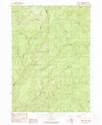 1989 Hobson Horn1989 Print · USGSThe Siskiyou National Forest wilderness is captured in the late eighties as it straddles the Josephine and Curry county line. Researchers can trace remote landmarks such as Buck Camp (Site), the summit of Hobson Horn, and Montana Spring.
Showing maps 1-25 of 49
Top cities of Curry County
Frequently asked questions
- What are the different types of historical maps available for Curry County?
- What is the oldest map of Curry County?
- Where can I purchase historical maps of Curry County for my home or office?
- Where can I download high-res historical maps of Curry County?
- Are there historical topographic maps available for Curry County?
- Is there historical aerial imagery available for Curry County?
- Where are historical maps of Curry County sourced from?