1990s Maps of Curry County, Oregon
Explore 49 historic maps of Curry County from the 1990s. These maps offer a rare glimpse into what life looked like during the 1990s — showing old roads, neighborhoods, homes, and landmarks that have changed or disappeared over time.
Whether you're researching your family's past, planning a metal detecting trip, or studying how Curry County's landscape evolved across the 1990s, these high-resolution maps are a powerful tool for exploring the history of this region.
- Focus on a specific era: All maps on this page are from the 1990s, giving you a focused view of this time period.
- See what’s changed: Compare century-old streets, trails, and buildings to today's modern landscape using overlays and satellite layers.
- Research with precision: Use these maps for genealogy, historical research, land use analysis, or educational projects.
- View, download, or print: Maps are fully viewable online in high resolution, and can be downloaded or printed for your own records.
Start exploring Curry County's history through authentic maps from the 1990s. This is your window into the past.
Curry County, OR maps
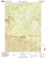
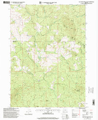
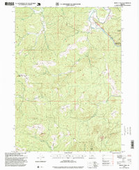
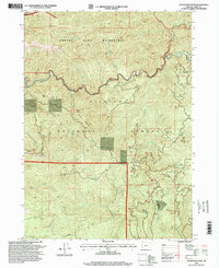
(49)- 1990 Map of Mount Bolivar
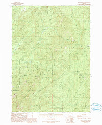 1990 Mount Bolivar1990 Print · USGSThe Oregon Coast Range at the turn of the 1990s reveals a landscape of protected wilderness and legacy resource extraction. Researchers can locate remote mining sites like Fuller Mine and trace the headwaters of the South Fork Coquille River near Mount Bolivar.
 - 1990 Map of Dutchman Butte
 1990 Dutchman Butte1990 Print · USGSThe Douglas and Josephine county lines meet in this high timber country during the late twentieth century. Trace the rugged drainage of West Fork Cow Creek to find remote landmarks like Dutchman Lookout, Ninemile Spring, and the Goat Trail.
 - 1990 Map of Eden Valley
 1990 Eden Valley1990 Print · USGSCoastal Oregon timberlands and protected wilderness meet in the Siskiyou National Forest during the late twentieth century. Researchers can trace the winding course of the South Fork Coquille River and identify localized landmarks like Camp Two or the remote Wild Rogue Wilderness.
 - 1992 Map of Port Orford, 1993 Print
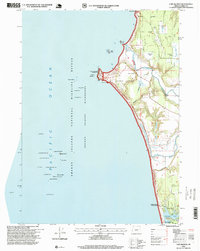
 1992 Port Orford1993 Print · USGSThe southern Oregon coast and the coastal ranges of the early nineties are captured here in both topographic and bathymetric detail. Researchers can trace landforms from the reefs of Oregon Islands to inland landmarks like Bingham Mountain and Albert H Powers Memorial State Park.
 - 1993 Map of Gold Beach
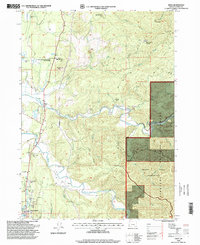
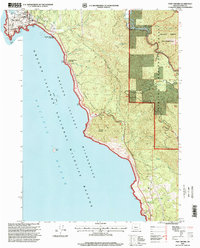
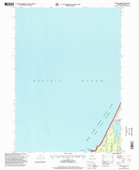
 1993 Gold Beach1993 Print · USGSThe Oregon coast at the end of the twentieth century reveals a landscape of river-mouth settlements and deep wilderness. Trace the coastal developments of Gold Beach and Brookings or explore the interior peaks of the Kalmiopsis Wilderness.2 unique versions available
 - 1996 Map of Sixes, 1999 Print
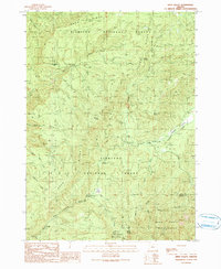
 1996 Sixes1999 Print · USGSThe coastal river valleys of Curry County are shown in the late 1990s as the landscape transitions from the small town of Sixes into deep timber country. Researchers can trace the Sixes River to the Grassy Knob Wilderness and locate the Pacific High School or the Port Orford Cedar Forest State Wayside.
 - 1996 Map of Biscuit Hill, 1999 Print
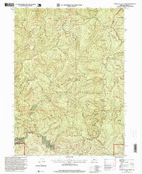
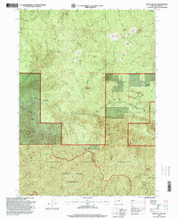
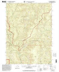 1996 Biscuit Hill1999 Print · USGSCurry County's backcountry is captured here in the mid-1990s, showing a remote landscape of wilderness boundaries and forest camps. Researchers can locate former occupational points like McKee Cabin (Site), Diamond Camp (Site), and old Mine workings near Chrome Creek.
 - 1996 Map of Langlois, 1999 Print
 1996 Langlois1999 Print · USGSThe Oregon coast near the Coos and Curry county line is shown here in the mid-nineties, where cranberry farming meets the Pacific wilderness. Researchers can locate the Denmark Cemetery, the inland waters of Floras Lake, and family-named landmarks like Woodens Butte.
 - 1996 Map of Mount Emily, 1999 Print
 1996 Mount Emily1999 Print · USGSCoastal Curry County meets the deep forests of the Siskiyou range in the late nineties, documenting a landscape of river valleys and high ridges. Researchers can trace land use from the shoreline near Crissey Airport to interior sites like Tamba Ranch and the Prospect Mine.
 - 1996 Map of Barklow Mountain, 1999 Print
 1996 Barklow Mountain1999 Print · USGSCoastal mountains and river headwaters in Curry and Coos Counties define this area during the late twentieth century. Researchers can trace remote ranching outposts like Dement Ranch, find a lonely Cem, and explore the high meadows of Carlton Prairie.
 - 1996 Map of Buckskin Peak, 1999 Print
 1996 Buckskin Peak1999 Print · USGSThe high peaks and deep drainages of the Siskiyou Mountains are documented in the late nineties as this region remained a focus for mineral exploration. Researchers can trace the network of 4WD trails leading to numerous prospects, a Mine Shaft, and isolated spots like Frantz Meadow.
 - 1996 Map of Fourth of July Creek, 1999 Print
 1996 Fourth of July Creek1999 Print · USGSCoastal Oregon’s deep woods are captured here in the late nineties, showcasing the remote reaches of the Siskiyou National Forest. Trace the historical Ludlum House and Ludlum Place (Site) along the banks of the Winchuck River.
 - 1996 Map of Smith River, 1999 Print
 1996 Smith River1999 Print · USGSCoastal Del Norte County meets the Oregon border in the 1990s, where the river mouth creates a unique landscape of sloughs and dunes. Researchers can trace tribal heritage at the Yontocket Indian Village Site or explore local junctions like Winton Corners and Tryon Corner.
 - 1996 Map of Cape Blanco, 1999 Print
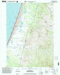
 1996 Cape Blanco1999 Print · USGSThe Oregon coast at its westernmost extremity is captured in the mid-nineties, showing the intersection of maritime heritage and cranberry agriculture. Genealogists and local historians can locate the Lighthouse at Cape Blanco, several Cranberry Bogs, and the northern reaches of Port Orford.
 - 1996 Map of Calf Ranch Mountain, 1999 Print
 1996 Calf Ranch Mountain1999 Print · USGSThe rugged Coast Range interior on the Coos and Curry County border comes into focus in the mid-nineties. Trace old mountain outposts and local landmarks like Graves, Camp Fir Croft, and the curiously named White Elephant Bridge.
 - 1996 Map of Dement Creek, 1999 Print
 1996 Dement Creek1999 Print · USGSThe interior mountains of Coos and Curry Counties are captured here in the late twentieth century, showing a landscape of high prairies and winding river forks. Researchers can trace family-named landmarks like Sears Rock, the Dement Cem, and the remote Long Prairie.
 - 1996 Map of Port Orford, 1999 Print
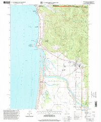
 1996 Port Orford1999 Print · USGSPort Orford and the Southern Oregon coast in the late twentieth century show a landscape shaped by maritime history and conservation. Trace local landmarks like the US Coast Guard Station, Graveyard Point, and the Elk River State Fish Hatchery.
 - 1996 Map of Floras Lake, 1999 Print
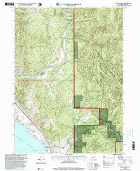
 1996 Floras Lake1999 Print · USGSThe Curry County coastline and its unique freshwater lagoons are captured in the mid-nineties, showing a region defined by conservation. Researchers can trace the boundaries of Floras Lake State Park or locate the Boat Ramp near Boise-Cope Park.
 - 1996 Map of Father Mountain, 1999 Print
 1996 Father Mountain1999 Print · USGSThe Siskiyou National Forest and the Elk River corridor are captured here during the mid-nineties, showing a landscape of deep drainages and high peaks. Genealogists and hikers can trace landmarks like Butler Bar, Salal Spring, and the summit of Father Mountain.
 - 1996 Map of Mount Butler, 1999 Print
 1996 Mount Butler1999 Print · USGSCoastal Curry County is defined by the steep timberlands of the Siskiyou National Forest during the mid-nineties. Researchers can locate family landmarks and historical sites like the Taylor Ranch (Site), the Edson Butte Lookout, and high meadows such as Philip Prairie.
 - 1997 Map of High Divide, 2001 Print
 1997 High Divide2001 Print · USGSThe Siskiyou and Six Rivers forests meet at the turn of the millennium along the wild California-Oregon border. You can trace early mountain transit and extraction history through the Wimer Road and sites like the Mountain View Mines or the Stone Corral (Site).
 - 1997 Map of Shelly Creek Ridge, 2001 Print
 1997 Shelly Creek Ridge2001 Print · USGSThe Smith River canyons and Siskiyou Mountains were a hub for early transit and prospectors during the late twentieth century. Trace the path of the Old Gasquet Toll Road or locate historical mineral sites like the Holiday Mine and Monumental (Site).
 - 1997 Map of High Plateau Mountain, 2001 Print
 1997 High Plateau Mountain2001 Print · USGSThe California-Oregon border country was a remote mining and timber frontier during the late twentieth century. Researchers can trace historic extraction sites like the Cleopatra Mine, Browns Mine, and the Big Boy Mine tucked into the rugged slopes of High Plateau Mountain.
 - 1998 Map of Big Craggies, 2001 Print
 1998 Big Craggies2001 Print · USGSThe Kalmiopsis Wilderness in the late 1990s is shown in its remote, roadless state along the border of Curry and Josephine counties. Historians and outdoor enthusiasts can trace isolated mountain outposts like Tolman Ranch and Jacks Camp or locate the headwaters of the Chetco River.
 - 1998 Map of Brushy Bald Mountain, 2001 Print
 1998 Brushy Bald Mountain2001 Print · USGSThe Siskiyou National Forest and Rogue River dominate this 1990s Oregon landscape. Genealogists and local historians can locate Colebrooke, the Sherman Ranch, and landmarks like Lobster Creek Bridge and Bark Shanty Prairie.
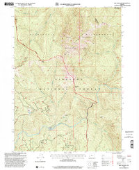
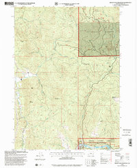
Showing maps 1-25 of 49
Top cities of Curry County
Frequently asked questions
- What are the different types of historical maps available for Curry County?
- What is the oldest map of Curry County?
- Where can I purchase historical maps of Curry County for my home or office?
- Where can I download high-res historical maps of Curry County?
- Are there historical topographic maps available for Curry County?
- Is there historical aerial imagery available for Curry County?
- Where are historical maps of Curry County sourced from?