1970s Maps of Grant County, Oregon
Explore 35 historic maps of Grant County from the 1970s. These maps offer a rare glimpse into what life looked like during the 1970s — showing old roads, neighborhoods, homes, and landmarks that have changed or disappeared over time.
Whether you're researching your family's past, planning a metal detecting trip, or studying how Grant County's landscape evolved across the 1970s, these high-resolution maps are a powerful tool for exploring the history of this region.
- Focus on a specific era: All maps on this page are from the 1970s, giving you a focused view of this time period.
- See what’s changed: Compare century-old streets, trails, and buildings to today's modern landscape using overlays and satellite layers.
- Research with precision: Use these maps for genealogy, historical research, land use analysis, or educational projects.
- View, download, or print: Maps are fully viewable online in high resolution, and can be downloaded or printed for your own records.
Start exploring Grant County's history through authentic maps from the 1970s. This is your window into the past.
Grant County, OR maps
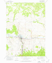
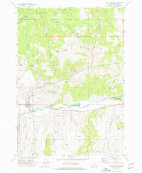
(35)- 1970 Map of Flag Prairie, 1973 Print
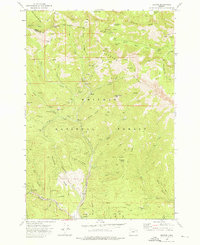
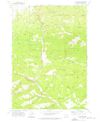
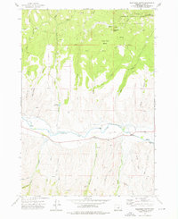
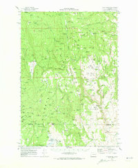 1970 Flag Prairie1973 Print · USGSGrant and Harney County high country is shown here in the early seventies, a land of high-elevation meadows and national forest management. Researchers can trace forest history and livestock movements through sites like Crane Prairie Guard Station, North Fork Cow Camp, and Knox Meadow.
 - 1970 Map of Castle Rock, 1973 Print
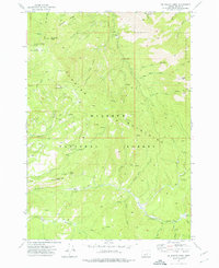
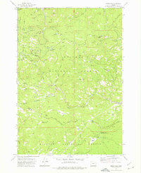
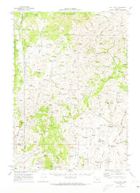 1970 Castle Rock1973 Print · USGSEastern Oregon ranching and forestry are documented here in the early seventies, spanning the borders of Grant, Harney, and Malheur Counties. Researchers can locate remote outposts like Dutch John Cabin, the isolated Goodwin Tomb, and the Castle Rock Fire Station.
 - 1972 Map of Austin
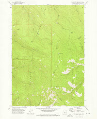
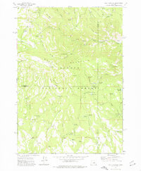
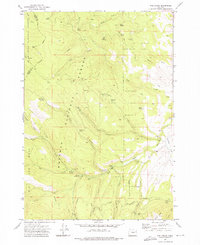
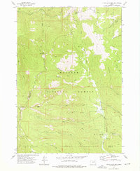
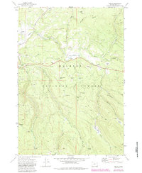 1972 Austin1972 Print · USGSIn the early 1970s, the high country of Grant County was a landscape of remote work centers and high-altitude meadows. Trace the cattle and timber history of the Malheur National Forest through sites like Sullens Cow Camp, Austin Junction, and the Blue Mtn Work Center.2 unique versions available
 - 1972 Map of Trout Meadows, 1975 Print
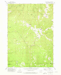
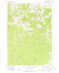
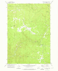 1972 Trout Meadows1975 Print · USGSThe Grant County wilderness in the early 1970s reveals a landscape shaped by river mining and high-altitude timber. Researchers can trace historic extraction sites like Klopp Placer Mine and remote backcountry hubs like Happy Prairie or Trout Meadows.3 unique versions available
 - 1972 Map of John Day, 1976 Print
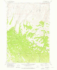
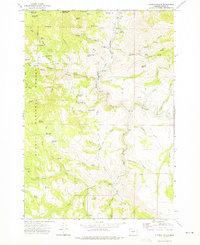
 1972 John Day1976 Print · USGSGrant County in the early seventies shows a landscape where industrial gold mining and civic growth meet. Genealogists and historians can trace the foundations of John Day, locate the historic Boot Hill Cem, and explore vast Dredge Tailings along the river.2 unique versions available
 - 1972 Map of Big Weasel Sprs, 1976 Print
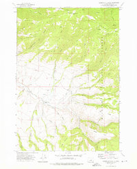
 1972 Big Weasel Sprs1976 Print · USGSThe Aldrich Mountains of Grant County are shown in the 1970s, detailed with a network of forest service outposts and high-altitude springs. Trace local history through the Oregon Mine, Buck Cabin (Site), and the Murderers Creek Forest Service Station.2 unique versions available
 - 1972 Map of Mt. Ireland, 1976 Print
 1972 Mt. Ireland1976 Print · USGSThe Blue Mountains along the Baker and Grant county line appear here in the early 1970s, showcasing a landscape defined by historic mining and high-country trails. Researchers can locate numerous claims including the California Mine and Ophir Mine, or trace the grounds of the former Gold Center (Site).2 unique versions available
 - 1972 Map of Deardorff Mtn, 1976 Print
 1972 Deardorff Mtn1976 Print · USGSThe high ridges of the Blue Mountains are captured in the early 1970s, where Grant and Baker counties meet. Researchers can trace remote pack trails and locate numerous named water sources like Wigwam Spring, Kline Spring, and the Looney Spring Campground.2 unique versions available
 - 1972 Map of Bullrun Rock, 1976 Print
 1972 Bullrun Rock1976 Print · USGSHigh in the Blue Mountains in the early seventies, this survey captures the intersection of two national forests at the Baker and Grant county line. Researchers can trace the remote network of trails and springs like Smokey Bear Spring, Table Rock, and the headwaters of the Little Malheur River.2 unique versions available
 - 1972 Map of Bourne, 1976 Print
 1972 Bourne1976 Print · USGSGold mining history and timber land dominate this 1970s survey of the Blue Mountains. Trace the massive dredge tailings near Sumpter and locate remote camps like Bourne and the North Pole Mine.3 unique versions available
 - 1972 Map of Wolf Mountain, 1976 Print
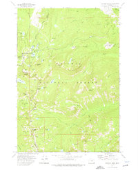
 1972 Wolf Mountain1976 Print · USGSThe high country of central Oregon is mapped here in the early seventies, centered on the lookout atop Wolf Mountain. Trace historic backcountry access via the Black Canyon Trail and remote camps like Mud Springs Campground.2 unique versions available
 - 1972 Map of Day Basin, 1976 Print
 1972 Day Basin1976 Print · USGSWheeler and Grant counties meet in this high-desert forest landscape during the early seventies, spanning the transition from ranching country to protected fossil beds. Researchers can find old backcountry landmarks like Nelson Place, China Camp, and the evocative Home Sweet Home Spring.2 unique versions available
 - 1972 Map of Granite, 1976 Print
 1972 Granite1976 Print · USGSThe high mining country of the Blue Mountains comes alive in the early seventies, showcasing a dense network of gold claims and timber tracts. Genealogists and historians can trace the foundations of Granite, the Alamo (Site), and the vast Dredge Tailings along Granite Creek.2 unique versions available
 - 1972 Map of Canyon Mtn, 1976 Print
 1972 Canyon Mtn1976 Print · USGSGrant County’s high country is captured here in the early seventies, detailing the intersection of mining history and forest management. Researchers can trace the location of old workings like the Great Northern Mine or locate high-altitude landmarks such as Eagle Peak Radio Facility and Cougar Camp.3 unique versions available
 - 1972 Map of Greenhorn, 1976 Print
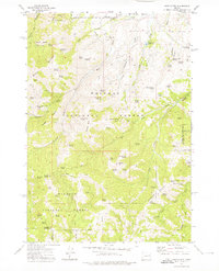
 1972 Greenhorn1976 Print · USGSThe high country of the Blue Mountains comes into focus in the early 1970s, revealing a landscape deeply marked by its mining and timber heritage. Genealogists and historians can trace the remnants of Robinsonville, the Old Railroad Grade, and dozens of lode mines like the IXL Mine.2 unique versions available
 - 1972 Map of Rail Gulch, 1976 Print
 1972 Rail Gulch1976 Print · USGSEastern Oregon's timbered interior is captured here in the early seventies, where the Malheur and Whitman National Forests meet. Researchers can trace historic mining operations at Bullrun Mine and locate recreational hubs like the Elk Creek Campground.2 unique versions available
 - 1972 Map of Mc Clellan Mtn, 1976 Print
 1972 Mc Clellan Mtn1976 Print · USGSThe Aldrich Mountains of eastern Oregon appear in the early 1970s as a high-altitude landscape of mines and trails. Researchers can trace the historic Cinnabar Mine, follow the rugged course of Murderers Creek, or locate old landmarks like Packsaddle Gap and Bear Flat.3 unique versions available
 - 1972 Map of Mount Vernon, 1976 Print
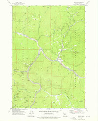
 1972 Mount Vernon1976 Print · USGSMount Vernon and the John Day River valley are captured in the early 1970s during a period of transition between mining history and modern recreation. Trace local heritage at Ingle Cem, locate the Mt Vernon Hot Springs, and explore the legacy of the river at the Dredge Tailings.2 unique versions available
 - 1972 Map of Anthony Lakes, 1976 Print
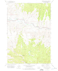
 1972 Anthony Lakes1976 Print · USGSHigh in the Blue Mountains during the early 1970s, this area shows a landscape of alpine lakes and mining history at the meeting point of three counties. Researchers can locate the Loy Mine, trace the North Fork Powder River, and explore remote basins like Cunningham Cove.2 unique versions available
 - 1972 Map of Aldrich Mountain North, 1976 Print
 1972 Aldrich Mountain North1976 Print · USGSThe John Day River valley in the early 1970s reveals a landscape of high-country trails and remote forest outposts. Genealogists and researchers can locate family-named landmarks like Stewarts Crossing, the Aldrich Grave, and the Lookout atop Aldrich Mtn.2 unique versions available
 - 1972 Map of Rastus Mtn, 1976 Print
 1972 Rastus Mtn1976 Print · USGSEastern Oregon mining and forest lands are captured in the early 1970s at the meeting point of Baker and Malheur counties. Researchers can trace historic water routes like the Eldorado Ditch and locate remote sites such as the Thomason Mine and Rastus Camp Spring.2 unique versions available
 - 1972 Map of Wolfinger Butte, 1976 Print
 1972 Wolfinger Butte1976 Print · USGSGrant County’s high country in the early seventies centers on the winding course of the John Day River. Local historians and genealogists can trace early infrastructure and family landmarks like the Moon Cr Cem and Yokom Reservoir.2 unique versions available
 - 1972 Map of Little Baldy Mnt., 1976 Print
 1972 Little Baldy Mnt.1976 Print · USGSThe high country of the Blue Mountains is mapped here in the early 1970s, showcasing the remote boundary between the Malheur and Whitman forests. Trace historical pack routes like the Little Baldy Trail or locate the Short Creek Forest Service Station.2 unique versions available
 - 1972 Map of Aldrich Gulch, 1976 Print
 1972 Aldrich Gulch1976 Print · USGSGrant County ranching and timber lands are captured here in the early seventies, showing a remote interior defined by the South Fork John Day River. Local historians can trace early land use through the Sundstrom Place (Site) and find numerous small-scale water projects like Happy Reservoir.2 unique versions available
 - 1972 Map of Aldrich Mountain South, 1976 Print
 1972 Aldrich Mountain South1976 Print · USGSThe Aldrich Mountains of Grant County are shown in the early 1970s as a landscape of high ridges and isolated forest camps. Map collectors and historians can trace old trails leading to Murderers Creek Ranch, Weaver Cabin, and Todd Creek Camp.2 unique versions available
Showing maps 1-25 of 35
Top cities of Grant County
- John Day historical maps
- Prairie City historical maps
- Canyon City historical maps
- Mount Vernon historical maps
- Long Creek historical maps
- Seneca historical maps
See more
Frequently asked questions
- What are the different types of historical maps available for Grant County?
- What is the oldest map of Grant County?
- Where can I purchase historical maps of Grant County for my home or office?
- Where can I download high-res historical maps of Grant County?
- Are there historical topographic maps available for Grant County?
- Is there historical aerial imagery available for Grant County?
- Where are historical maps of Grant County sourced from?