1980s Maps of Grant County, Oregon
Explore 23 historic maps of Grant County from the 1980s. These maps offer a rare glimpse into what life looked like during the 1980s — showing old roads, neighborhoods, homes, and landmarks that have changed or disappeared over time.
Whether you're researching your family's past, planning a metal detecting trip, or studying how Grant County's landscape evolved across the 1980s, these high-resolution maps are a powerful tool for exploring the history of this region.
- Focus on a specific era: All maps on this page are from the 1980s, giving you a focused view of this time period.
- See what’s changed: Compare century-old streets, trails, and buildings to today's modern landscape using overlays and satellite layers.
- Research with precision: Use these maps for genealogy, historical research, land use analysis, or educational projects.
- View, download, or print: Maps are fully viewable online in high resolution, and can be downloaded or printed for your own records.
Start exploring Grant County's history through authentic maps from the 1980s. This is your window into the past.
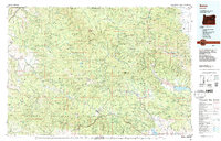
Grant County, OR maps
(23)- 1980 Map of Monument, 1997 Print
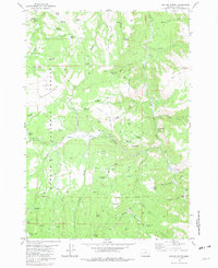
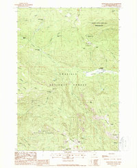
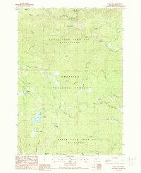
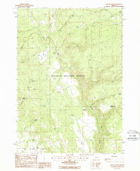
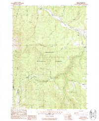
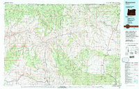 1980 Monument1997 Print · USGSCentral Oregon’s river-cut high country comes into focus in the early 1980s, documenting a landscape of remote ranching and timber work. Genealogists and researchers can trace local landmarks like Ritter, the Cohoe Mine, and the high reaches of Sourdough Ridge.
 - 1981 Map of Powell Mtn
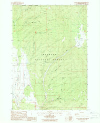
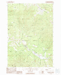
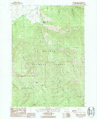
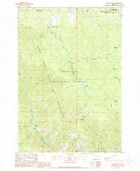
 1981 Powell Mtn1981 Print · USGSCrook County ranching and timber lands are captured here in the early eighties, centered on the high ridges of the Ochoco National Forest. Researchers can find isolated homestead sites like Humphrey Ranch, the Rager Ranger Station, and even a lone Grave in the backcountry.
 - 1981 Map of Suplee
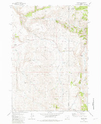 1981 Suplee1981 Print · USGSCrook and Grant counties were defined by isolated ranching outposts and thermal features in the early eighties. Genealogists and historians can trace the foundations of the Suplee (Site) community and family landmarks like Bernard Ranch and Weberg Ranch.
 - 1981 Map of Dayville
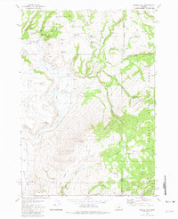
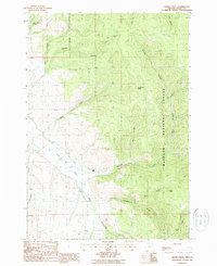
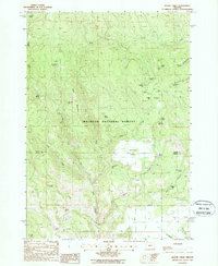
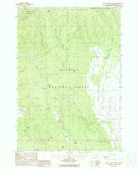
 1981 Dayville1981 Print · USGSEastern Oregon’s high-desert rangeland and timber country are captured here in the early eighties, centered on the John Day River valley. Genealogists and historians can trace isolated settlements like Izee and Suplee alongside historical mining sites including Chambers Mine.2 unique versions available
 - 1981 Map of Suplee Butte
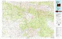
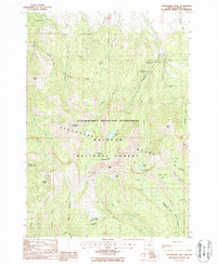
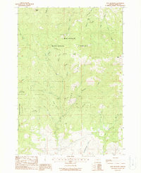
 1981 Suplee Butte1981 Print · USGSGrant County, Oregon, as it appeared in the early 1980s reveals a high-country landscape of forest management and early homesteading. Researchers can trace the footprints of industry at Ellingson Mill or find family history at the Robinson Homestead and Negro Cabin.
 - 1981 Map of Funny Butte, 1982 Print
 1981 Funny Butte1982 Print · USGSGrant County’s high-elevation forests and volcanic ridges are captured here during the early 1980s. Researchers can trace remote ranching outposts and land-management markers like Swamp Creek Ranch, Ortman Cabin, and the Lookout Tower Pyramid Point.
 - 1987 Map of Bates
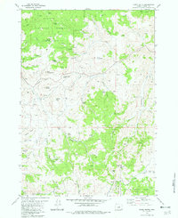
 1987 Bates1987 Print · USGSEastern Oregon's rugged mining and timber heartland is detailed here in the late 1980s. Local historians and genealogists can trace the Sumpter Valley Railroad and find historic mining sites like the Standard Mine and settlements at Greenhorn or Galena.
 - 1988 Map of Vinegar Hill
 1988 Vinegar Hill1988 Print · USGSThe high peaks of the Greenhorn Mountains are documented here in the late eighties, showing a wilderness area still marked by its mining legacy. Researchers can locate remote sites like the Ben Harrison Mine, Camp Simms, and the Bimetallic Mine among the ridges.
 - 1988 Map of Desolation Butte
 1988 Desolation Butte1988 Print · USGSThe high ridges of the Greenhorn Mountains are captured in the late eighties as a junction of national forest lands and wilderness outposts. Trace the locations of isolated mining sites like Skinner Mine and seasonal settlements such as Jumpoff Joe Camp and Sponge Creek Camp.
 - 1988 Map of Logan Valley East
 1988 Logan Valley East1988 Print · USGSGrant County’s high-altitude timberlands and meadows are captured here in the late eighties, just south of the Strawberry Range. Researchers can trace the remnants of French Cabin (Ruins) or locate forest landmarks like Summit Prairie and Wickup Spring.
 - 1988 Map of Isham Creek
 1988 Isham Creek1988 Print · USGSGrant County, Oregon, is shown in the late 1980s as a landscape of timber and river-fed valleys. Genealogists and researchers can trace local landmarks like Morgan Ranch or explore the drainages of Isham Creek and the John Day River.
 - 1988 Map of Prairie City
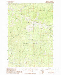
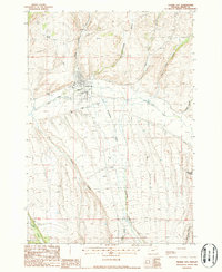 1988 Prairie City1988 Print · USGSPrairie City and the surrounding Grant County ranchlands are documented here in the late eighties during a period of steady agricultural and industrial use. Researchers can trace the legacy of resource extraction through Dredge Tailings along the John Day River or locate historic holdings like Oxbow Ranch.
 - 1988 Map of Olive Lake
 1988 Olive Lake1988 Print · USGSGrant County's high country during the 1980s reveals a landscape of protected wilderness and legacy mining sites. Trace the relationship between historic operations at Gold Bug Mine and established backcountry spots like Olive Lake Campground and Big Meadow Camp.
 - 1988 Map of Kelsay Butte
 1988 Kelsay Butte1988 Print · USGSThe Umatilla National Forest in the late 1980s remains a landscape of high meadows and remote camps. Trace the river-fed terrain of the North Fork John Day River and find mining history at Welch Creek Mine or Kelsay Spring.
 - 1988 Map of Boulder Butte
 1988 Boulder Butte1988 Print · USGSThe Greenhorn Mountains of Grant County are shown here in the late 1980s as a high-elevation landscape of mining and forestry. Researchers can trace historic extraction sites like China Diggings Mine, Reed Mine, and Sunshine Guard Station.2 unique versions available
 - 1988 Map of Magpie Table
 1988 Magpie Table1988 Print · USGSThe Grant and Harney county line in the late eighties is a landscape of high-elevation forests and numerous named springs. Researchers can trace the legacy of land management and geology at Magpie Table, the Frazier Point Lookout Tower, and Frost Mill Spring.
 - 1988 Map of Strawberry Mtn
 1988 Strawberry Mtn1988 Print · USGSGrant County’s high alpine backcountry is documented here during the late 1980s, centered on the Strawberry Mountain Wilderness. Researchers can trace the drainage of Big Creek or locate the site of the Marks-Thompson Mine and Strawberry Falls.
 - 1988 Map of Dollar Basin
 1988 Dollar Basin1988 Print · USGSEastern Oregon's forest interior is documented here in the late eighties, showing a landscape shaped by the Malheur River. Researchers can locate historic water sources and crossings like the Malheur Ford, Jordan Spr, and the Rock Quarry.
 - 1988 Map of Roberts Creek
 1988 Roberts Creek1988 Print · USGSThe Strawberry Range and Malheur National Forest define this part of Grant County during the late eighties. Researchers can trace remote high-country landmarks and water sources like Blue Mountain Hot Springs, Frog Lake, and Starvation Rock.
 - 1988 Map of Logan Valley West
 1988 Logan Valley West1988 Print · USGSGrant County's high country is captured here in the late eighties, showing the transition from the peaks down into the broad valley floor. Researchers can trace the path of an Old RR Grade or locate historical forest sites like the Lake Creek Organization Camp and Shoestring Glade.
 - 1988 Map of Dixie Meadows
 1988 Dixie Meadows1988 Print · USGSGrant County’s mountain mining districts are captured here during the late 1980s. Local history researchers can trace the locations of historic claims like the Copperopolis Mine, Smuggler Mine, and Shatt Mine along the rugged slopes of Cougar Ridge.
 - 1988 Map of Bates
 1988 Bates1988 Print · USGSGrant County’s timber and high-country history is captured here during the 1980s, centered on the logging settlement of Bates. You can trace the Old Railroad Grade along the river or locate legacy sites like the Dixie Trail Mine and Dixie Summit.
 - 1988 Map of Silver Butte
 1988 Silver Butte1988 Print · USGSGrant County in the late 1980s was characterized by its deep canyons and national forest lands. Researchers can trace the management of the North Fork John Day River through the Forks Guard Station and explore names like Dixson Bar and Silver Butte.
End of results
Showing maps 1-23 of 23
Top cities of Grant County
- John Day historical maps
- Prairie City historical maps
- Canyon City historical maps
- Mount Vernon historical maps
- Long Creek historical maps
- Seneca historical maps
See more
Frequently asked questions
- What are the different types of historical maps available for Grant County?
- What is the oldest map of Grant County?
- Where can I purchase historical maps of Grant County for my home or office?
- Where can I download high-res historical maps of Grant County?
- Are there historical topographic maps available for Grant County?
- Is there historical aerial imagery available for Grant County?
- Where are historical maps of Grant County sourced from?