Old Maps of Grant County, Oregon for Hiking & Exploration
Hike through history with 672 historic maps of Grant County. Explore old trails, ghost towns, and forgotten backroads — perfect for outdoor adventurers and local explorers.
- Rediscover forgotten places: Map out old mining camps, roads, and footpaths that no longer exist on modern maps.
- Layer with modern tools: Combine with LiDAR or satellite views to plan hikes through historical terrain.
- Made for exploration: Popular among hikers, overlanders, and local history lovers.
Use these maps to find adventure and explore the hidden past of Grant County.
Grant County, OR maps
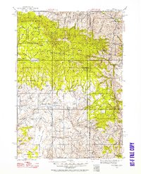
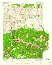
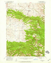
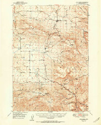
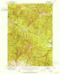
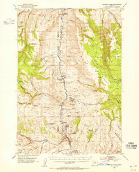
(672)- 1901 Map of Sumpter
 1901 Sumpter1901 Print · USGSThe Oregon gold boom is at its peak in this turn-of-the-century survey of the high Elkhorn Range. Miners and genealogists can trace the early rail corridor of the Sumpter Valley River and locate historic camps like Bourne, Belleview, and French Diggings.4 unique versions available
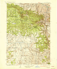
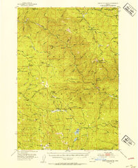
 - 1908 Map of Ironside Mountain
 1908 Ironside Mountain1908 Print · USGSEastern Oregon ranching and timber frontiers come alive in this survey of the Blue Mountains region at the turn of the century. Researchers can trace early family holdings like Tureman's Ranch and Hunter's Ranch, or locate the historic Otis Sawmill.2 unique versions available
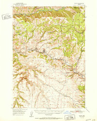
 - 1932 Map of Dayville, 1958 Print
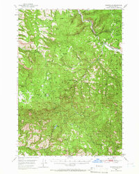
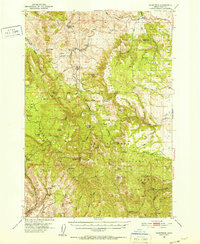
 1932 Dayville1958 Print · USGSCentral Oregon ranching and timber frontiers are captured here in the early 1930s, documenting a remote landscape of high plateaus and river valleys. Genealogists and historians can locate family landmarks like Congleton Ranch, the ruins of Camp Watson, and early rural school sites like Beaver Creek Sch.
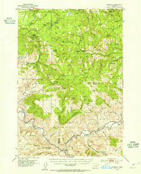
 - 1936 Map of Dayville
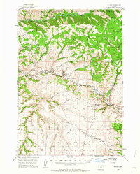
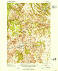
 1936 Dayville1936 Print · USGSIn the early 1930s, this portion of Central Oregon was a landscape of high timber and remote cattle ranches along the John Day River. Researchers can trace the era's ranching families at Dexter Ranch and Mills Ranch, or find the location of the Old Bear Creek Sawmill and Fort Camp Watson.3 unique versions available
 - 1940 Map of Mount Vernon, 1959 Print
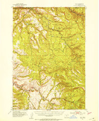
 1940 Mount Vernon1959 Print · USGSMount Vernon and the John Day River valley are shown here just before mid-century, capturing a landscape of remote ranches and forest lookouts. Genealogists can locate family landmarks like Fletcher Ranch, Belshaw Sch, and the Cinnabar Mine.2 unique versions available
 - 1940 Map of Aldrich Mtn., 1960 Print
 1940 Aldrich Mtn.1960 Print · USGSGrant County ranching and timber management are captured here just before the mid-century, following the winding John Day River. You can trace early 20th-century family history through the Mountain View Sch and various homesteads like Clark Ranch and Weaver Cabin.2 unique versions available
 - 1940 Map of John Day, 1960 Print
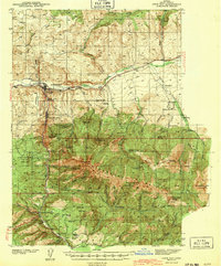
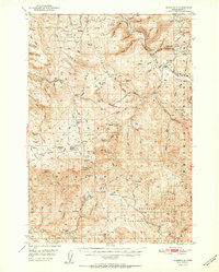
 1940 John Day1960 Print · USGSGrant County is captured here at the end of the 1930s as a region defined by high-desert ranching and the remnants of a gold-mining boom. Genealogists can trace early landmarks like Canyon City, the Joaquin Miller Resort, and several abandoned workings such as the Iron King Mine.2 unique versions available
 - 1943 Map of Aldrich Mtn.
 1943 Aldrich Mtn.1943 Print · USGSGrant County ranching and mining life are detailed here in the early 1940s, showing a remote landscape connected by river crossings and mountain trails. Researchers can locate family landmarks like the Aldrich Grave, Black Ranch, and the Oregon Mine.2 unique versions available
 - 1943 Map of John Day
 1943 John Day1943 Print · USGSGrant County is captured during the early 1940s, showing the intersection of ranching and the waning mining era near Canyon City. Genealogists and historians can locate family landmarks like the Kuhl Ranch or trace the history of the Golden West Mine (abandoned) and Marysville Sch.2 unique versions available
 - 1943 Map of Mount Vernon
 1943 Mount Vernon1943 Print · USGSMount Vernon and the surrounding Grant County highlands are seen here during the early 1940s as a hub for ranching and mercury mining. Genealogists and historians can locate early homesteads and community centers like the Belshaw Sch, Koehler Ranch, and the Cinnabar Mine.
 - 1949 Map of Long Creek, 1959 Print
 1949 Long Creek1959 Print · USGSGrant County is captured here in the late 1940s, showing a high-country landscape of timber and ranching before modern development. Genealogists and historians can locate old rural hubs like Round Basin School and trace industrial sites such as Fox Mill and the Cohoe Mine.2 unique versions available
 - 1949 Map of Susanville, 1966 Print
 1949 Susanville1966 Print · USGSGrant County’s high country is captured here during the post-war era, showing the intersection of the Malheur National Forest and Whitman National Forest. Local historians can trace early wilderness infrastructure at Galena, the Hi Yu Guard Station, and isolated sites like Hamburger Cabin.
 - 1950 Map of Ritter, 1964 Print
 1950 Ritter1964 Print · USGSThe river forks of Grant County are documented here mid-century, showing the isolated ranching and timber communities of the Blue Mountains. Genealogists and local historians can trace family-named landmarks like Ritter Cemetery, Threemile School, and the local Lumber Mill.2 unique versions available
 - 1951 Map of Susanville
 1951 Susanville1951 Print · USGSThe Middle Fork of the John Day River corridor is shown here in the mid-twentieth century, at the meeting of two national forests. Genealogists and researchers can trace the roads and trails connecting Susanville, Galena, and the remote HiYu Guard Station.2 unique versions available
 - 1951 Map of Long Creek
 1951 Long Creek1951 Print · USGSMid-century Grant County is defined here by its high-altitude timber and mining operations within the Malheur National Forest. Researchers can locate early forest infrastructure like the Black Butte Lookout alongside local industry at the Fox Mill and Cohoe Mine.2 unique versions available
 - 1951 Map of Courtrock, 1952 Print
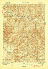
 1951 Courtrock1952 Print · USGSSettlement and high-country ranching define this portion of central Oregon in the early fifties. Genealogists and historians can trace the foundations of the Hamilton community, locating the Courtrock school and landmarks like Courthouse Rock.3 unique versions available
 - 1951 Map of Monument, 1953 Print
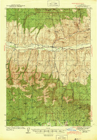
 1951 Monument1953 Print · USGSThe Grant and Morrow County borderlands in the early 1950s center on the vital confluence of the John Day River forks. Genealogists and historians can trace old homestead sites near the Top School (Aband) or explore the remote canyon reaches of Monument and Kimberly.3 unique versions available
 - 1951 Map of Dale, 1953 Print
 1951 Dale1953 Print · USGSThe northern Blue Mountains come into focus in the 1950s, where the North Fork John Day River divides Grant and Umatilla counties. Researchers can trace the era's mining and forest service history through landmarks like the Keeney Mine, Dale Ranger Sta, and Peep Creek Camp.4 unique versions available
 - 1951 Map of Bates, 1953 Print
 1951 Bates1953 Print · USGSThe high country of Grant and Baker counties is captured here in the early fifties during a period of active mountain forestry and mining. Genealogists and historians can trace old claims like the Ben Harrison Mine and Standard Mine or locate the settlement at Bates.3 unique versions available
 - 1951 Map of Desolation Butte, 1954 Print
 1951 Desolation Butte1954 Print · USGSGrant County in the early fifties was a rugged landscape of forest service stations and remote mining claims. Genealogists and historians can trace old resource camps like Headquarters Camp and Miners Cabin, or locate vanished operations such as Gutridge Mine.3 unique versions available
 - 1952 Map of Ritter
 1952 Ritter1952 Print · USGSThe Ritter community and the North Fork John Day River corridor are frozen in time during the early fifties. Genealogists and local historians can locate rural landmarks like Ritter Hot Springs, Threemile School, and Ritter Cemetery.2 unique versions available
 - 1953 Map of Kimberly, 1955 Print
 1953 Kimberly1955 Print · USGSThe high desert of Grant and Wheeler counties comes into focus in the early 1950s, centered on the John Day River and its rugged basins. Researchers can locate remote landmarks like the Haystack Cem, the Bull Prairie Guard Sta, and the settlement of Kimberly.2 unique versions available
 - 1953 Map of Picture, 1955 Print
 1953 Picture1955 Print · USGSThe John Day River country in the early fifties remains a landscape of isolated homesteads and dramatic geology. Researchers can locate several historic properties like Cant Ranch and Mascall Ranch, or trace the canyon through Picture Gorge.3 unique versions available
 - 1955 Map of Burns, 1964 Print
 1955 Burns1964 Print · USGSHarney County's high desert ranching and timber heartland is captured here in the mid-fifties, centered on the hub of Burns and Hines. Genealogists and researchers can locate remote landmarks like the Suntex School, New Princeton P. O., and the Lumber Mill.3 unique versions available
 - 1955 Map of Canyon City, 1966 Print
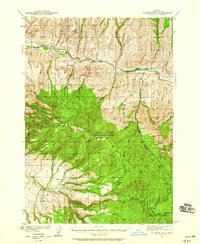
 1955 Canyon City1966 Print · USGSCentral Oregon's high desert and timber country are captured here in the mid-fifties, showing the rugged ranching and logging landscape. Trace the path of the Sumpter Valley Ry or locate remote settlements like Izee, Whitney, and Ritter.4 unique versions available
Showing maps 1-25 of 672
Top cities of Grant County
- John Day historical maps
- Prairie City historical maps
- Canyon City historical maps
- Mount Vernon historical maps
- Long Creek historical maps
- Seneca historical maps
See more
Frequently asked questions
- What are the different types of historical maps available for Grant County?
- What is the oldest map of Grant County?
- Where can I purchase historical maps of Grant County for my home or office?
- Where can I download high-res historical maps of Grant County?
- Are there historical topographic maps available for Grant County?
- Is there historical aerial imagery available for Grant County?
- Where are historical maps of Grant County sourced from?