1970s Maps of Harney County, Oregon
Explore 71 historic maps of Harney County from the 1970s. These maps offer a rare glimpse into what life looked like during the 1970s — showing old roads, neighborhoods, homes, and landmarks that have changed or disappeared over time.
Whether you're researching your family's past, planning a metal detecting trip, or studying how Harney County's landscape evolved across the 1970s, these high-resolution maps are a powerful tool for exploring the history of this region.
- Focus on a specific era: All maps on this page are from the 1970s, giving you a focused view of this time period.
- See what’s changed: Compare century-old streets, trails, and buildings to today's modern landscape using overlays and satellite layers.
- Research with precision: Use these maps for genealogy, historical research, land use analysis, or educational projects.
- View, download, or print: Maps are fully viewable online in high resolution, and can be downloaded or printed for your own records.
Start exploring Harney County's history through authentic maps from the 1970s. This is your window into the past.
Harney County, OR maps
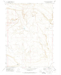
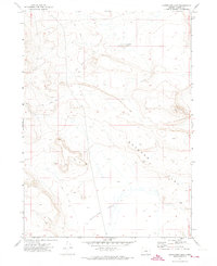
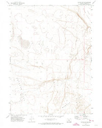
(71)- 1970 Map of Flag Prairie, 1973 Print
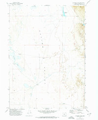
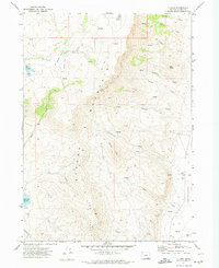
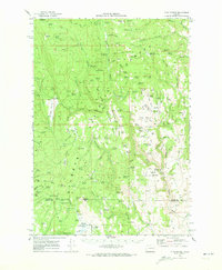 1970 Flag Prairie1973 Print · USGSGrant and Harney County high country is shown here in the early seventies, a land of high-elevation meadows and national forest management. Researchers can trace forest history and livestock movements through sites like Crane Prairie Guard Station, North Fork Cow Camp, and Knox Meadow.
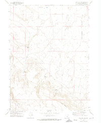
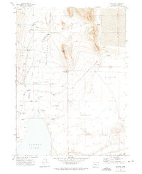
 - 1970 Map of Castle Rock, 1973 Print
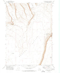
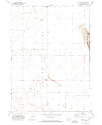
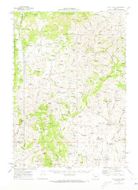 1970 Castle Rock1973 Print · USGSEastern Oregon ranching and forestry are documented here in the early seventies, spanning the borders of Grant, Harney, and Malheur Counties. Researchers can locate remote outposts like Dutch John Cabin, the isolated Goodwin Tomb, and the Castle Rock Fire Station.
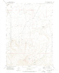
 - 1971 Map of Fish Fin Rim
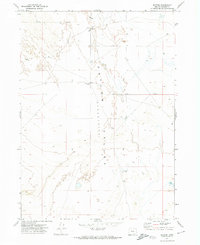
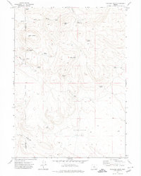
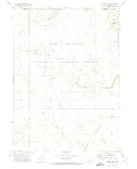
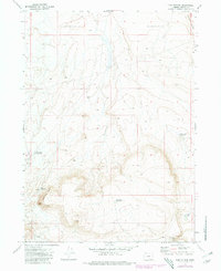 1971 Fish Fin Rim1971 Print · USGSHarney County's high-desert rangeland is documented here in the early 1970s, showcasing the remote volcanic escarpments of the Oregon backcountry. Trace the vital water network of the era through Rimrock Waterhole and the intriguing site of Mustang Jail.2 unique versions available
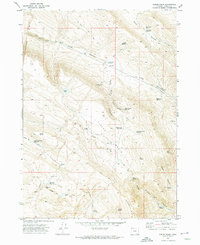
 - 1971 Map of Square Mountain, 1974 Print
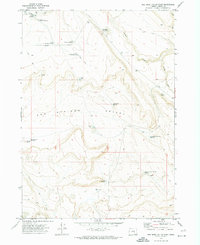
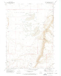 1971 Square Mountain1974 Print · USGSHarney County's high desert comes into focus during the early 1970s, showcasing a landscape shaped by remote ranching and essential water rights. Researchers can trace the heritage of local figures at Bass Haines Place or locate early landmarks like McDade Cache and Lee Morris Spring.
 - 1971 Map of Duhaime Flat East, 1974 Print
 1971 Duhaime Flat East1974 Print · USGSHarney County's high desert ranching country is captured here during the early seventies, showcasing a landscape of isolated outposts and vital water sources. Genealogists and researchers can locate family landmarks like Tucker Place and Miller Place or trace remote Jeep Trails past Meadow Flat Reservoir.
 - 1971 Map of Acty Mountain NW, 1974 Print
 1971 Acty Mountain NW1974 Print · USGSHarney County's high desert rangelands are captured in the early 1970s, showing a landscape shaped by water management and grazing. Researchers can trace the placement of vital water sources like Swede Reservoir and Shallow Lake, or the broad expanse of Butcher Flat.
 - 1971 Map of Beatys Butte, 1974 Print
 1971 Beatys Butte1974 Print · USGSHarney and Lake County high desert terrain is meticulously documented during the early 1970s. Researchers can locate critical water sources and remote landmarks like Beatys Butte, Mustang Basin, and Willow Spring.2 unique versions available
 - 1971 Map of Fields Basin, 1974 Print
 1971 Fields Basin1974 Print · USGSHarney County's high-desert ranching country is documented here in the early 1970s, showing a landscape carved by canyons and remote reservoirs. Researchers can locate isolated stock water sites like Eleven Horse Reservoir and natural landmarks such as Pearl Wise Springs.
 - 1971 Map of Surveyors Lake, 1974 Print
 1971 Surveyors Lake1974 Print · USGSHigh desert rangeland in Harney County is captured during the early seventies, showing a remote landscape defined by seasonal waters. Researchers can trace early access routes via Jeep Trail across Butcher Flat near Surveyors Lake.
 - 1971 Map of Andrews, 1974 Print
 1971 Andrews1974 Print · USGSHigh desert ranching and water management define this corner of Harney County in the early seventies. Genealogists and historians can trace family-named outposts like Serrano Point Ranch and Kueny Ranch alongside the Cem at Wilson Creek.2 unique versions available
 - 1971 Map of Clover Swale, 1974 Print
 1971 Clover Swale1974 Print · USGSHarney County high desert is captured here in the early 1970s, showing a remote landscape of canyons and rangeland. Researchers can trace land use through features like Matties Ark, Tucke Lake, and the winding route of The Jeep Dipper.
 - 1971 Map of Blitzen, 1974 Print
 1971 Blitzen1974 Print · USGSHarney County's high desert landscape is captured here in the early seventies, centered on the expansive basin of the Catlow Valley. Genealogists and researchers can trace the essential water infrastructure of the era, from Blitzen to the remote McBurney Well.
 - 1971 Map of Coyote Gap SE, 1974 Print
 1971 Coyote Gap SE1974 Print · USGSHarney County's high desert landscape is recorded here in the early seventies, showing a land defined by geological depressions and wide-open flats. Researchers can trace the sparse access across Butcher Flat or follow the Jeep Trail into the Basque Hills.
 - 1971 Map of Steamboat Point, 1974 Print
 1971 Steamboat Point1974 Print · USGSHarney County's high desert landscape is captured here in the early seventies, centered on the dramatic rimrock above the Warner Valley. Researchers can trace the network of Jeep Trails leading to vital water sources like Chrome Reservoir and Drift Fence Waterhole.2 unique versions available
 - 1971 Map of Mahogany Butte, 1974 Print
 1971 Mahogany Butte1974 Print · USGSIn the early 1970s, this high-desert border between Lake and Harney counties was a land of critical waterholes and remote outposts. Trace the locations of Rock Springs Camp, Shirks Lookout, and named springs like Reed Spring.
 - 1971 Map of Keg Sprs Valley East, 1974 Print
 1971 Keg Sprs Valley East1974 Print · USGSHarney County's high-desert ranching country is mapped here in the early 1970s, showcasing a landscape defined by water management and remote tracks. Researchers can trace the water infrastructure of the era, from the Well Corral to Keg Springs Reservoir and the Lower Herlihy Reservoir.
 - 1971 Map of Garrison Lake, 1974 Print
 1971 Garrison Lake1974 Print · USGSHarney County's high desert landscape is revealed in the early 1970s, focused on the drainage patterns of the Great Basin. Researchers can trace the importance of water at Garrison Lake, Threemile Reservoir, and the vast Catlow Valley.
 - 1971 Map of Butler Hill, 1974 Print
 1971 Butler Hill1974 Print · USGSHarney County's high desert landscape was still defined by remote ranching outposts and rugged terrain in the early seventies. Genealogists and local historians can locate the Koontz Homestead, Rieckens Corner, and the steep ascent of the Catlow Rim.
 - 1971 Map of Orejana Canyon, 1974 Print
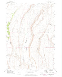
 1971 Orejana Canyon1974 Print · USGSHarney County's high desert plateaus are revealed in the early seventies, centered on the dramatic basaltic walls of Orejana Canyon. Researchers can trace the essential water infrastructure of the era through sites like South Lake Waterhole, Spine Cob Butte, and Cyclone Reservoir.
 - 1971 Map of Rock Camp Draw, 1974 Print
 1971 Rock Camp Draw1974 Print · USGSHigh-desert Harney County comes to life in the early 1970s, showing a remote landscape of high ridges and isolated cabins. Trace the locations of Hempy Cabin, Anderson Cabin, and local landmarks like Mule Tit alongside mountain waters like Rock Camp Lake.
 - 1971 Map of V Lake, 1974 Print
 1971 V Lake1974 Print · USGSSteens Mountain and the arid basins of Harney County are captured here in the early 1970s. Local researchers can trace old ranching and aviation markers like Smith Landing Strip, Skull Creek Reservoir, and the remote V Lake.
 - 1971 Map of Sixmile Draw, 1974 Print
 1971 Sixmile Draw1974 Print · USGSThe high desert of Lake County is documented here in the early 1970s, showcasing the remote wildlife conservation lands and early ranching sites. Genealogists and historians can trace family-named sites like Poindexter Place and remote lifelines like Murphy Waterholes.
 - 1971 Map of Guano Reservoir, 1974 Print
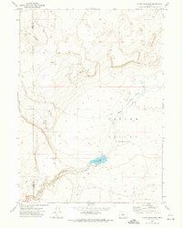 1971 Guano Reservoir1974 Print · USGSHarney and Lake Counties are captured here in the early seventies, showing a quiet expanse of high desert hydrology. Trace the basin of Catlow Valley to find Guano Reservoir and its associated Guano Slough.
 - 1971 Map of Duhaime Flat West, 1974 Print
 1971 Duhaime Flat West1974 Print · USGSHarney County's high desert reveals its ranching and water-scarcity history in the early seventies. Genealogists and historians can trace family-named landmarks like the Augustine Gilbert Place and remote sites such as the Natural Corral and Ruins.
 - 1971 Map of Coyote Gap, 1974 Print
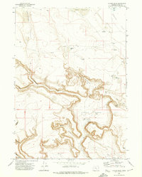
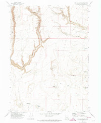
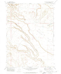
 1971 Coyote Gap1974 Print · USGSThe high desert of Harney County comes into focus in the early 1970s, showing the remote ranching infrastructure of the Catlow Valley. Researchers can trace vital water sources and land use through Coyote Gap Corral, GARRISON LAKE, and numerous mapped wells.
Showing maps 1-25 of 71
Top cities of Harney County
Frequently asked questions
- What are the different types of historical maps available for Harney County?
- What is the oldest map of Harney County?
- Where can I purchase historical maps of Harney County for my home or office?
- Where can I download high-res historical maps of Harney County?
- Are there historical topographic maps available for Harney County?
- Is there historical aerial imagery available for Harney County?
- Where are historical maps of Harney County sourced from?