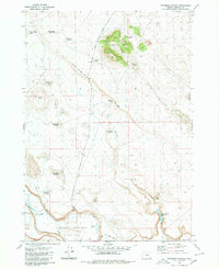
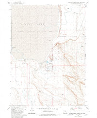
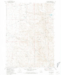
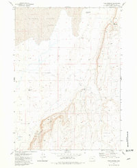
1980s Maps of Harney County, Oregon
Explore 82 historic maps of Harney County from the 1980s. These maps offer a rare glimpse into what life looked like during the 1980s — showing old roads, neighborhoods, homes, and landmarks that have changed or disappeared over time.
Whether you're researching your family's past, planning a metal detecting trip, or studying how Harney County's landscape evolved across the 1980s, these high-resolution maps are a powerful tool for exploring the history of this region.
- Focus on a specific era: All maps on this page are from the 1980s, giving you a focused view of this time period.
- See what’s changed: Compare century-old streets, trails, and buildings to today's modern landscape using overlays and satellite layers.
- Research with precision: Use these maps for genealogy, historical research, land use analysis, or educational projects.
- View, download, or print: Maps are fully viewable online in high resolution, and can be downloaded or printed for your own records.
Start exploring Harney County's history through authentic maps from the 1980s. This is your window into the past.
Harney County, OR maps
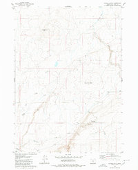
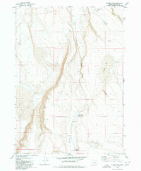
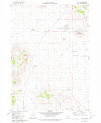
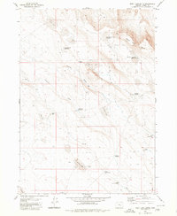
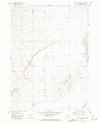
(82)- 1980 Map of Capehart Lake
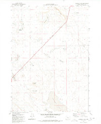 1980 Capehart Lake1980 Print · USGSHarney County's high desert is captured here in the early eighties, showcasing a remote landscape of volcanic buttes and seasonal basins. Trace the movement of early travelers and ranchers through Kellogg Waterhole, Lookout Butte, and the diagonal Jeep Trail.
 - 1980 Map of Hughet Spring
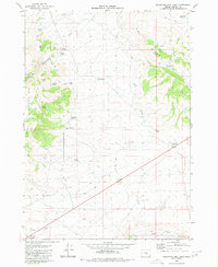
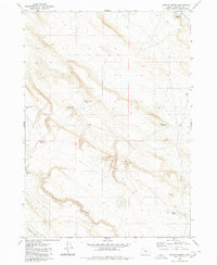 1980 Hughet Spring1980 Print · USGSHigh desert ranching and water management in Harney County are documented here in the late seventies. Researchers can trace the layout of essential water sources and landmarks like Buckaroo Flat, Stud Horse Reservoir, and Buzzard Canyon.
 - 1980 Map of Meadow Lake
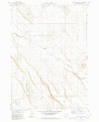
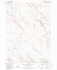 1980 Meadow Lake1980 Print · USGSHarney County's high desert rangeland is captured here in the early 1980s, showing a landscape shaped by the search for water. Trace the remote network of desert pools and seasonal catchments like Moon Lake, Alex Spring Reservoir, and the curiously named Deadmans Bedground.
 - 1980 Map of Twin Buttes
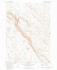 1980 Twin Buttes1980 Print · USGSHarney County's high-desert ranching country is documented here in the early 1980s, revealing a landscape defined by critical water management. Trace named catchments like Long Canyon Reservoir and isolated outposts such as Mammoth Waterhole and Tooney Waterhole.
 - 1980 Map of Jackass Butte
 1980 Jackass Butte1980 Print · USGSIn the high desert of Malheur County during the late seventies, this survey shows a remote landscape defined by essential water sources and volcanic landmarks. Trace the distribution of water at Heber Ranch, Grafton Well, and the Bull Canyon Reservoir.
 - 1980 Map of Lunch Lake
 1980 Lunch Lake1980 Print · USGSHarney County's high-desert landscape is captured here in the early eighties, showing a network of canyons and seasonal basins. Researchers can locate the site of Ruins near the head of Buzzard Canyon and trace water features like Lunch Lake and Buckaroo Flat.
 - 1980 Map of Squaw Butte
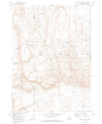
 1980 Squaw Butte1980 Print · USGSHigh-desert rangeland in Harney County is captured here during the 1980s, centered on federal research lands. Researchers and historians can trace water management and survey points across Squaw Butte, China Lake, and Papoose Lake.
 - 1980 Map of Wagontire Mtn West
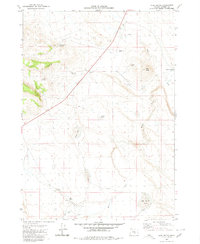
 1980 Wagontire Mtn West1980 Print · USGSHigh desert ranching and observation stations define this 1980 survey of the Oregon interior at the border of Lake and Harney counties. Researchers can trace land use through remote water features like Peila Reservoir, Snookum Spring, and the high Lookout Tower on Wagontire Mtn.
 - 1980 Map of Flybee Lake
 1980 Flybee Lake1980 Print · USGSHarney County's high desert landscape is captured here in the early eighties, showcasing a remote network of vital watering holes and canyons. Trace the path of a Jeep Trail as it connects Flybee Lake, Hole in Rocks, and Flynn Lake.
 - 1980 Map of Iron Mtn. Flat
 1980 Iron Mtn. Flat1980 Print · USGSHarney County's high desert landscape is captured here in the early 1980s, centered on the stark transition between volcanic uplands and seasonal alkali basins. Local historians can trace old livestock routes and water sources like Dead Bull Waterhole, Crane Spring, and the prominent Iron Mountain.
 - 1980 Map of Round Top Butte
 1980 Round Top Butte1980 Print · USGSHigh-desert rangeland on the border of Lake and Harney Counties is captured in the late 1970s, showcasing a network of remote springs and reservoirs. Researchers can locate isolated homestead sites like Anderl Place and trace the drainage of Lost Creek toward the Sinks of Lost Creek.
 - 1980 Map of Alec Butte
 1980 Alec Butte1980 Print · USGSHarney County's high-desert ranching country is captured here during the 1980s, showcasing a landscape defined by vital water resources and isolated outposts. Researchers can trace historic ranching infrastructure like the Old Peterson Ranch, Horseshoe Bar Reservoir, and Alec Butte.
 - 1980 Map of Southwest Harney Lake
 1980 Southwest Harney Lake1980 Print · USGSHigh desert ranching and conservation efforts meet in Harney County during the late twentieth century. Genealogists and historians can trace old homestead sites and vital water sources like Moon Ranch, Basque Flat, and Soldier Spring.
 - 1980 Map of Hay Lake
 1980 Hay Lake1980 Print · USGSHarney County's high-desert ranching landscape is captured here in the late seventies, showing a territory defined by seasonal water and isolated homesteads. Researchers can trace local land use through features like the Harry Arnold Ranch, the Old Egli Place, and the curiously named Hole in Ground.
 - 1980 Map of Wagontire Mtn East
 1980 Wagontire Mtn East1980 Print · USGSHigh-desert ranching life in central Harney County is captured here during the 1980s. Researchers can trace legacy family sites like Whitehouse Ranch, Old Jackson Place, and the remote Stinkhole Reservoir.
 - 1980 Map of Stinking Lake
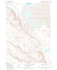
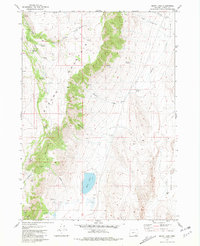
 1980 Stinking Lake1980 Print · USGSThe Harney Basin in the late twentieth century is shown here as a landscape defined by its vital water sources and bird habitat. Researchers can trace the water systems of the Malheur National Wildlife Refuge, from Stinking Lake to local landmarks like Double O Station and Basque Spring.
 - 1980 Map of Lake on The Trail
 1980 Lake on The Trail1980 Print · USGSHarney County's high desert landscape is captured here in the mid-1970s, showcasing the vital water network of the Oregon interior. Trace the remote ranching history of the region through named landmarks like Table Butte, Big Stick Waterhole, and Murphy Well.
 - 1980 Map of Weed Lake Butte
 1980 Weed Lake Butte1980 Print · USGSHarney County's high desert ranching landscape is captured here in the early eighties, showing a reliance on seasonal waterholes and catchments. Researchers can trace land use through features like Shelley Corral, Campbell Reservoir, and the West Weed Lake Butte Waterhole.
 - 1980 Map of Palomino Buttes
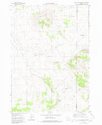
 1980 Palomino Buttes1980 Print · USGSHarney County in the late seventies is a land of high rims and vital waterholes centered on the Palomino Buttes. Genealogists and historians can trace old ranching routes like Ferry Grade and locate remote landmarks such as Wild Horse Lake or the Landing Strip.
 - 1980 Map of Southeast Harney Lake
 1980 Southeast Harney Lake1980 Print · USGSIn the high desert of Harney County in the late 1970s, this survey documents the delicate hydrology of the Malheur National Wildlife Refuge. Researchers can locate thermal features like Bathtub Spring (Hot) and trace the dry expanses of Alkali Flat.
 - 1980 Map of Windy Point, 1981 Print
 1980 Windy Point1981 Print · USGSThe high desert of Harney County is captured here in the late twentieth century, showing a remote landscape of canyons and cattle ranching. Researchers can trace land use through the Hamilton Ranch, the high-altitude Little Windy Pass, and the Holloway Reservoir irrigation network.
 - 1981 Map of Coyote Lake West
 1981 Coyote Lake West1981 Print · USGSThe high desert of southeastern Oregon comes into focus in the early eighties, capturing a remote landscape of lakebeds and cattle country. Trace the arid topography around Coyote Lake and find historic landmarks like the Lower Willow Creek Waterhole and Twin Buttes.
 - 1981 Map of Tule Springs
 1981 Tule Springs1981 Print · USGSHarney County's high desert landscape comes into focus during the early eighties, showing a remote terrain of sagebrush and spring-fed sites. Researchers can locate remote outposts like Tule Springs, identify Ruins, and trace the rugged Tule Springs Rims.
 - 1981 Map of Mann Lake
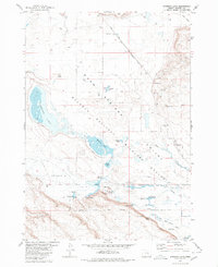
 1981 Mann Lake1981 Print · USGSHarney County's high desert landscape is shown here in the early 1980s, centered on the dramatic slopes of Steens Mountain. Local historians can trace old homestead sites and routes like Hamilton Place (Ruins), Alberson Station (Ruins), and the Shortcut Trail.
 - 1981 Map of Johnny Creek SW
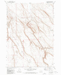
 1981 Johnny Creek SW1981 Print · USGSSoutheastern Oregon’s high desert comes into focus in the early eighties, revealing a landscape shaped by water scarcity and remote ranching. Researchers can trace the essential network of desert wells and basins, including Canyon Well, Steel Post Reservoir, and Saychen Spring.
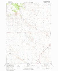
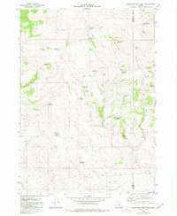
Showing maps 1-25 of 82
Top cities of Harney County
Frequently asked questions
- What are the different types of historical maps available for Harney County?
- What is the oldest map of Harney County?
- Where can I purchase historical maps of Harney County for my home or office?
- Where can I download high-res historical maps of Harney County?
- Are there historical topographic maps available for Harney County?
- Is there historical aerial imagery available for Harney County?
- Where are historical maps of Harney County sourced from?