1950s Maps of Harney County, Oregon
Explore 15 historic maps of Harney County from the 1950s. These maps offer a rare glimpse into what life looked like during the 1950s — showing old roads, neighborhoods, homes, and landmarks that have changed or disappeared over time.
Whether you're researching your family's past, planning a metal detecting trip, or studying how Harney County's landscape evolved across the 1950s, these high-resolution maps are a powerful tool for exploring the history of this region.
- Focus on a specific era: All maps on this page are from the 1950s, giving you a focused view of this time period.
- See what’s changed: Compare century-old streets, trails, and buildings to today's modern landscape using overlays and satellite layers.
- Research with precision: Use these maps for genealogy, historical research, land use analysis, or educational projects.
- View, download, or print: Maps are fully viewable online in high resolution, and can be downloaded or printed for your own records.
Start exploring Harney County's history through authentic maps from the 1950s. This is your window into the past.
Harney County, OR maps
(15)- 1954 Map of Vya, 1967 Print
 1954 Vya1967 Print · USGSThe tri-state corner of Nevada, Oregon, and California appears here in the mid-fifties, dominated by wildlife refuges and massive naval gunnery ranges. Trace isolated high-desert outposts like Vya and Soldier Meadow Ranch or find historic workings at the Ashdown Mine.3 unique versions available
 - 1955 Map of Burns, 1964 Print
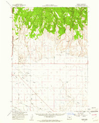
 1955 Burns1964 Print · USGSHarney County's high desert ranching and timber heartland is captured here in the mid-fifties, centered on the hub of Burns and Hines. Genealogists and researchers can locate remote landmarks like the Suntex School, New Princeton P. O., and the Lumber Mill.3 unique versions available
 - 1955 Map of Canyon City, 1966 Print
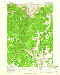
 1955 Canyon City1966 Print · USGSCentral Oregon's high desert and timber country are captured here in the mid-fifties, showing the rugged ranching and logging landscape. Trace the path of the Sumpter Valley Ry or locate remote settlements like Izee, Whitney, and Ritter.4 unique versions available
 - 1955 Map of Adel, 1971 Print
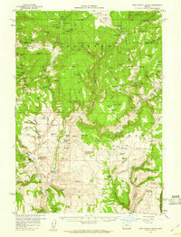
 1955 Adel1971 Print · USGSSoutheast Oregon in the mid-fifties remains a landscape of vast alkaline basins and high mountain scarps, anchored by remote outposts. Researchers can trace historic ranching routes through Catlow Valley and locate landmarks like Beatys Butte or the small settlement of Blitzen.2 unique versions available
 - 1957 Map of Adel
 1957 Adel1957 Print · USGSSoutheast Oregon in the mid-fifties reveals a high-desert landscape of sprawling ranches and vast wildlife refuges before modern development. Genealogists and researchers can trace the remote outposts of the region, from the Red Point School to historic headquarters like the Guano Ranch and Frenchglen.
 - 1958 Map of Burns
 1958 Burns1958 Print · USGSHarney County ranching and timber lands are captured here in the late fifties. Genealogists and local historians can trace family holdings and rural institutions, from the Kimball Flat School to remote outposts like Crow Camp Ranch and the Sutton Ranch.
 - 1958 Map of Vya
 1958 Vya1958 Print · USGSNorthwest Nevada and the tri-state border region are mapped here during the mid-fifties, showing a remote landscape of high desert ranches and sprawling antelope range. Trace historic operations like the Ashdown Mine, find local camps like Coyote Camp, and locate isolated outposts from Vya to Denio.2 unique versions available
 - 1958 Map of Adel
 1958 Adel1958 Print · USGSSoutheastern Oregon in the mid-fifties is captured here, showing a vast territory of high desert basins and isolated ranching outposts. Genealogists and researchers can trace the locations of the Red Point School, Frenchglen, and remote sites like Guano Ranch.2 unique versions available
 - 1959 Map of Burns
 1959 Burns1959 Print · USGSHarney County in the late fifties remains a landscape of high-desert ranching and timber production, centered on the hubs of Burns and Hines. Researchers can locate remote rural institutions like the Suntex School or trace family landholdings such as the Stallard Ranch and O'Keefe Homestead.
 - 1959 Map of Canyon City
 1959 Canyon City1959 Print · USGSEastern Oregon in the late fifties was a landscape of high timber and remote river valleys shaped by the cattle and mining trades. Genealogists and historians can trace the paths of the Sumpter Valley RR and find early settlements like Antone, Richmond, and Dayville.2 unique versions available
 - 1959 Map of West Myrtle Butte, 1960 Print
 1959 West Myrtle Butte1960 Print · USGSHigh-elevation ranching and timberlands define this Oregon backcountry during the late fifties, where the Malheur National Forest spans the county line. Genealogists and historians can locate early family outposts like the Old Dole Smith Homestead, Peabody Homestead, and Bassuot Cabin.2 unique versions available
 - 1959 Map of Sawtooth Creek, 1960 Print
 1959 Sawtooth Creek1960 Print · USGSHigh desert rangeland and timber country come to life in this late 1950s survey of the Grant and Harney County line. Researchers can trace remote ranching history at the Ramsey Ranch and Rickman Ranch or locate forest service landmarks like the Snow Mtn Lookout.2 unique versions available
 - 1959 Map of Harney, 1961 Print
 1959 Harney1961 Print · USGSThe Harney County high desert and forest transition are captured here in the late fifties, showing the area's vital water and rail infrastructure. Researchers can locate the Fort Harney (Site), trace the Union Pacific railroad, and find small locales like Gradon and Harney.2 unique versions available
 - 1959 Map of Dog Mountain, 1961 Print
 1959 Dog Mountain1961 Print · USGSThe high desert of Harney County comes into focus in the late fifties, showcasing a vast basin and range landscape before modern development. Researchers can trace the water levels of Harney Lake and locate remote landmarks like Frank Schmidt Lake or the Savage Grade Jeep Trail.2 unique versions available
 - 1959 Map of Lawen, 1961 Print
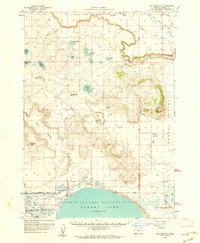
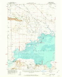 1959 Lawen1961 Print · USGSHarney County's high desert wetlands are preserved here during the late fifties, showing the complex hydrology of the Malheur Lake basin. Researchers can locate the historic Sod House School, the Lawen settlement along the Union Pacific railroad, and the Sod House Dam.
End of results
Showing maps 1-15 of 15
Top cities of Harney County
Frequently asked questions
- What are the different types of historical maps available for Harney County?
- What is the oldest map of Harney County?
- Where can I purchase historical maps of Harney County for my home or office?
- Where can I download high-res historical maps of Harney County?
- Are there historical topographic maps available for Harney County?
- Is there historical aerial imagery available for Harney County?
- Where are historical maps of Harney County sourced from?