Old Maps of Medford, Oregon for Metal Detecting
Plan your next treasure hunt with 36 historic maps of Medford. Find old homesites, ghost towns, trails, and gathering spots that may be lost to time — perfect for identifying promising metal detecting locations.
- Locate forgotten sites: Uncover places like long-lost settlements, abandoned rail lines, or gathering spots.
- Plan better hunts: Use map overlays combined with LiDAR or satellite views to narrow in on historically rich areas.
- Made for detectorists: Thousands of hobbyists use these maps to discover relics, coins, and hidden history.
Use these historic maps to boost your research and find new opportunities beneath the surface of Medford.
Medford, OR maps
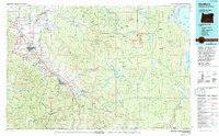
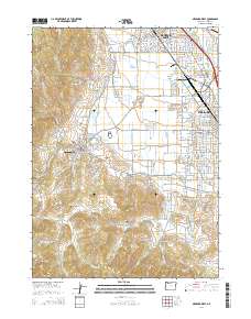
(36)- 1891 Map of Ashland
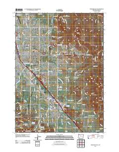
 1891 Ashland1891 Print · USGSSouthern Oregon's Rogue River Valley was undergoing rapid transformation in the late nineteenth century as rail lines connected its emerging towns. Genealogists and historians can trace early property and settlement patterns near Jacksonville, Medford, and the pristine Crater Lake basin.
 - 1893 Map of Ashland
 1893 Ashland1893 Print · USGSSouthern Oregon in the late nineteenth century was a region of rapid change as the Oregon and California R. R. linked the valley floor. Researchers can trace the early footprints of Jacksonville, Medford, and Ashland, or locate landmarks like Crater Lake and Mt Pitt.6 unique versions available
 - 1897 Map of Ashland, 1937 Print
 1897 Ashland1937 Print · USGSSouthern Oregon's Rogue River Valley is captured here in the late nineteenth century as the railroad began to transform local commerce. Trace the early footprints of Jacksonville and Medford, or locate remote landmarks like Wizard Island and the high peaks of the Rogue River National Forest.
 - 1938 Map of Medford
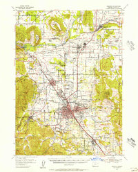
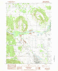
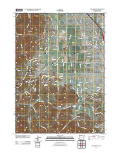
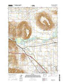
 1938 Medford1938 Print · USGSIn the 1930s, the Rogue River Valley served as a thriving hub for southern Oregon mining and transit. Genealogists and historians can trace old homesteads and landmarks like the Willow Springs Cem, the Millionaire Mine, and the Bybee Bridge.3 unique versions available
 - 1954 Map of Medford, 1956 Print
 1954 Medford1956 Print · USGSMedford and the Rogue River Valley are captured here in the mid-fifties, showing a landscape defined by volcanic peaks and growing orchards. Genealogists and historians can trace family ties at Pankey Park Cemetery, locate the Table Rock School, or map the early footprints of White City and Jacksonville.3 unique versions available
 - 1955 Map of Medford, 1964 Print
 1955 Medford1964 Print · USGSSouthern Oregon's valley towns and high peaks are captured here in the mid-1950s, showing the region before the completion of the modern interstate system. Genealogists and historians can trace the development of timber and mining outposts from Wolf Creek to Butte Falls and the early roads to Crater Lake.3 unique versions available
 - 1957 Map of Medford
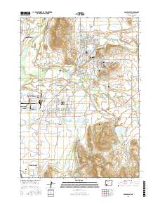
 1957 Medford1957 Print · USGSSouthern Oregon during the mid-fifties is captured here as a region of growing valley cities and vast timberlands. Genealogists and historians can trace the rail-and-road corridors connecting Medford, Jacksonville, and Grants Pass to more remote locales like Wolf Creek or Butte Falls.
 - 1958 Map of Medford
 1958 Medford1958 Print · USGSSouthern Oregon's Rogue River valley thrived in the 1950s as a crossroads of rail and road. Researchers can trace the legacy of timber and tourism through Southern Pacific RR lines and landmarks like Crater Lake and Oregon Caves National Monument.
 - 1974 Map of Medford NW, 1978 Print
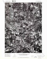
 1974 Medford NW1978 Print · USGSJackson County during the mid-seventies is captured here through detailed aerial imagery, showing the expansion of Central Point. Researchers can trace the riverbank geography of the Rogue River and locate rural landmarks like Sams Valley and Upper Table Rock.
 - 1974 Map of Medford SE, 1979 Print
 1974 Medford SE1979 Print · USGSSouthern Oregon's Bear Creek Valley comes into focus during the mid-seventies, documenting the transition from orchard land to suburban sprawl. Genealogists and local historians can trace the 1970s footprints of Medford and Phoenix as they appeared just before significant modern expansion.2 unique versions available
 - 1974 Map of Medford NE, 1979 Print
 1974 Medford NE1979 Print · USGSJackson County is captured during the mid-seventies in this detailed orthophotomap showing the layout of the Rogue Valley. Genealogists and local historians can trace the development of Eagle Point, White City, and the crossroads at Four Corners.2 unique versions available
 - 1974 Map of Medford SW, 1981 Print
 1974 Medford SW1981 Print · USGSJackson County during the mid-seventies is captured in this detailed aerial survey of the valley and foothills. Genealogists and local historians can trace the early residential growth and agricultural layout around Central Point as it appeared decades ago.2 unique versions available
 - 1978 Map of Medford, 1994 Print
 1978 Medford1994 Print · USGSSouthern Oregon's Bear Creek Valley comes into sharp focus during the late seventies, showing the growth of Medford and Ashland along the rail lines. Local researchers can trace the development of White City, old routes through Sams Valley, and the irrigation infrastructure at Hyatt Reservoir.
 - 1983 Map of Sams Valley
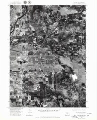
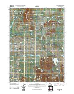
 1983 Sams Valley1983 Print · USGSJackson County's Rogue River valley is captured here in the early eighties, showing a landscape of volcanic plateaus and river industry. Researchers can locate the Fort Lane (Site), the Millionaire Mine, and the rail corridor of the K D S G M R.2 unique versions available
 - 1983 Map of Eagle Point
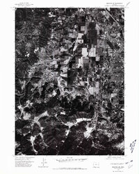
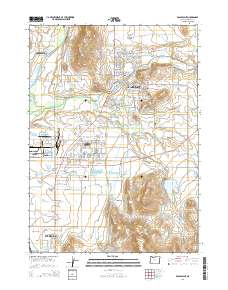
 1983 Eagle Point1983 Print · USGSJackson County's landscape in the early 1980s shows the growth of settlements and water infrastructure around the Agate Desert. Researchers can trace local landmarks like the Veterans Administration Domiciliary, Agate Reservoir, and the Shot Tower.2 unique versions available
 - 1983 Map of Medford West
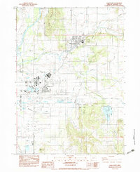
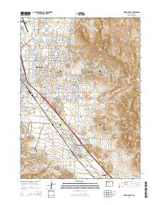
 1983 Medford West1983 Print · USGSJackson County is shown in the early eighties as the urban centers of Medford and Central Point expand toward the surrounding hills. Researchers can trace historic property boundaries in the Jacksonville Historic District or locate early mining activity near Rich Gulch and Johns Peak.
 - 1983 Map of Medford East
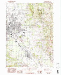 1983 Medford East1983 Print · USGSThe Rogue Valley at the start of the 1980s shows a landscape of expanding settlements and vital infrastructure. Researchers can trace the development of Phoenix and Voorhies or locate regional landmarks like Roxy Ann Peak and Jefferson Sch.
 - 2011 Map of Medford West, 2011 Print
 2011 Medford West2011 Print · USGSCovers Medford, including Central Point, Jacksonville, and other nearby areas
 - 2011 Map of Medford East, 2011 Print
 2011 Medford East2011 Print · USGSCovers Medford, including Talent, Phoenix, and other nearby areas
 - 2011 Map of Eagle Point, 2011 Print
 2011 Eagle Point2011 Print · USGSCovers Medford, including Eagle Point, White City, and other nearby areas
 - 2014 Map of Eagle Point, 2014 Print
 2014 Eagle Point2014 Print · USGSCovers Medford, including Eagle Point, White City, and other nearby areas
 - 2014 Map of Medford West, 2014 Print
 2014 Medford West2014 Print · USGSCovers Medford, including Central Point, Jacksonville, and other nearby areas
 - 2014 Map of Sams Valley, 2014 Print
 2014 Sams Valley2014 Print · USGSCovers Medford, including Central Point, Sams Valley, and other nearby areas
 - 2014 Map of Medford East, 2014 Print
 2014 Medford East2014 Print · USGSCovers Medford, including Talent, Phoenix, and other nearby areas
 - 2017 Map of Eagle Point, 2017 Print
 2017 Eagle Point2017 Print · USGSCovers Medford, including Eagle Point, White City, and other nearby areas
Showing maps 1-25 of 36
Top cities near Medford
- Ashland historical maps
- Central Point historical maps
- Eagle Point historical maps
- White City historical maps
- Talent historical maps
- Phoenix historical maps
See more
Top neighborhoods of Medford
Frequently asked questions
- What are the different types of historical maps available for Medford?
- What is the oldest map of Medford?
- Where can I purchase historical maps of Medford for my home or office?
- Where can I download high-res historical maps of Medford?
- Are there historical topographic maps available for Medford?
- Is there historical aerial imagery available for Medford?
- Where are historical maps of Medford sourced from?