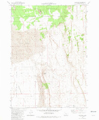
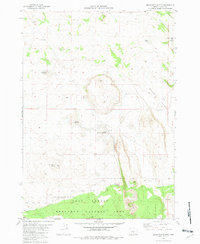
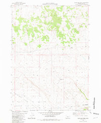
1980s Maps of Lake County, Oregon
Explore 91 historic maps of Lake County from the 1980s. These maps offer a rare glimpse into what life looked like during the 1980s — showing old roads, neighborhoods, homes, and landmarks that have changed or disappeared over time.
Whether you're researching your family's past, planning a metal detecting trip, or studying how Lake County's landscape evolved across the 1980s, these high-resolution maps are a powerful tool for exploring the history of this region.
- Focus on a specific era: All maps on this page are from the 1980s, giving you a focused view of this time period.
- See what’s changed: Compare century-old streets, trails, and buildings to today's modern landscape using overlays and satellite layers.
- Research with precision: Use these maps for genealogy, historical research, land use analysis, or educational projects.
- View, download, or print: Maps are fully viewable online in high resolution, and can be downloaded or printed for your own records.
Start exploring Lake County's history through authentic maps from the 1980s. This is your window into the past.
Lake County, OR maps
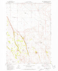
(91)- 1980 Map of Wagontire Mtn West
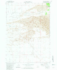
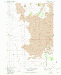
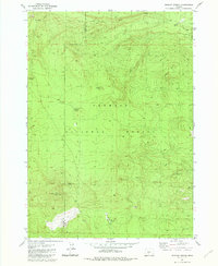
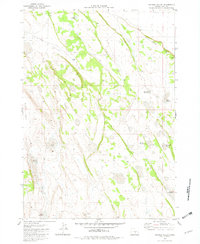
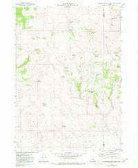 1980 Wagontire Mtn West1980 Print · USGSHigh desert ranching and observation stations define this 1980 survey of the Oregon interior at the border of Lake and Harney counties. Researchers can trace land use through remote water features like Peila Reservoir, Snookum Spring, and the high Lookout Tower on Wagontire Mtn.
 - 1980 Map of Clover Flat
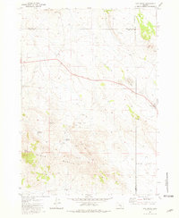
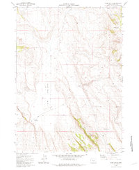
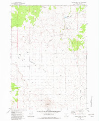
 1980 Clover Flat1980 Print · USGSLake County, Oregon, is shown in the early eighties as a network of high-elevation meadows and vital water sources within the Fremont National Forest. Researchers can trace the drainages of Ben Young Creek and Bauers Creek or locate landmarks like O'Leary Reservoir and Moss Pass.
 - 1980 Map of Round Top Butte
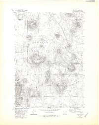
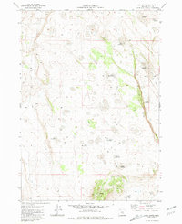
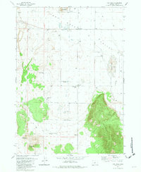
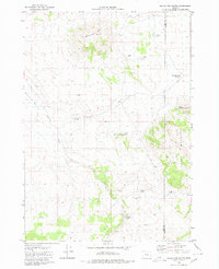 1980 Round Top Butte1980 Print · USGSHigh-desert rangeland on the border of Lake and Harney Counties is captured in the late 1970s, showcasing a network of remote springs and reservoirs. Researchers can locate isolated homestead sites like Anderl Place and trace the drainage of Lost Creek toward the Sinks of Lost Creek.
 - 1980 Map of Williamson River, 1997 Print
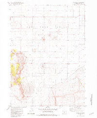
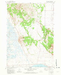
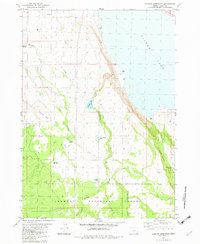
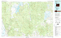 1980 Williamson River1997 Print · USGSSouthern Oregon in the late twentieth century was a landscape of high-desert forests and vast marshes managed by multiple federal agencies. Genealogists and historians can trace the rail-side settlements of Lenz and Kirk, or locate the historic Klamath Agency and Fort Klamath.
 - 1981 Map of Fossil Lake
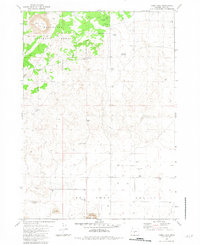
 1981 Fossil Lake1981 Print · USGSChristmas Lake Valley in the early eighties reveals a stark high-desert landscape of historic homesteads and vital water points. Researchers can trace the location of Cliff (Site) or locate the unique Lost Forest Research Natural Area among the dunes.
 - 1981 Map of Fox Butte
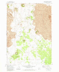
 1981 Fox Butte1981 Print · USGSThe high desert volcanic landscape of Lake and Deschutes Counties comes into focus in the early 1980s. Local history researchers can trace water infrastructure vital to the region, including Kittredge Reservoir, Derrick Well, and the remote Glen Cabin.2 unique versions available
 - 1981 Map of Hat Butte
 1981 Hat Butte1981 Print · USGSThe high desert of Lake County meets the borders of Harney and Deschutes in the early eighties, showing a landscape of volcanic peaks and isolated ranching outposts. Trace the locations of historic livestock infrastructure at Carlon Corral or geological landmarks like Glass Buttes and Midnight Point.
 - 1981 Map of Hogback Butte
 1981 Hogback Butte1981 Print · USGSThe Oregon high desert south of the lava flows is captured here in the late seventies. Researchers can trace remote water sources like Rickey Well and locate geographic landmarks including Fort Rock Station and the volcanic peak of Lava Mountain.
 - 1981 Map of Tired Horse Butte
 1981 Tired Horse Butte1981 Print · USGSLake County high desert terrain is captured here in the early eighties, showing a remote landscape of volcanic buttes and vital water holes. Researchers can trace land use through named features like Stauffer Well, Pilot Butte, and the Sinks of Lost Creek.
 - 1981 Map of Sand Rock
 1981 Sand Rock1981 Print · USGSThe Lake County high desert in the early eighties was a landscape of shifting sands and isolated volcanic peaks. Trace the boundaries of the Lost Forest Research Natural Area and identify landmarks like Wildcat Butte and Sand Rock.
 - 1981 Map of Moonlight Butte
 1981 Moonlight Butte1981 Print · USGSLake County, Oregon, is captured in the early eighties as a landscape of isolated buttes and critical water management. Researchers can locate remote water sources like Sagehen Waterhole and trace the boundaries of the Lost Forest Research Natural Area.
 - 1981 Map of Mean Rock Well
 1981 Mean Rock Well1981 Print · USGSLake County, Oregon, is surveyed here in the early eighties, showcasing the intersection of arid basins and protected forest land. Researchers can locate critical desert water sources like Mean Rock Well and Rock Spring or trace the boundaries of the Lost Forest Research Natural Area.
 - 1981 Map of Cougar Mtn
 1981 Cougar Mtn1981 Print · USGSLake County ranching and volcanic geology meet in the early eighties at the edge of the Fort Rock Valley. Researchers can trace isolated water sources like Harrison Place Well and Kunceider Well near the volcanic Cougar Mtn.
 - 1981 Map of Elk Butte
 1981 Elk Butte1981 Print · USGSLake County's high desert landscape is captured here in the early eighties, showing a remote region defined by volcanic rimrock and essential water management. Trace old ranching and travel routes between the Elk Butte Camp Corral and unique sites like Immigrant Waterhole and Dragon Rock.
 - 1981 Map of Rams Butte
 1981 Rams Butte1981 Print · USGSJew Valley and the surrounding high desert are captured here in the early eighties, revealing a landscape defined by ranching and water management. Researchers can trace historic stock water locations like Currie Waterhole, Eades Well, and Burnt Lake Reservoir.
 - 1981 Map of Thorn Lake
 1981 Thorn Lake1981 Print · USGSThe high desert of Oregon's Lake County in the early eighties shows a landscape focused on groundwater and geology. Researchers can locate remote industrial sites like the American Fossil Mine and landmarks such as Bottomless Lake and the BM 4319 Government Well.
 - 1981 Map of Wickiup Spring, 1982 Print
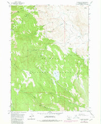
 1981 Wickiup Spring1982 Print · USGSThe Fremont National Forest high country comes into focus in this late-century survey of the Klamath and Lake county border. Researchers can trace the network of 4WD trails connecting vital water sources like Wickiup Spring, Mush Spring, and the Forest Service Sta.
 - 1981 Map of Lane Lake, 1982 Print
 1981 Lane Lake1982 Print · USGSFort Rock Valley's high desert landscape in Lake County reveals a history of early homesteading and resource management in the late seventies. Genealogists and local historians can trace former community hubs at Fleetwood and Loma Vista or locate family-named landmarks like Gerkin Well.2 unique versions available
 - 1981 Map of Tuff Butte, 1982 Print
 1981 Tuff Butte1982 Print · USGSLake County, Oregon, is captured here in the early eighties as a landscape of remote ranching outposts and high desert basins. Trace the history of regional settlement and land use through Tuff Cabin (Site), Hayes Place, and the Fort Rock Substation.
 - 1981 Map of Fort Rock, 1982 Print
 1981 Fort Rock1982 Print · USGSLake County, Oregon, is captured in the early eighties as a landscape defined by its volcanic geology and isolated well-watered homesteads. Researchers can trace the lineage of high-desert settlement through the Fort Rock Cem, Beasley Lake, and numerous family-named landmarks like Gubsher Well.
 - 1981 Map of Chicago Valley, 1982 Print
 1981 Chicago Valley1982 Print · USGSHigh desert ranching in Lake County is captured here in the late seventies. Researchers can trace essential water sources and landmarks like Stauffer Rim, One Crock Waterhole, and Hidden Lake across the basin floor.
 - 1981 Map of Cabin Lake, 1982 Print
 1981 Cabin Lake1982 Print · USGSLake County high-desert ranching and volcanic geology are on full display in the early eighties. Researchers can trace the importance of water sources through named sites like Wegert Well and Poppy Well, or locate the Roub Long Cave and Fort Rock State Mon.
 - 1982 Map of Schaub Lake
 1982 Schaub Lake1982 Print · USGSFort Rock Valley was a landscape of remote ranching and desert hydrology in the late seventies and early eighties. Researchers can trace the distribution of early water sources and outposts like Poplars Well Ranch, Woodrow, and the seasonal Schaub Lake.
 - 1982 Map of Duncan Reservoir
 1982 Duncan Reservoir1982 Print · USGSHigh desert water management and timber lands define this Lake County area in the early eighties. Researchers can trace the remote network of Duncan Reservoir, family-named landmarks like Murphy Windmill, and the rise of Dead Indian Rim.
 - 1982 Map of Peters Creek Sink
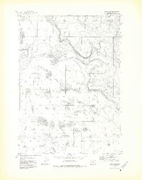
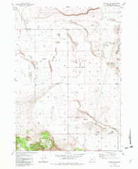
 1982 Peters Creek Sink1982 Print · USGSLake County high desert life in the early 1980s is centered on water management and grazing lands. You can trace the path of Peters Creek to its terminus at Peters Creek Sink and locate isolated water sources like Juniper Well.
Showing maps 1-25 of 91
Top cities of Lake County
Frequently asked questions
- What are the different types of historical maps available for Lake County?
- What is the oldest map of Lake County?
- Where can I purchase historical maps of Lake County for my home or office?
- Where can I download high-res historical maps of Lake County?
- Are there historical topographic maps available for Lake County?
- Is there historical aerial imagery available for Lake County?
- Where are historical maps of Lake County sourced from?