1970s Maps of Lake County, Oregon
Explore 15 historic maps of Lake County from the 1970s. These maps offer a rare glimpse into what life looked like during the 1970s — showing old roads, neighborhoods, homes, and landmarks that have changed or disappeared over time.
Whether you're researching your family's past, planning a metal detecting trip, or studying how Lake County's landscape evolved across the 1970s, these high-resolution maps are a powerful tool for exploring the history of this region.
- Focus on a specific era: All maps on this page are from the 1970s, giving you a focused view of this time period.
- See what’s changed: Compare century-old streets, trails, and buildings to today's modern landscape using overlays and satellite layers.
- Research with precision: Use these maps for genealogy, historical research, land use analysis, or educational projects.
- View, download, or print: Maps are fully viewable online in high resolution, and can be downloaded or printed for your own records.
Start exploring Lake County's history through authentic maps from the 1970s. This is your window into the past.
Lake County, OR maps
(15)- 1970 Map of Crescent, 1973 Print
 1970 Crescent1973 Print · USGSCentral Oregon in the early seventies reveals a landscape of volcanic peaks and timber outposts connected by the Southern Pacific rail line. Researchers can trace the layout of Christmas Valley, locate Cabin Lake Ranger Station, and explore the geological footprint of Newberry Crater.
 - 1971 Map of Beatys Butte, 1974 Print
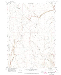
 1971 Beatys Butte1974 Print · USGSHarney and Lake County high desert terrain is meticulously documented during the early 1970s. Researchers can locate critical water sources and remote landmarks like Beatys Butte, Mustang Basin, and Willow Spring.2 unique versions available
 - 1971 Map of Mahogany Butte, 1974 Print
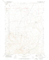
 1971 Mahogany Butte1974 Print · USGSIn the early 1970s, this high-desert border between Lake and Harney counties was a land of critical waterholes and remote outposts. Trace the locations of Rock Springs Camp, Shirks Lookout, and named springs like Reed Spring.
 - 1971 Map of Murphy Waterholes, 1974 Print
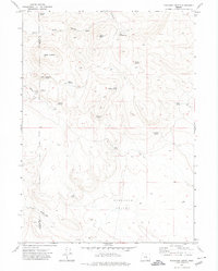
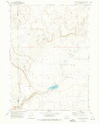
 1971 Murphy Waterholes1974 Print · USGSLake County, Oregon, is seen here in the early 1970s as a high-desert landscape focused on wildlife conservation and livestock management. You can trace the primitive routes of the Jeep Trail to remote landmarks like Murphy Corral and Pistol Lake.
 - 1971 Map of Sixmile Draw, 1974 Print
 1971 Sixmile Draw1974 Print · USGSThe high desert of Lake County is documented here in the early 1970s, showcasing the remote wildlife conservation lands and early ranching sites. Genealogists and historians can trace family-named sites like Poindexter Place and remote lifelines like Murphy Waterholes.
 - 1971 Map of Guano Reservoir, 1974 Print
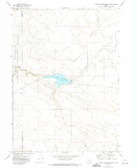
 1971 Guano Reservoir1974 Print · USGSHarney and Lake Counties are captured here in the early seventies, showing a quiet expanse of high desert hydrology. Trace the basin of Catlow Valley to find Guano Reservoir and its associated Guano Slough.
 - 1971 Map of Beatys Butte NW, 1974 Print
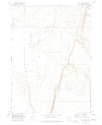
 1971 Beatys Butte NW1974 Print · USGSThe high desert of Lake County in the early seventies shows a landscape defined by deep canyons and wildlife management. Researchers can trace the drainage of Guano Slough and locate seasonal water sources like Spring near Beatys Butte.
 - 1971 Map of Murphy Waterholes NE, 1974 Print
 1971 Murphy Waterholes NE1974 Print · USGSHarney County in the early 1970s reveals a high-desert landscape managed for wildlife and water. Researchers can locate Ruins near the Rock Creek Reservoir and trace the eastern boundary of the Hart Mountain National Antelope Refuge.
 - 1971 Map of Rocky Canyon, 1975 Print
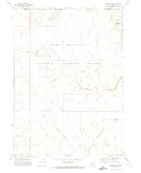
 1971 Rocky Canyon1975 Print · USGSLake County ranching and the high desert landscape are captured here in the early 1970s. Researchers can trace the steep Guano Rim to the Spalding Ranch or explore the boundaries of the Hart Mountain National Antelope Refuge.
 - 1971 Map of Sage Hen Flats, 1975 Print
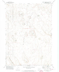
 1971 Sage Hen Flats1975 Print · USGSHigh desert Oregon in the early seventies reveals a landscape where water and ancient history intersect. Researchers can locate Petroglyphs near The Potholes or trace the drainage of Sage Hen Creek past the Dixon Waterhole.
 - 1971 Map of Chimney Rock, 1975 Print
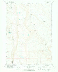 1971 Chimney Rock1975 Print · USGSThe high desert of Lake and Harney Counties in the early 1970s was a landscape of remote ranches and vital waterholes. Researchers can trace land use through features like Chimney Rock, Spalding Reservoir, and the isolated Spalding area.
 - 1971 Map of Antelope Butte, 1975 Print
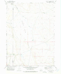
 1971 Antelope Butte1975 Print · USGSLake County high desert in the early 1970s reveals a landscape of massive escarpments and vital springs. Researchers can trace the rugged Guano Rim, locate the Langslet Monument Rest Area, and identify water sources like Snake Eyes Spring.
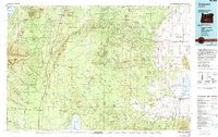
 - 1974 Map of Lake Abert, 1994 Print
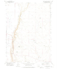
 1974 Lake Abert1994 Print · USGSThe high desert of Lake County is captured here in the mid-1970s, showing a landscape defined by massive fault blocks and terminal lakes. Genealogists and historians can locate legacy ranching sites like O'Keefe Ranch and follow the Chewaucan River past Paisley.
 - 1975 Map of Lakeview, 1994 Print
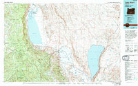
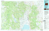 1975 Lakeview1994 Print · USGSLakeview and the surrounding high desert terrain are captured in the mid-seventies just as the region’s timber and mining industries remained active. Researchers can trace the layout of Booth-Kelly State Park or locate the White King Mine and the Thomas Creek Work Center.
 - 1979 Map of Crescent, 1994 Print
 1979 Crescent1994 Print · USGSHigh-altitude timber country and volcanic craters define this region of the Oregon interior during the late seventies. Researchers can trace the rail lines of the Southern Pacific and Burlington Northern past Chemult, Crescent, and the unique geological formation at Hole in the Ground.
End of results
Showing maps 1-15 of 15
Top cities of Lake County
Frequently asked questions
- What are the different types of historical maps available for Lake County?
- What is the oldest map of Lake County?
- Where can I purchase historical maps of Lake County for my home or office?
- Where can I download high-res historical maps of Lake County?
- Are there historical topographic maps available for Lake County?
- Is there historical aerial imagery available for Lake County?
- Where are historical maps of Lake County sourced from?