Old Maps of Linn County, Oregon
Explore 170 old maps of Linn County, spanning from 1909 to today. These high-resolution historic maps reveal how streets, neighborhoods, landmarks, and natural features evolved over time — perfect for genealogy, metal detecting, research, and local history exploration.
What you can do with these maps:
- See how Linn County changed over time: Compare historical maps to modern-day views to trace roads, homesites, rail lines & more.
- View detailed metadata: Each map includes creators, publishers, year, scale, and archive source.
- Overlay maps with satellite & LiDAR: Visualize the past alongside modern tools to explore terrain & human change.
- Trusted historical sources: Maps sourced from the USGS, Library of Congress, and other archives.
- Access maps your way: View online, download high-res files, or order prints for personal or research use.
Start exploring old maps of Linn County to uncover forgotten places, hidden landmarks, and the deep history beneath your feet.
Linn County, OR maps
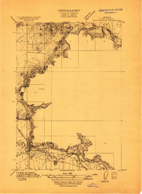
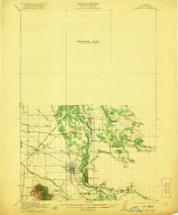
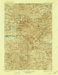
(170)- 1909 Map of Harrisburg
 1909 Harrisburg1909 Print · USGSCovers Linn County, including Harrisburg, Lancaster, and other nearby areas
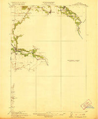
 - 1909 Map of Rowland
 1909 Rowland1909 Print · USGSCovers Linn County, including United States, Oregon, and other nearby areas
 - 1910 Map of Eugene
 1910 Eugene1910 Print · USGSCovers Linn County, including Eugene, Springfield, and other nearby areas2 unique versions available
 - 1911 Map of Brownsville
 1911 Brownsville1911 Print · USGSCovers Linn County, including Brownsville, Sodaville, and other nearby areas
 - 1911 Map of Lebanon
 1911 Lebanon1911 Print · USGSCovers Linn County, including Lebanon, South Lebanon, and other nearby areas
 - 1911 Map of Tangent
 1911 Tangent1911 Print · USGSCovers Linn County, including Albany, Tangent, and other nearby areas
 - 1912 Map of Jefferson
 1912 Jefferson1912 Print · USGSCovers Linn County, including Albany, Jefferson, and other nearby areas
 - 1912 Map of Halsey
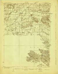
 1912 Halsey1912 Print · USGSCovers Linn County, including Harrisburg, Halsey, and other nearby areas3 unique versions available
 - 1913 Map of Philomath
 1913 Philomath1913 Print · USGSCovers Linn County, including Corvallis, Philomath, and other nearby areas
 - 1913 Map of Oakville
 1913 Oakville1913 Print · USGSCovers Linn County, including Corvallis, Albany, and other nearby areas
 - 1913 Map of Wells
 1913 Wells1913 Print · USGSCovers Linn County, including Albany, Adair Village, and other nearby areas
 - 1914 Map of Independence
 1914 Independence1914 Print · USGSCovers Linn County, including Monmouth, Independence, and other nearby areas
 - 1915 Map of Sidney
 1915 Sidney1915 Print · USGSCovers Linn County, including Salem, Sunnyside, and other nearby areas
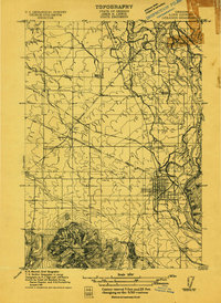
 - 1916 Map of Albany
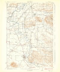
 1916 Albany1916 Print · USGSCovers Linn County, including Corvallis, Albany, and other nearby areas4 unique versions available
 - 1917 Map of Salem
 1917 Salem1917 Print · USGSCovers Linn County, including Salem, Keizer, and other nearby areas3 unique versions available
 - 1921 Map of Brownsville
 1921 Brownsville1921 Print · USGSCovers Linn County, including Sweet Home, Brownsville, and other nearby areas4 unique versions available
 - 1921 Map of Lebanon
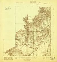
 1921 Lebanon1921 Print · USGSCovers Linn County, including Lebanon, Jefferson, and other nearby areas
 - 1921 Map of Corvallis
 1921 Corvallis1921 Print · USGSCovers Linn County, including Corvallis, Philomath, and other nearby areas5 unique versions available
 - 1922 Map of Lebanon
 1922 Lebanon1922 Print · USGSCovers Linn County, including Lebanon, Jefferson, and other nearby areas
 - 1924 Map of Lebanon
 1924 Lebanon1924 Print · USGSCovers Linn County, including Lebanon, Jefferson, and other nearby areas3 unique versions available
 - 1925 Map of Stayton
 1925 Stayton1925 Print · USGSCovers Linn County, including Salem, Silverton, and other nearby areas3 unique versions available
 - 1927 Map of Mt. Jefferson, 1956 Print
 1927 Mt. Jefferson1956 Print · USGSCovers Linn County, including Clackamas County, Marion County, and other nearby areas2 unique versions available
 - 1929 Map of Mill City
 1929 Mill City1929 Print · USGSCovers Linn County, including Mill City, Detroit, and other nearby areas4 unique versions available
 - 1929 Map of Three Sisters, 1956 Print
 1929 Three Sisters1956 Print · USGSCovers Linn County, including Sisters, Camp Sherman, and other nearby areas2 unique versions available
 - 1930 Map of Mt. Jefferson
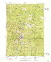
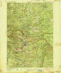 1930 Mt. Jefferson1930 Print · USGSCovers Linn County, including Clackamas County, Marion County, and other nearby areas3 unique versions available
Showing maps 1-25 of 170
Top cities of Linn County
- Lebanon historical maps
- Sweet Home historical maps
- Harrisburg historical maps
- Brownsville historical maps
- Lyons historical maps
- Tangent historical maps
See more
Frequently asked questions
- What are the different types of historical maps available for Linn County?
- What is the oldest map of Linn County?
- Where can I purchase historical maps of Linn County for my home or office?
- Where can I download high-res historical maps of Linn County?
- Are there historical topographic maps available for Linn County?
- Is there historical aerial imagery available for Linn County?
- Where are historical maps of Linn County sourced from?