Old Maps of Polk County, Oregon for Genealogy
Trace your family roots with 182 historic maps of Polk County. These high-res maps reveal old neighborhoods, homesites, landmarks, and streets — helping you uncover where your ancestors lived and how the area evolved over time.
- Explore historic neighborhoods: Identify where your relatives may have lived in the 1800s or 1900s.
- Compare maps over time: Trace the changes in streets, buildings, and landmarks for multi-generational research.
- Perfect for genealogy & ancestry research: Used by family historians and researchers to map out lineage and migration.
These maps are an incredible resource for exploring your personal connection to Polk County's past.
Polk County, OR maps
(182)- 1913 Map of Wells
 1913 Wells1913 Print · USGSBenton and Polk counties are mapped here before the First World War, showing a Willamette Valley landscape defined by rail-stop settlements and riverside sloughs. Researchers can trace the development of Suver and Granger, or locate the historic State Game Farm and Suver Cem.
 - 1914 Map of Independence
 1914 Independence1914 Print · USGSIn the early twentieth century, the Willamette Valley was a bustling network of river landings and short-line railroads. Trace the routes of the Valley and Siletz RR or locate family sites like Highland School and Buena Vista along the river.
 - 1914 Map of Soap Creek
 1914 Soap Creek1914 Print · USGSBenton and Polk counties were primarily rural landscapes of schoolhouses and creek valleys before the First World War. Genealogists can trace the early road network and family-centered landmarks like Savage School, Oak Hill, and Sulphur Springs.
 - 1915 Map of Rickreall
 1915 Rickreall1915 Print · USGSPolk County at the start of the Great War reveals a landscape defined by diverging rail lines and early orchards. Genealogists and historians can trace the foundations of Rickreall, locate the old Greenwood School, and follow the Southern Pacific tracks through Gerlinger.
 - 1915 Map of Eola
 1915 Eola1915 Print · USGSThe Willamette Valley at the start of the twentieth century reveals a landscape defined by the growth of Salem and its major state institutions. Researchers can trace early railroad lines like the Oregon Electric Railway and find vanished rural schools including Peanut School and Mountainview School.
 - 1915 Map of Sidney
 1915 Sidney1915 Print · USGSMarion County's riverfront and rail corridors are captured here just before the First World War, showing a landscape of mills and tight-knit rural schools. Researchers can locate stops on the Oregon Electric line and local landmarks like Sidney Mills and Looney Butte.
 - 1916 Map of Albany
 1916 Albany1916 Print · USGSThe Willamette Valley thrives at a peak of rail and river activity in the early twentieth century. Genealogists and local historians can trace rural school districts like Dixie School, early river crossings such as Fisher Ferry, and the original paths of the Southern Pacific railroad.4 unique versions available
 - 1917 Map of Salem
 1917 Salem1917 Print · USGSThe Willamette Valley at the peak of its rail-and-river era shows a landscape of growing towns and specialized state institutions. Researchers can trace early family-named junctions and rural educational sites like Grabenhorst Corners, Keizer School, and Wigrich Landing.3 unique versions available
 - 1921 Map of Corvallis
 1921 Corvallis1921 Print · USGSCorvallis and the surrounding Willamette Valley are captured in the early twentieth century as the region's agricultural and educational roots were deepening. Researchers can trace rural schoolhouse locations like Witham School and family-named landmarks such as Smith Hill or the Mt Union Cemetery.5 unique versions available
 - 1922 Map of Airlie
 1922 Airlie1922 Print · USGSPolk County at the conclusion of the First World War shows a landscape defined by the river valleys and emerging rail lines. Genealogists can trace family locations near Lewisville or identify local heritage at Antioch School and Simpson Siding.3 unique versions available
 - 1924 Map of Mc Minnville
 1924 Mc Minnville1924 Print · USGSYamhill County in the mid-twenties shows a thriving landscape of rural schools and river-tied commerce. Researchers can locate family landmarks like Grub College, the Yamhill Locks, and old railroad stops at St Joseph or Whiteson.
 - 1926 Map of Mc Minnville
 1926 Mc Minnville1926 Print · USGSThe mid-Willamette Valley thrived as a rail and river hub in the mid-twenties, centered on the growing town of Mc Minnville. Researchers can trace the era's rural life through dozens of local landmarks, from the Wheatland Ferry to small schoolhouses like Grub College and Zena School.4 unique versions available
 - 1939 Map of Marys Peak, 1956 Print
 1939 Marys Peak1956 Print · USGSCoastal mountains and logging rail lines define this landscape in the late 1930s as it transitions from the Willamette Valley into the timberlands. Trace the Southern Pacific route through Nashville and locate local landmarks like Knights Of Pythias Camp and Wildwood Sch.
 - 1940 Map of McMinnville
 1940 McMinnville1940 Print · USGSWillamette Valley life centered on river and rail transit in the 1940s, from the streets of McMinnville to the fertile bottomlands. Local historians can trace early school sites like Grub College and river crossings such as the Wheatland Ferry.3 unique versions available
 - 1940 Map of Salem
 1940 Salem1940 Print · USGSThe Willamette Valley thrives in the early days of the war, as Salem expands around its rail hubs and state institutions. Researchers can trace the legacy of the Southern Pacific line and find vanished local landmarks like the Poor Farm School for the Deaf or Oak Grove Church.
 - 1942 Map of Sheridan
 1942 Sheridan1942 Print · USGSThe South Yamhill River valley flourished in the early 1940s as a hub for timber and rail transport. Researchers can locate numerous vanished rural landmarks, including the Thompson Bros Lumber Mill, Wabash Sta, and many neighborhood schoolhouses like Red Prairie Sch.
 - 1942 Map of Marys Peak
 1942 Marys Peak1942 Print · USGSCoastal Oregon timber country and the surrounding National Forest are mapped here just after the start of the war. Researchers can trace the Southern Pacific rail line through remote stops like Nashville, find old schoolhouses such as Noise Sch, or locate the Oregon State Fish Hatchery.
 - 1942 Map of Spirit Mtn
 1942 Spirit Mtn1942 Print · USGSThe northern Oregon Coast Range and Grand Ronde Valley come into focus during the early years of the war. Researchers can trace the timber economy and tribal history through landmarks like the Grand Ronde Agency, Midway Lumber Co, and Cloverleaf Sch.
 - 1942 Map of Corvallis
 1942 Corvallis1942 Print · USGSCorvallis and the Willamette Valley are captured in detail during the early war years, showing a landscape of college grounds and timbered hills. Researchers can locate family landmarks like Hoskins (Fort School), trace the Southern Pacific rail line, or find rural cemeteries such as IOOF Cem.3 unique versions available
 - 1942 Map of Valsetz
 1942 Valsetz1942 Print · USGSThe Oregon Coast Range was a hive of timber activity during the early 1940s, centered on the company town of Valsetz. Trace the operations of the Cobbs-Mitchell Lumber Co and locate high-altitude lookouts like Fanno Pk Lookout and Riley Pk Lookout.
 - 1942 Map of Dallas
 1942 Dallas1942 Print · USGSPolk County at the start of the 1940s reveals a landscape of timber-dependent towns and rural school districts. Genealogists can trace family roots through numerous local landmarks like Pioneer Sch, Falls City, and the Southern Pacific rail lines.
 - 1944 Map of Albany
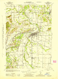 1944 Albany1944 Print · USGSThe Willamette Valley during the Second World War era shows a landscape of river-fed agriculture and growing rail hubs. Genealogists can locate family landmarks like Oakville Ch, Dover Cem, and dozens of district schools such as Fir Grove Sch.
 - 1948 Map of Vancouver, 1957 Print
 1948 Vancouver1957 Print · USGSPost-war growth transforms the river valleys of the Pacific Northwest as the timber and rail economy thrives. Trace family roots in Tillamook or Oregon City, and locate vanished landmarks like the spit at Bayocean or the Skamania Mine.
 - 1950 Map of Vancouver
 1950 Vancouver1950 Print · USGSCoastal Oregon and the lower Columbia River valley are captured in detail just after the war. Researchers can trace historic rail routes like the Southern Pacific or locate early settlements such as Vernonia, Gaston, and the Grand Ronde Indian Reservation.
 - 1950 Map of Vancouver, 1951 Print
 1950 Vancouver1951 Print · USGSThe Pacific Northwest urban corridor meets the rugged coast in the years following the war, showing the expansion of Portland and Vancouver. Genealogists and historians can trace the reach of the Southern Pacific RR and locate coastal communities like Tillamook, Seaside, and Tolovana Park.
Showing maps 1-25 of 182
Top cities of Polk County
- Dallas historical maps
- Monmouth historical maps
- Independence historical maps
- Falls City historical maps
- Rickreall historical maps
Frequently asked questions
- What are the different types of historical maps available for Polk County?
- What is the oldest map of Polk County?
- Where can I purchase historical maps of Polk County for my home or office?
- Where can I download high-res historical maps of Polk County?
- Are there historical topographic maps available for Polk County?
- Is there historical aerial imagery available for Polk County?
- Where are historical maps of Polk County sourced from?