1970s Maps of Tillamook County, Oregon
Explore 14 historic maps of Tillamook County from the 1970s. These maps offer a rare glimpse into what life looked like during the 1970s — showing old roads, neighborhoods, homes, and landmarks that have changed or disappeared over time.
Whether you're researching your family's past, planning a metal detecting trip, or studying how Tillamook County's landscape evolved across the 1970s, these high-resolution maps are a powerful tool for exploring the history of this region.
- Focus on a specific era: All maps on this page are from the 1970s, giving you a focused view of this time period.
- See what’s changed: Compare century-old streets, trails, and buildings to today's modern landscape using overlays and satellite layers.
- Research with precision: Use these maps for genealogy, historical research, land use analysis, or educational projects.
- View, download, or print: Maps are fully viewable online in high resolution, and can be downloaded or printed for your own records.
Start exploring Tillamook County's history through authentic maps from the 1970s. This is your window into the past.
Tillamook County, OR maps
(14)- 1975 Map of Tillamook NE, 1980 Print
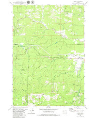
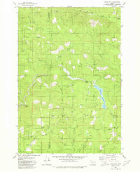
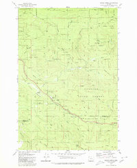
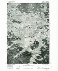 1975 Tillamook NE1980 Print · USGSCoastal Oregon dairy lands and river valleys are captured in this mid-seventies aerial survey. Researchers can trace the development of Tillamook and the rural reaches of Fairview and Juno along the Wilson River.
 - 1979 Map of Roaring Creek
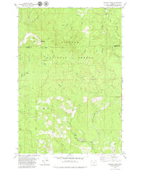
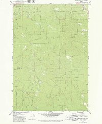 1979 Roaring Creek1979 Print · USGSThe Oregon Coast Range at the edge of the Washington County line is shown here in the late seventies as a managed timber landscape. Researchers can trace historic logging access via the Old Wilson River Road and locate sites like Camp Brown Forest Park and Saddle Mtn.2 unique versions available
 - 1979 Map of Stony Mountain
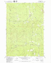
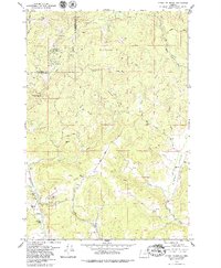 1979 Stony Mountain1979 Print · USGSYamhill County timberlands and river valleys are captured here in the late seventies. Genealogists and local historians can trace the Highland Cemetery and Deer Creek Park or follow the waters of Willamina Creek and Gopher Valley Creek.2 unique versions available
 - 1979 Map of Woods Point
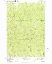
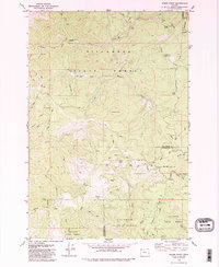 1979 Woods Point1979 Print · USGSThe northern Coast Range of Oregon in the late 1970s reveals a dense landscape of timber management and remote outposts. Researchers can trace forest access via Jordan Cutoff Rd, locate the isolated Timbuktu, or find the waters of University Falls.
 - 1979 Map of Midway
 1979 Midway1979 Print · USGSCoastal mountains and timberlands meet in the late seventies where Yamhill, Tillamook, Lincoln, and Polk counties converge. Researchers can locate the Church in the Wildwood, trace the Nestucca River, and find small settlements like Midway and Boyer.
 - 1979 Map of Niagara Creek
 1979 Niagara Creek1979 Print · USGSYamhill and Tillamook counties meet in this high-altitude forest landscape during the late seventies. Researchers can trace the timber and military history of the Coast Range through features like the U S Military Reservation and Asinine Bridge.
 - 1979 Map of Timber
 1979 Timber1979 Print · USGSNorthwestern Oregon's timber country is documented here during the late seventies, showing the rail and river corridors that shaped the region. Researchers can trace the Southern Pacific line through Walcott Tunnel or locate the Weieburg (Site) and Gales Creek Childrens Camp.2 unique versions available
 - 1979 Map of Cochran, 1980 Print
 1979 Cochran1980 Print · USGSThe Oregon Coast Range in the late seventies reveals a landscape of intensive timber management and railroad history. Researchers can trace the Southern Pacific line through Cochran and locate old logging routes like Standard Grade and Pennoyer Road.2 unique versions available
 - 1979 Map of Trask Mtn, 1980 Print
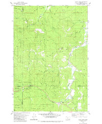
 1979 Trask Mtn1980 Print · USGSThe rugged timberlands of the Coast Range are documented here in the late seventies as industrial forestry and water management shaped the landscape. Researchers can trace forest access via Headquarters Grade, locate remote spots like Ball Bearing Hill, and explore the area around McGuire Reservoir.2 unique versions available
 - 1979 Map of Gobblers Knob, 1980 Print
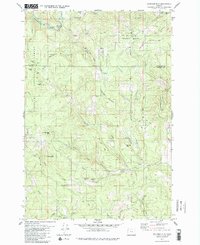
 1979 Gobblers Knob1980 Print · USGSThe northern Coast Range peaks and headwaters appear in detail during the late seventies at the junction of three Oregon counties. Trace the timber and water infrastructure of the era through Barney Reservoir, the Toll Road, and Headquarters Grade.
 - 1979 Map of Clear Creek, 1980 Print
 1979 Clear Creek1980 Print · USGSThe northern Coast Range comes alive in the late 1970s where four counties converge amidst the Clatsop State Forest. Researchers can trace old logging grades and family-named routes while locating historic sites like Keasey and the riverfront Cem.
 - 1979 Map of Springer Mtn, 1980 Print
 1979 Springer Mtn1980 Print · USGSThe high timber country of the Oregon Coast Range is captured here in the late 1970s, spanning the border of Yamhill and Tillamook counties. Researchers can trace the logging infrastructure and backcountry outposts of the era, from Camp Cooper to the Nestucca River and the remote Rocky Bend Campground.2 unique versions available
 - 1979 Map of Sunset Spring, 1980 Print
 1979 Sunset Spring1980 Print · USGSCoastal Oregon highlands in the late seventies showcase a landscape of managed timberlands and industrial outposts. Local historians can trace the footprints of Camp McGregor (Site), locate the Sterling FS Station, or follow the winding North Fork Salmonberry River.2 unique versions available
 - 1979 Map of Nehalem River, 1980 Print
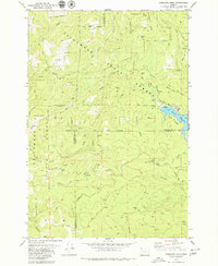
 1979 Nehalem River1980 Print · USGSThe northern Oregon coast and its timber-rich interior are captured here in the late seventies, showing the vital connection between sea and forest. Researchers can trace the rail lines of the Southern Pacific and Burlington Northern through historic logging hubs like Vernonia, Timber, and Nehalem.3 unique versions available
End of results
Showing maps 1-14 of 14
Top cities of Tillamook County
- Tillamook historical maps
- Rockaway Beach historical maps
- Bay City historical maps
- Garibaldi historical maps
- Manzanita historical maps
- Wheeler historical maps
See more
Frequently asked questions
- What are the different types of historical maps available for Tillamook County?
- What is the oldest map of Tillamook County?
- Where can I purchase historical maps of Tillamook County for my home or office?
- Where can I download high-res historical maps of Tillamook County?
- Are there historical topographic maps available for Tillamook County?
- Is there historical aerial imagery available for Tillamook County?
- Where are historical maps of Tillamook County sourced from?