1980s Maps of Tillamook County, Oregon
Explore 25 historic maps of Tillamook County from the 1980s. These maps offer a rare glimpse into what life looked like during the 1980s — showing old roads, neighborhoods, homes, and landmarks that have changed or disappeared over time.
Whether you're researching your family's past, planning a metal detecting trip, or studying how Tillamook County's landscape evolved across the 1980s, these high-resolution maps are a powerful tool for exploring the history of this region.
- Focus on a specific era: All maps on this page are from the 1980s, giving you a focused view of this time period.
- See what’s changed: Compare century-old streets, trails, and buildings to today's modern landscape using overlays and satellite layers.
- Research with precision: Use these maps for genealogy, historical research, land use analysis, or educational projects.
- View, download, or print: Maps are fully viewable online in high resolution, and can be downloaded or printed for your own records.
Start exploring Tillamook County's history through authentic maps from the 1980s. This is your window into the past.
Tillamook County, OR maps
(25)- 1980 Map of Yamhill River
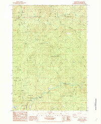
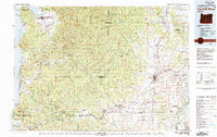 1980 Yamhill River1980 Print · USGSThe Oregon Coast Range and the western Willamette Valley meet in this 1980 survey, showing the landscape from the Pacific shore to the valley floor. Genealogists and historians can trace old routes like the Salmon River Highway to find the Grand Ronde Agency, Cloverdale, and Perrydale.3 unique versions available
 - 1984 Map of Cook Creek
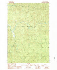
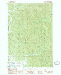
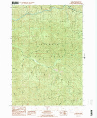 1984 Cook Creek1984 Print · USGSThe Northern Oregon Coast Range's dense river canyons and timberlands are captured here in the mid-1980s. Trace the mountain rail route of the Southern Pacific or locate remote landmarks like Buck Mountain and Hatchery Creek.2 unique versions available
 - 1984 Map of Jordan Creek
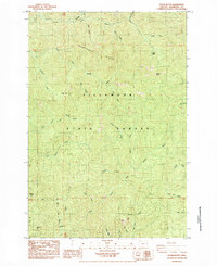
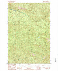
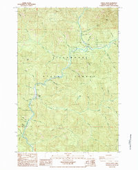 1984 Jordan Creek1984 Print · USGSThe Tillamook State Forest comes alive in this mid-1980s record of the Wilson River corridor. Researchers can trace the layout of Lees Camp, locate the Jordan Creek Trailer Park, and find recreational landmarks like Diamond Mill Park Campground and Kings Mtn.
 - 1984 Map of Blaine
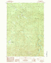
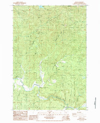 1984 Blaine1984 Print · USGSThe Oregon Coast Range in the early 1980s was a landscape of deep timber and winding waterways like the Nestucca River. Trace the rural layout of Blaine, locate Detrick Ranch, or study the high ridges of Hardscrabble Mtn and Grindstone Mtn.
 - 1984 Map of Dovre Peak
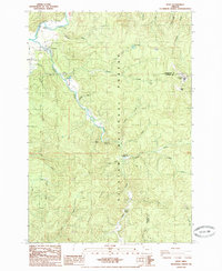
 1984 Dovre Peak1984 Print · USGSThe northern Oregon Coast Range is captured here in the mid-1980s, where federal and state forest lands meet. You can trace the drainage of the Nestucca River, locate early recreation spots like Alder Glen Campground, and find local landmarks such as Dovre Peak.2 unique versions available
 - 1984 Map of Trask
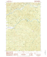
 1984 Trask1984 Print · USGSThe Oregon Coast Range in the early eighties was a landscape of timber management and river culture within the Tillamook State Forest. Researchers can trace the drainage of the Trask River or locate sites like Hollywood Camp and Trask Park.
 - 1984 Map of Cedar Butte
 1984 Cedar Butte1984 Print · USGSThe Oregon Coast Range in the mid-1980s reveals a steep landscape of timber and rushing water within the Tillamook State Forest. Trace the rugged drainages of the North Fork Kilchis River and Wilson River, finding remote landmarks like Kilchis Falls and Mutt Peak.
 - 1984 Map of Hamlet
 1984 Hamlet1984 Print · USGSCoastal Oregon timberlands and river valleys are captured here in the mid-eighties as the state forests matured. Local historians can trace the remote Hamlet settlement and river landmarks like Beaver Eddy or the strangely named Helloff terrain.2 unique versions available
 - 1984 Map of Elsie
 1984 Elsie1984 Print · USGSCoastal Oregon timber country is recorded here in the mid-1980s, centered on the river settlements of the northern Coast Range. Researchers can trace the winding Nehalem River past Elsie and Jewell Junction or locate the historic Camp Olsen (Site) near the Salmonberry River.
 - 1984 Map of Rogers Peak
 1984 Rogers Peak1984 Print · USGSThe northern Coast Range comes into focus during the 1980s, showing the intersection of heavy timber production and mountain railroading. Trace the Southern Pacific line through several tunnels to the Enright (Site) or locate the high ridges of Rogers Peak and Pingchle Peak.
 - 1984 Map of The Peninsula, 1985 Print
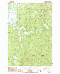
 1984 The Peninsula1985 Print · USGSThe Oregon Coast Range is captured in the mid-1980s, centered on the dramatic river bends and timberlands of the Tillamook State Forest. Researchers can trace the river-bound economy of the day through the Trask River State Fish Hatchery, Stones Camp, and The Dam Hole.
 - 1985 Map of Soapstone Lake
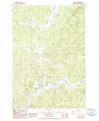
 1985 Soapstone Lake1985 Print · USGSCoastal Oregon timberlands and river valleys are captured here during the mid-eighties, showing the intersection of two state forests. Researchers can locate the small settlements of Aldervale and Acey or trace the course of the Nehalem River through Gods Valley.
 - 1985 Map of Nehalem
 1985 Nehalem1985 Print · USGSCoastal Tillamook County is captured here in the mid-1980s, showcasing the intricate tidal environment where the river meets the sea. Researchers can trace local development in Nehalem, Wheeler, and Manzanita, or locate family sites near the Cem and Bayside Gardens.2 unique versions available
 - 1985 Map of Garibaldi
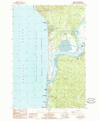
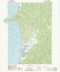
 1985 Garibaldi1985 Print · USGSThe Tillamook coast in the mid-1980s reveals the striking geography of the Bayocean Peninsula and its lost resort site. Researchers can trace the maritime infrastructure of Garibaldi and explore coastal settlements like Watseco, Twin Rocks, and Hobsonville.2 unique versions available
 - 1985 Map of Tillamook
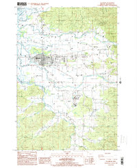 1985 Tillamook1985 Print · USGSThe Oregon coast at the mid-eighties reveals a landscape defined by the convergence of four major rivers at Tillamook. Genealogists and local historians can trace family-named sites and rural settlements like Fairview, Fawcett, and the Substation Cem.
 - 1985 Map of Sand Lake
 1985 Sand Lake1985 Print · USGSThe Tillamook coast in the mid-eighties shows a landscape of protected wilderness and quiet settlements. Trace the boundaries of Cape Lookout State Park and find local landmarks like Camp Meriwether and Tierra Del Mar.2 unique versions available
 - 1985 Map of Neskowin
 1985 Neskowin1985 Print · USGSThe Oregon coast at the mid-eighties reveals a landscape of protected forests and quiet seaside communities along the Salmon River. Genealogists and local historians can trace the early layout of Neskowin, Otis, and Rose Lodge amid the Siuslaw National Forest.2 unique versions available
 - 1985 Map of Dolph
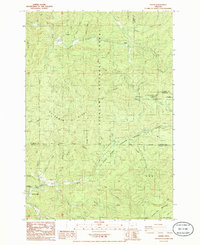 1985 Dolph1985 Print · USGSThe coastal mountains of Tillamook County are shown here in the mid-1980s, where the headwaters of the Nestucca and Salmon Rivers meet. Researchers can locate the small communities of Dolph and Rose Lodge, or trace landmarks like Sourdough Trail and Saddle Bag Mountain.
 - 1985 Map of Kilchis River
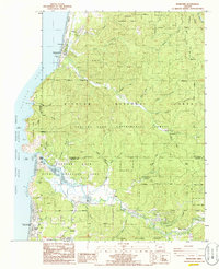
 1985 Kilchis River1985 Print · USGSCoastal Tillamook County in the mid-1980s shows a landscape of timber-covered hills and winding river valleys. Genealogists and historians can trace old homestead locations and recreation sites near Bay City, Idaville, and the Kilchis River County Park.
 - 1985 Map of Beaver
 1985 Beaver1985 Print · USGSCoastal Oregon timber country and river valleys are captured here in the mid-1980s. Local researchers can trace the roads and homesteads near Beaver, locate the Cem, or explore the drainages of the Nestucca River and Munson Creek Falls.
 - 1985 Map of Hebo
 1985 Hebo1985 Print · USGSThe mid-1980s coast range near Hebo reveals a landscape of working forests and river-fed industry. Genealogists and historians can trace local landmarks like the cemetery, the Hebo Work Camp, and early infrastructure such as Condor Bridge.
 - 1985 Map of Foley Peak
 1985 Foley Peak1985 Print · USGSThe Tillamook County timberlands and river corridors are shown here in the mid-eighties. You can trace the Nehalem River past small settlements like Batterson and Mohler, or locate landmarks such as Foley Peak and Nehalem Falls.
 - 1985 Map of Arch Cape
 1985 Arch Cape1985 Print · USGSThe northern Oregon coast in the mid-1980s reveals a landscape of protected state parks and rugged headlands between the Clatsop and Tillamook county lines. Researchers can trace the boundaries of Oswald D West State Park and locate coastal features like Smuggler Cove, Devils Cauldron, and Arch Cape.2 unique versions available
 - 1985 Map of Nestucca Bay, 1986 Print
 1985 Nestucca Bay1986 Print · USGSThe Tillamook coast in the mid-1980s reveals a landscape of tidal estuaries and timbered ridges where the river meets the sea. Researchers can trace family history through the Cem near Cloverdale or locate old coastal landmarks like Fisher Landing and Oretown.
 - 1986 Map of Netarts
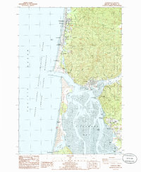
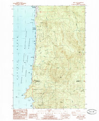
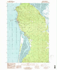 1986 Netarts1986 Print · USGSThe Oregon coast at the mid-eighties shows a landscape of established beach communities and protected wilderness areas. You can trace the shorelines of Netarts Bay and Tillamook Bay, or locate local landmarks like the Lighthouse and the Netarts Spit.
End of results
Showing maps 1-25 of 25
Top cities of Tillamook County
- Tillamook historical maps
- Rockaway Beach historical maps
- Bay City historical maps
- Garibaldi historical maps
- Manzanita historical maps
- Wheeler historical maps
See more
Frequently asked questions
- What are the different types of historical maps available for Tillamook County?
- What is the oldest map of Tillamook County?
- Where can I purchase historical maps of Tillamook County for my home or office?
- Where can I download high-res historical maps of Tillamook County?
- Are there historical topographic maps available for Tillamook County?
- Is there historical aerial imagery available for Tillamook County?
- Where are historical maps of Tillamook County sourced from?