1980s Maps of Union County, Oregon
Explore 6 historic maps of Union County from the 1980s. These maps offer a rare glimpse into what life looked like during the 1980s — showing old roads, neighborhoods, homes, and landmarks that have changed or disappeared over time.
Whether you're researching your family's past, planning a metal detecting trip, or studying how Union County's landscape evolved across the 1980s, these high-resolution maps are a powerful tool for exploring the history of this region.
- Focus on a specific era: All maps on this page are from the 1980s, giving you a focused view of this time period.
- See what’s changed: Compare century-old streets, trails, and buildings to today's modern landscape using overlays and satellite layers.
- Research with precision: Use these maps for genealogy, historical research, land use analysis, or educational projects.
- View, download, or print: Maps are fully viewable online in high resolution, and can be downloaded or printed for your own records.
Start exploring Union County's history through authentic maps from the 1980s. This is your window into the past.
Union County, OR maps
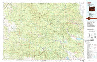
(6)- 1981 Map of Baker
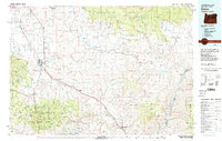 1981 Baker1981 Print · USGSEastern Oregon in the early eighties shows a landscape of deep canyons and high mountain mining districts. Genealogists and researchers can trace the Union Pacific corridor through Baker or locate remote operations like the Young American Mine and Rachel Mine.2 unique versions available
 - 1982 Map of Wallowa, 1983 Print
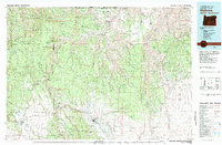 1982 Wallowa1983 Print · USGSNortheast Oregon's rugged canyon country is captured here in the early eighties, showing a landscape defined by the Grande Ronde River and its high plateaus. Researchers can trace the Union Pacific line through Rondowa or locate vanished sites like Maxville and Palmer Junction.2 unique versions available
 - 1983 Map of Pendleton, 1984 Print
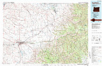 1983 Pendleton1984 Print · USGSPendleton and the Blue Mountain foothills are captured here in the early eighties as a hub of rail, ranching, and forest management. Genealogists and historians can trace local landmarks like Indian Agency Hdqrs, Bingham Springs, and the Union Pacific line.
 - 1986 Map of Enterprise, 1987 Print
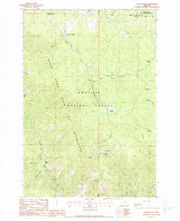
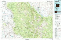 1986 Enterprise1987 Print · USGSThe high peaks and deep valleys of Northeast Oregon are captured in the mid-1980s, showcasing the transition from the Grande Ronde Valley to the wilderness. Researchers can trace the Union Pacific rail corridor through Telocaset or locate historic sites like Cornucopia and Medical Springs.
 - 1987 Map of Bates
 1987 Bates1987 Print · USGSEastern Oregon's rugged mining and timber heartland is detailed here in the late 1980s. Local historians and genealogists can trace the Sumpter Valley Railroad and find historic mining sites like the Standard Mine and settlements at Greenhorn or Galena.
 - 1988 Map of Silver Butte
 1988 Silver Butte1988 Print · USGSGrant County in the late 1980s was characterized by its deep canyons and national forest lands. Researchers can trace the management of the North Fork John Day River through the Forks Guard Station and explore names like Dixson Bar and Silver Butte.
End of results
Showing maps 1-6 of 6
Top cities of Union County
- La Grande historical maps
- Union historical maps
- Elgin historical maps
- Island City historical maps
- Cove historical maps
- North Powder historical maps
See more
Frequently asked questions
- What are the different types of historical maps available for Union County?
- What is the oldest map of Union County?
- Where can I purchase historical maps of Union County for my home or office?
- Where can I download high-res historical maps of Union County?
- Are there historical topographic maps available for Union County?
- Is there historical aerial imagery available for Union County?
- Where are historical maps of Union County sourced from?