Old Maps of Union County, Oregon for Academic Research
Study the evolution of Union County with 179 high-resolution historic maps. Whether you're teaching, researching, or modeling changes in land use, these maps provide essential visual documentation of urban, environmental, and geographic change.
- Analyze long-term change: Track patterns in development, transportation, and natural features.
- Ideal for environmental or urban studies: Support academic projects with primary historical map data.
- Use in the classroom or lab: Educators and researchers rely on these maps to bring historical context to life.
These maps are a powerful tool for teaching, research, and visualizing how Union County has changed over the decades.
Union County, OR maps
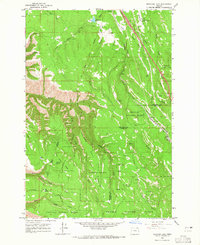
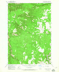
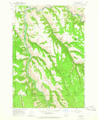
(179)- 1901 Map of Baker City
 1901 Baker City1901 Print · USGSBaker County at the close of the century was a landscape of bustling rail hubs and active mining districts. Genealogists and historians can trace early settlements like Auburn, follow the Sumpter Valley Railroad line, or locate specific operations like the Flagstaff Mine.4 unique versions available
 - 1901 Map of Sumpter
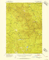
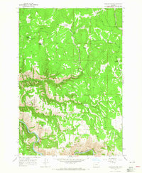
 1901 Sumpter1901 Print · USGSThe Oregon gold boom is at its peak in this turn-of-the-century survey of the high Elkhorn Range. Miners and genealogists can trace the early rail corridor of the Sumpter Valley River and locate historic camps like Bourne, Belleview, and French Diggings.4 unique versions available
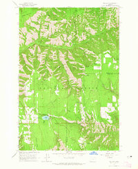
 - 1906 Map of Telocaset
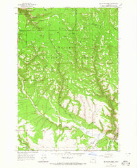
 1906 Telocaset1906 Print · USGSEastern Oregon at the peak of its railroad and ranching era features a landscape of thriving valley towns and high forest reserves. Genealogists and local historians can trace early settlements like Union and Cove, or locate long-standing landmarks such as Hot Lake and Medical Springs.3 unique versions available
 - 1951 Map of Desolation Butte, 1954 Print
 1951 Desolation Butte1954 Print · USGSGrant County in the early fifties was a rugged landscape of forest service stations and remote mining claims. Genealogists and historians can trace old resource camps like Headquarters Camp and Miners Cabin, or locate vanished operations such as Gutridge Mine.3 unique versions available
 - 1953 Map of Pendleton, 1957 Print
 1953 Pendleton1957 Print · USGSNortheastern Oregon and the Columbia River frontier are captured here in the early fifties, a time of massive federal infrastructure projects. Researchers can trace the historic route of The Old Oregon Trail as it passes near the Umatilla Ordnance Depot and the new McNary Dam.4 unique versions available
 - 1954 Map of Eagle Cap, 1958 Print
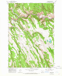
 1954 Eagle Cap1958 Print · USGSThe Wallowa Mountains are captured here in the mid-fifties, showing a landscape of alpine lakes and high-country outposts. You can trace early trails and mining sites like the Basin Mine, or locate backcountry landmarks such as Boulder Park Resort and the Two Color Guard Sta.4 unique versions available
 - 1955 Map of Baker, 1964 Print
 1955 Baker1964 Print · USGSThe Oregon-Idaho borderlands are captured here in the mid-fifties as the Snake River underwent massive changes from dam construction. Trace the Oregon Trail Memorial Monument near Baker, find early mines like Virtue Mine, and follow the Union Pacific Railroad through Huntington.4 unique versions available
 - 1955 Map of Grangeville, 1964 Print
 1955 Grangeville1964 Print · USGSThe high country of the Idaho-Oregon border comes alive in the mid-1950s, showing the deep river canyons and mountain peaks. Trace the Union Pacific RR through the valleys or locate settlements like Grangeville, Joseph, and the shoreline of Wallowa Lake.4 unique versions available
 - 1955 Map of Canyon City, 1966 Print
 1955 Canyon City1966 Print · USGSCentral Oregon's high desert and timber country are captured here in the mid-fifties, showing the rugged ranching and logging landscape. Trace the path of the Sumpter Valley Ry or locate remote settlements like Izee, Whitney, and Ritter.4 unique versions available
 - 1956 Map of Pendleton
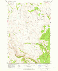
 1956 Pendleton1956 Print · USGSNortheastern Oregon’s high plateau and timbered peaks appear here in the mid-fifties, during a time of major military and hydroelectric development. Trace the path of The Old Oregon Trail alongside modern landmarks like McNary Dam and the Umatilla Ordnance Depot.
 - 1959 Map of Baker
 1959 Baker1959 Print · USGSThe Oregon and Idaho borderlands come alive in the late fifties, showing the rugged corridor along the Snake River and the high peaks of the Wallowa Mountains. Researchers can trace the legacy of the Union Pacific railroad or locate historic mining sites like the Flagstaff Mine and Virtue Mine.2 unique versions available
 - 1959 Map of Grangeville
 1959 Grangeville1959 Print · USGSThe high alpine peaks and deep river canyons of the Idaho-Oregon borderlands are captured in the late fifties. Researchers can trace the Union Pacific RR through the valleys to settlements like Enterprise, Union, and Grangeville.2 unique versions available
 - 1959 Map of Canyon City
 1959 Canyon City1959 Print · USGSEastern Oregon in the late fifties was a landscape of high timber and remote river valleys shaped by the cattle and mining trades. Genealogists and historians can trace the paths of the Sumpter Valley RR and find early settlements like Antone, Richmond, and Dayville.2 unique versions available
 - 1963 Map of La Grande SE, 1965 Print
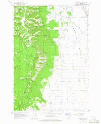
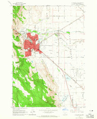 1963 La Grande SE1965 Print · USGSThe Grande Ronde Valley in the early 1960s was a hub of education and transport, centered on the growing city of LA GRANDE. Researchers can trace the mid-century footprint of Eastern Oregon College, locate family sites near Calvary Cem, and follow the UNION PACIFIC rail lines through Island City.2 unique versions available
 - 1963 Map of Andies Prairie, 1965 Print
 1963 Andies Prairie1965 Print · USGSThe high backcountry of the Blue Mountains comes into focus in the early sixties, showing the rugged divide between Umatilla and Union counties. Modern researchers can trace old forest routes like Skyline Road to sites like the Lookout Tower and Will Rogers Spring.3 unique versions available
 - 1963 Map of Sanderson Spring, 1965 Print
 1963 Sanderson Spring1965 Print · USGSThe high timber and mountain ridges of northeastern Oregon meet the valley floor in the 1960s. Genealogists and local researchers can trace the locations of seasonal mountain sites like Finley Creek Cow Camp and Craigs Cabin or follow the waters of Phillips Creek through the canyons.2 unique versions available
 - 1963 Map of Meacham Lake, 1965 Print
 1963 Meacham Lake1965 Print · USGSThe Blue Mountains of Oregon are captured here in the early sixties, showing the rail and timber landscape around the county line. Genealogy and history buffs can trace the Union Pacific Railroad route past Meacham, Kamela, and the Old Indian Treaty Boundary.2 unique versions available
 - 1963 Map of Tollgate, 1965 Print
 1963 Tollgate1965 Print · USGSThe high country of the Blue Mountains comes into focus in the early sixties, showing a landscape of forest camps and fire lookouts. Researchers can locate Langdon Lake and Tollgate, or trace the network of trails around Bear Creek Guard Station and McIntyre Lookout.3 unique versions available
 - 1963 Map of Hilgard, 1966 Print
 1963 Hilgard1966 Print · USGSThe Grande Ronde River valley in the early 1960s shows a landscape of mountain canyons and essential rail-and-river transport. Researchers can trace the Union Pacific line through Hilgard and Perry or locate the old Hilgard Cem.3 unique versions available
 - 1963 Map of Summerville, 1966 Print
 1963 Summerville1966 Print · USGSThe Grande Ronde Valley and the Blue Mountains meet in this Oregon study from the early sixties. Researchers can trace the area's rural development through the Pioneer Monument, the Grange Hall, and high-altitude landmarks like the Mt Emily Lookout Tower.2 unique versions available
 - 1964 Map of Partridge Creek, 1965 Print
 1964 Partridge Creek1965 Print · USGSUnion County's high forest country comes into sharp focus during the mid-sixties, showing a landscape defined by timber and rugged drainage basins. Researchers can locate the Palmer Junction Sch, trace the Grande Ronde River, and find remote landmarks like the Balloon Tree.2 unique versions available
 - 1964 Map of Howard Butte, 1965 Print
 1964 Howard Butte1965 Print · USGSWallowa and Union counties meet among the high meadows and forest ridges of the Oregon backcountry during the mid-1960s. Researchers can trace remote landmarks like the Lookout Tower on Howard Butte, find a lonely Grave, or locate Camp Five.3 unique versions available
 - 1964 Map of Mc Intyre Creek, 1965 Print
 1964 Mc Intyre Creek1965 Print · USGSThe Blue Mountains of northeastern Oregon are shown in the mid-1960s, a period defined by active timber management and remote forest outposts. Researchers can trace historical routes like the Old Railroad Grade and locate landmarks such as the Flat Lake Lookout Tower and Coyote Spring.2 unique versions available
 - 1964 Map of Cricket Flat, 1966 Print
 1964 Cricket Flat1966 Print · USGSCricket Flat and the surrounding Oregon highlands are captured here in the mid-sixties during a period of established mountain ranching and forestry. Local history buffs can trace family ties at Highland Cemetery and find old gathering places like the Grange Hall.2 unique versions available
 - 1964 Map of Minam, 1966 Print
 1964 Minam1966 Print · USGSThe rail-and-river settlement of Minam sits at a strategic canyon junction in the 1960s, where the Union Pacific tracks meet the water. Researchers can trace historic access routes across Elliott Flat or find named landmarks like Chestnut Spring and the Wallowa National Forest boundary.2 unique versions available
Showing maps 1-25 of 179
Top cities of Union County
- La Grande historical maps
- Union historical maps
- Elgin historical maps
- Island City historical maps
- Cove historical maps
- North Powder historical maps
See more
Frequently asked questions
- What are the different types of historical maps available for Union County?
- What is the oldest map of Union County?
- Where can I purchase historical maps of Union County for my home or office?
- Where can I download high-res historical maps of Union County?
- Are there historical topographic maps available for Union County?
- Is there historical aerial imagery available for Union County?
- Where are historical maps of Union County sourced from?