1960s Maps of Union County, Oregon
Explore 52 historic maps of Union County from the 1960s. These maps offer a rare glimpse into what life looked like during the 1960s — showing old roads, neighborhoods, homes, and landmarks that have changed or disappeared over time.
Whether you're researching your family's past, planning a metal detecting trip, or studying how Union County's landscape evolved across the 1960s, these high-resolution maps are a powerful tool for exploring the history of this region.
- Focus on a specific era: All maps on this page are from the 1960s, giving you a focused view of this time period.
- See what’s changed: Compare century-old streets, trails, and buildings to today's modern landscape using overlays and satellite layers.
- Research with precision: Use these maps for genealogy, historical research, land use analysis, or educational projects.
- View, download, or print: Maps are fully viewable online in high resolution, and can be downloaded or printed for your own records.
Start exploring Union County's history through authentic maps from the 1960s. This is your window into the past.
Union County, OR maps
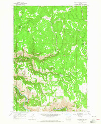
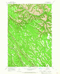
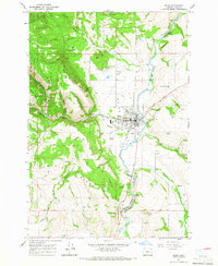
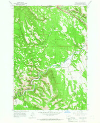
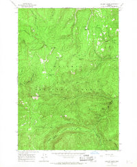
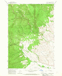
(52)- 1963 Map of La Grande SE, 1965 Print
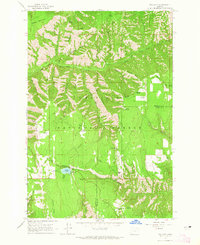
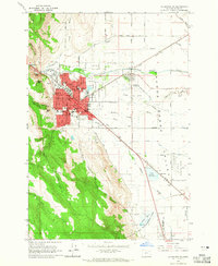 1963 La Grande SE1965 Print · USGSThe Grande Ronde Valley in the early 1960s was a hub of education and transport, centered on the growing city of LA GRANDE. Researchers can trace the mid-century footprint of Eastern Oregon College, locate family sites near Calvary Cem, and follow the UNION PACIFIC rail lines through Island City.2 unique versions available
 - 1963 Map of Andies Prairie, 1965 Print
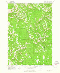
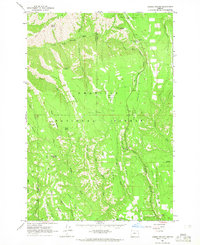 1963 Andies Prairie1965 Print · USGSThe high backcountry of the Blue Mountains comes into focus in the early sixties, showing the rugged divide between Umatilla and Union counties. Modern researchers can trace old forest routes like Skyline Road to sites like the Lookout Tower and Will Rogers Spring.3 unique versions available
 - 1963 Map of Sanderson Spring, 1965 Print
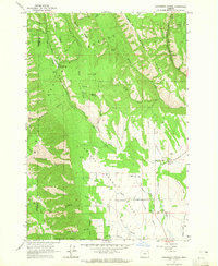 1963 Sanderson Spring1965 Print · USGSThe high timber and mountain ridges of northeastern Oregon meet the valley floor in the 1960s. Genealogists and local researchers can trace the locations of seasonal mountain sites like Finley Creek Cow Camp and Craigs Cabin or follow the waters of Phillips Creek through the canyons.2 unique versions available
 - 1963 Map of Meacham Lake, 1965 Print
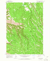 1963 Meacham Lake1965 Print · USGSThe Blue Mountains of Oregon are captured here in the early sixties, showing the rail and timber landscape around the county line. Genealogy and history buffs can trace the Union Pacific Railroad route past Meacham, Kamela, and the Old Indian Treaty Boundary.2 unique versions available
 - 1963 Map of Tollgate, 1965 Print
 1963 Tollgate1965 Print · USGSThe high country of the Blue Mountains comes into focus in the early sixties, showing a landscape of forest camps and fire lookouts. Researchers can locate Langdon Lake and Tollgate, or trace the network of trails around Bear Creek Guard Station and McIntyre Lookout.3 unique versions available
 - 1963 Map of Hilgard, 1966 Print
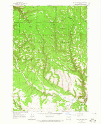
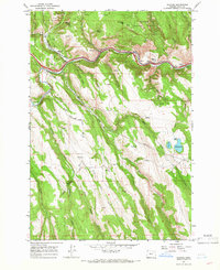 1963 Hilgard1966 Print · USGSThe Grande Ronde River valley in the early 1960s shows a landscape of mountain canyons and essential rail-and-river transport. Researchers can trace the Union Pacific line through Hilgard and Perry or locate the old Hilgard Cem.3 unique versions available
 - 1963 Map of Summerville, 1966 Print
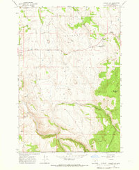
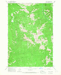
 1963 Summerville1966 Print · USGSThe Grande Ronde Valley and the Blue Mountains meet in this Oregon study from the early sixties. Researchers can trace the area's rural development through the Pioneer Monument, the Grange Hall, and high-altitude landmarks like the Mt Emily Lookout Tower.2 unique versions available
 - 1964 Map of Partridge Creek, 1965 Print
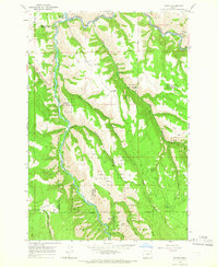
 1964 Partridge Creek1965 Print · USGSUnion County's high forest country comes into sharp focus during the mid-sixties, showing a landscape defined by timber and rugged drainage basins. Researchers can locate the Palmer Junction Sch, trace the Grande Ronde River, and find remote landmarks like the Balloon Tree.2 unique versions available
 - 1964 Map of Howard Butte, 1965 Print
 1964 Howard Butte1965 Print · USGSWallowa and Union counties meet among the high meadows and forest ridges of the Oregon backcountry during the mid-1960s. Researchers can trace remote landmarks like the Lookout Tower on Howard Butte, find a lonely Grave, or locate Camp Five.3 unique versions available
 - 1964 Map of Mc Intyre Creek, 1965 Print
 1964 Mc Intyre Creek1965 Print · USGSThe Blue Mountains of northeastern Oregon are shown in the mid-1960s, a period defined by active timber management and remote forest outposts. Researchers can trace historical routes like the Old Railroad Grade and locate landmarks such as the Flat Lake Lookout Tower and Coyote Spring.2 unique versions available
 - 1964 Map of Cricket Flat, 1966 Print
 1964 Cricket Flat1966 Print · USGSCricket Flat and the surrounding Oregon highlands are captured here in the mid-sixties during a period of established mountain ranching and forestry. Local history buffs can trace family ties at Highland Cemetery and find old gathering places like the Grange Hall.2 unique versions available
 - 1964 Map of Minam, 1966 Print
 1964 Minam1966 Print · USGSThe rail-and-river settlement of Minam sits at a strategic canyon junction in the 1960s, where the Union Pacific tracks meet the water. Researchers can trace historic access routes across Elliott Flat or find named landmarks like Chestnut Spring and the Wallowa National Forest boundary.2 unique versions available
 - 1964 Map of Huron, 1966 Print
 1964 Huron1966 Print · USGSThe Blue Mountains of Northeast Oregon are captured in the mid-1960s, showing a landscape defined by industrial forestry and the Union Pacific Railroad. Genealogists and historians can trace the remote Rugg Cabin, the rail siding at Motanic, and countless named water sources like Four Horse Smith Spring.2 unique versions available
 - 1964 Map of Elgin, 1966 Print
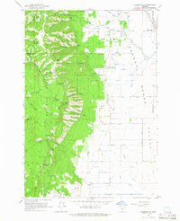
 1964 Elgin1966 Print · USGSElgin and the surrounding Indian Valley are captured in the mid-sixties as a vital hub for the Union Pacific and the regional timber economy. Researchers can locate family landmarks like Galloway Cemetery and Bennetts Point, or trace historic routes such as the Fish Trap Grade.2 unique versions available
 - 1964 Map of Drumhill Ridge, 1966 Print
 1964 Drumhill Ridge1966 Print · USGSThe high Blue Mountains of Eastern Oregon come to life in this mid-sixties survey of the Umatilla National Forest. Researchers can trace old forestry outposts like Summit Guard Station, family-named sites such as Kellers Cabin, and historic camps including Camp Three.2 unique versions available
 - 1964 Map of Rondowa, 1966 Print
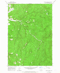
 1964 Rondowa1966 Print · USGSNear the Union and Wallowa county line in the mid-sixties, the Union Pacific railroad followed the serpentine Grande Ronde River. Trace the old rail stop at Rondowa, the mountain settlement of Palmer Junction, or family sites near Mt Pleasant Cem.3 unique versions available
 - 1964 Map of Kamela SE, 1966 Print
 1964 Kamela SE1966 Print · USGSThe Blue Mountains area near the Union-Umatilla county line comes into focus during the mid-1960s. Researchers can trace the path of the Union Pacific Railroad or locate family landmarks like Standley Cabin and Red Bridge State Park.3 unique versions available
 - 1965 Map of Limber Jim Creek, 1967 Print
 1965 Limber Jim Creek1967 Print · USGSUnion County during the mid-sixties reveals a remote landscape of mining claims and rugged forest trails within the Whitman National Forest. Researchers can trace old mountain routes like the Limber Jim Pack Trail and locate historic operations such as the Camp Carson Mine and Aurelia Mine.3 unique versions available
 - 1965 Map of Marley Creek, 1967 Print
 1965 Marley Creek1967 Print · USGSThe timberlands of Union County are captured in the mid-sixties, highlighting the intersection of forest management and early rail history. Researchers can trace the Old Railroad Grade near Starkey and locate landmarks like Camp Elkanah or the Johnson Rock Lookout Tower.2 unique versions available
 - 1965 Map of China Cap, 1967 Print
 1965 China Cap1967 Print · USGSThe high Divide between Union and Wallowa counties is documented here in the mid-1960s before modern road expansion. Researchers can trace remote backcountry outposts and early exploration sites like Catherine Creek Cabin, Mule Peak Lookout, and several unnamed prospects.2 unique versions available
 - 1965 Map of Anthony Butte, 1967 Print
 1965 Anthony Butte1967 Print · USGSThe high divide of the Whitman National Forest in the mid-1960s is preserved here at the intersection of Union and Baker Counties. Trace the remote mountain geography through the site of the Indiana Mine, the Porcupine Guard Station, and high-altitude landmarks like Anthony Butte.3 unique versions available
 - 1965 Map of Conley, 1967 Print
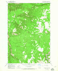
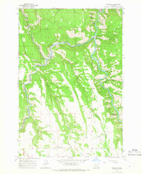
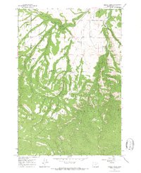
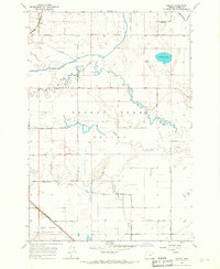 1965 Conley1967 Print · USGSThe Grande Ronde Valley in the mid-sixties reveals a landscape of intricate sloughs and managed waterways at the height of its rail-and-ranching era. Genealogists and local historians can trace family-named landmarks like Booth Lane while locating rural hubs such as Conley, Wright, and the Ladd Marsh Game Management Area.
 - 1965 Map of Flagstaff Butte, 1967 Print
 1965 Flagstaff Butte1967 Print · USGSThe high Oregon backcountry near the Union and Baker county line is captured here in the mid-1960s. Researchers can locate remote landmarks like Taylor Green, the Gaging Station, and the distinctively named Sufferin Smith Spring among the winding trails of the Eagle Cap Wilderness.2 unique versions available
 - 1965 Map of Glass Hill, 1967 Print
 1965 Glass Hill1967 Print · USGSThe Oregon backcountry south of La Grande is captured here in the mid-sixties, characterized by the working landscapes of the Whitman National Forest. Researchers can trace old mountain routes and land holdings such as Vincent Ranch, the Reinecke Cabin, and the lookout atop Glass Hill.2 unique versions available
 - 1965 Map of Tucker Flat, 1967 Print
 1965 Tucker Flat1967 Print · USGSThe Oregon backcountry between Union and Baker counties was a land of timber and water management in the mid-sixties. Researchers can trace the legacy of resource use through sites like China Diggings and the intricate network of the flume and ditch systems near Tucker Flat.2 unique versions available
Showing maps 1-25 of 52
Top cities of Union County
- La Grande historical maps
- Union historical maps
- Elgin historical maps
- Island City historical maps
- Cove historical maps
- North Powder historical maps
See more
Frequently asked questions
- What are the different types of historical maps available for Union County?
- What is the oldest map of Union County?
- Where can I purchase historical maps of Union County for my home or office?
- Where can I download high-res historical maps of Union County?
- Are there historical topographic maps available for Union County?
- Is there historical aerial imagery available for Union County?
- Where are historical maps of Union County sourced from?