1990s Maps of Union County, Oregon
Explore 42 historic maps of Union County from the 1990s. These maps offer a rare glimpse into what life looked like during the 1990s — showing old roads, neighborhoods, homes, and landmarks that have changed or disappeared over time.
Whether you're researching your family's past, planning a metal detecting trip, or studying how Union County's landscape evolved across the 1990s, these high-resolution maps are a powerful tool for exploring the history of this region.
- Focus on a specific era: All maps on this page are from the 1990s, giving you a focused view of this time period.
- See what’s changed: Compare century-old streets, trails, and buildings to today's modern landscape using overlays and satellite layers.
- Research with precision: Use these maps for genealogy, historical research, land use analysis, or educational projects.
- View, download, or print: Maps are fully viewable online in high resolution, and can be downloaded or printed for your own records.
Start exploring Union County's history through authentic maps from the 1990s. This is your window into the past.
Union County, OR maps
(42)- 1990 Map of Krag Peak
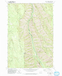
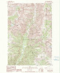 1990 Krag Peak1990 Print · USGSIn the high Wallowa Mountains during the late twentieth century, this survey tracks a wilderness landscape at the intersection of three counties. Hikers and historians can trace the Cliff Creek Trail and locate remote landmarks like the Bradley Creek Mine and Lookingglass Lake.2 unique versions available
 - 1990 Map of Eagle Cap
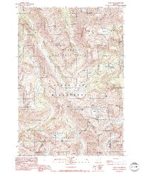 1990 Eagle Cap1990 Print · USGSHigh in the Wallowas during the late twentieth century, this survey documents a dense cluster of alpine lakes and granite peaks. Trace the trails between Eagle Cap and Mirror Lake, or locate the high-altitude headwaters of the Lostine River.3 unique versions available
 - 1990 Map of Bennet Peak
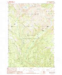 1990 Bennet Peak1990 Print · USGSNortheastern Oregon's high Wallowa wilderness is mapped here in the 1990s as a preserve of alpine lakes and national forest lands. Researchers can trace remote mountain activity at the Basin Mine, Boulder Park Resort, and the Two Color Guard Station.
 - 1990 Map of Steamboat Lake
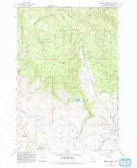
 1990 Steamboat Lake1990 Print · USGSThe Eagle Cap Wilderness is mapped here in the late twentieth century as a roadless expanse of high alpine basins and peaks. Hikers and researchers can trace the drainage of the Minam River and locate remote landmarks like Steamboat Lake, Glacier Mountain, and China Cap Ridge.
 - 1993 Map of Medical Springs
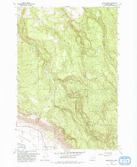
 1993 Medical Springs1993 Print · USGSThe foothills of the Whitman National Forest come alive in this 1990s record of Union County mountain life. Genealogists and researchers can trace the vicinity of Medical Springs and Bondosa, or locate family sites near the Cem and Wisdom.
 - 1993 Map of Telocaset
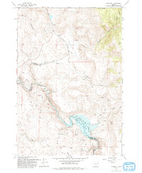 1993 Telocaset1993 Print · USGSThe high valley and river landscape near the Union and Baker County line are shown here as they appeared in the early nineties. Researchers can trace the water levels of the Thief Valley Reservoir or locate the old Quarry and Prospects near Telocaset.
 - 1993 Map of Cove
 1993 Cove1993 Print · USGSThe Grande Ronde Valley's agricultural and forest boundaries are clearly drawn in the early nineties near Cove. Researchers can trace local genealogy through landmarks like Cove Cemetery, the High Sch, and rural homesteads near Eckesley and Shanghai.
 - 1993 Map of Gasset Bluff
 1993 Gasset Bluff1993 Print · USGSThe eastern Union County high country meets the valley floor in the 1990s as it appeared before modern development. Trace the intersection of wilderness and settlement from the heights of Gasset Bluff down to the Cem and old routes like Kerns.
 - 1993 Map of Jim White Ridge
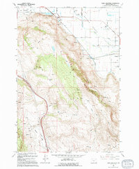
 1993 Jim White Ridge1993 Print · USGSThe high backcountry of Wallowa and Union Counties is captured here in the early nineties, centered on the Jim White Ridge divide. Researchers can trace the winding Minam River and locate remote landmarks such as the Big Burn and a primitive Landing Strip.
 - 1993 Map of Mount Moriah
 1993 Mount Moriah1993 Print · USGSIn the early nineties, this high-country survey of Union and Wallowa counties highlights a network of trails and ridges within the Wallowa-Whitman National Forest. Researchers can trace old routes to the Minam River Ridge Mine or find historical landmarks like Collusion Point and Chicken Spring.
 - 1993 Map of China Cap
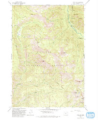 1993 China Cap1993 Print · USGSThe Oregon high country in the early nineties is captured here, where the Wallowa and Whitman national forests meet. Outdoor historians and researchers can trace pack trails to Lackeys Lake, locate old prospects, and find landmarks like China Cap and Burger Meadows.
 - 1993 Map of Little Catherine Creek
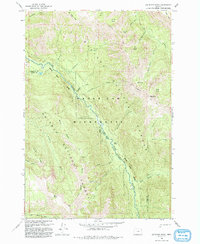
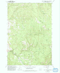 1993 Little Catherine Creek1993 Print · USGSThe high timber and alpine meadows of Union County are charted here in the early nineties, centered on the protected lands of the Whitman National Forest. Hikers and researchers can trace the route of the Merry-Go-Round Road or locate remote landmarks like Billy Small Meadow and Bearwallow Spring.
 - 1993 Map of Mt. Fanny
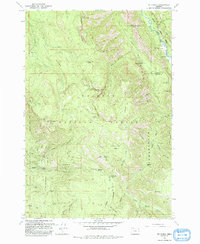 1993 Mt. Fanny1993 Print · USGSThe Wallowa and Union county line runs through this high wilderness in the early 1990s, where the Minam and Little Minam rivers converge. Researchers can trace remote mountain outposts and backcountry access points like Minam Lodge, Moss Springs FS Station, and the Indian Creek Camp.
 - 1993 Map of Flagstaff Butte
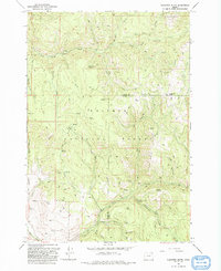 1993 Flagstaff Butte1993 Print · USGSNortheast Oregon's high timberlands and headwaters are captured here in the early nineties, straddling the Union and Baker county line. Researchers can trace early mining activity near Pawnee Gulch and locate remote water sources like Marlin Spring and Sufferin Smith Spring.
 - 1994 Map of Haines
 1994 Haines1994 Print · USGSThe Powder Valley’s ranching and irrigation systems are frozen in time on the Baker-Union county line in the mid-1990s. Genealogists and local historians can locate family landmarks like Sky Ranch and Christensen alongside the historic Rock Creek Cem.
 - 1994 Map of Union
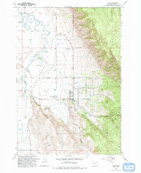
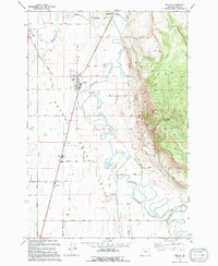
 1994 Union1994 Print · USGSThe community of Union is captured in the mid-1990s as the anchor of the southeastern Grande Ronde Valley. Researchers can trace local landmarks like the Eastern Oregon Livestock Exhibition Grounds, the High Sch, and the winding path of Catherine Creek.
 - 1994 Map of La Grande
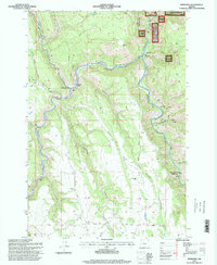
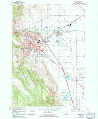 1994 La Grande1994 Print · USGSLa Grande and the Grande Ronde Valley are captured here in the mid-1990s as a thriving regional hub. Genealogists and historians can trace the Union Pacific rail lines, old burials at Ackles Cem, and the grounds of Eastern Oregon State College.
 - 1994 Map of Craig Mountain
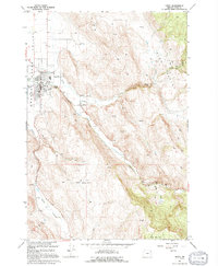
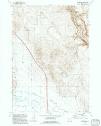
 1994 Craig Mountain1994 Print · USGSThe Grande Ronde Valley meets the steep slopes of Craig Mountain in the 1990s, where geothermal activity and historic rail grades define the terrain. Trace family land near Hot Lake, Union Junction, and the waters of Catherine Creek.
 - 1994 Map of Conley
 1994 Conley1994 Print · USGSThe Grande Ronde Valley in the early nineties shows a landscape shaped by significant hydraulic engineering and agricultural tradition. Trace family-named roads and water features like Pepper Road, Conley Lake, and the small settlement of Nibley.
 - 1994 Map of Imbler
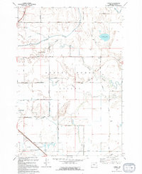
 1994 Imbler1994 Print · USGSSettlement in the Grande Ronde Valley was well-established by the late twentieth century, centered on farming hubs and river management. Researchers can trace family history through the Summerville Cem or explore the rural development around Imbler, Rhinehart, and Alicel.
 - 1994 Map of North Powder
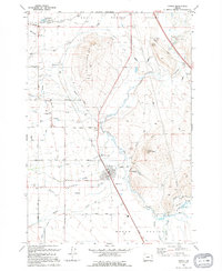
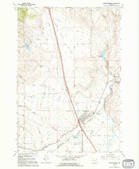 1994 North Powder1994 Print · USGSNorth Powder and the surrounding valley floor are captured here in the early nineties as they straddle the Union and Baker county line. Genealogists and local historians can trace family-named roads like Bagwell Lane and Coughanour Lane, or locate the Cem and Dorion Historical Marker.
 - 1994 Map of Magpie Peak
 1994 Magpie Peak1994 Print · USGSEastern Oregon high desert and agricultural valleys meet in the early nineties, revealing a landscape shaped by water rights and mining. Trace historic irrigation via Lilley Ditch, explore the uplands around Magpie Peak, and locate old Mines.
 - 1995 Map of Lehman Springs, 1998 Print
 1995 Lehman Springs1998 Print · USGSThe high forest country of the Blue Mountains comes alive in the mid-1990s as the timber and water resources are carefully documented. Researchers can trace the layout of Lehman Springs, the Frazier Guard Station, and the Bear Willow Interpretive Trail.
 - 1995 Map of Drumhill Ridge, 1998 Print
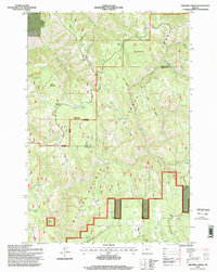 1995 Drumhill Ridge1998 Print · USGSThe Oregon high country along the Umatilla and Union county lines comes into focus in the mid-1990s, revealing a landscape of dense national forests. Researchers can trace historic markers and camps including the Summit Guard Station, Keilers Cabin, and the Whitman Route Overlook.
 - 1995 Map of Rondowa, 1998 Print
 1995 Rondowa1998 Print · USGSDeep in the canyons of northeastern Oregon during the mid-nineties, this map captures the confluence of the Grande Ronde River and the Wallowa River. Trace the remote site of Rondowa and the rugged topography of Duncan Canyon.
Showing maps 1-25 of 42
Top cities of Union County
- La Grande historical maps
- Union historical maps
- Elgin historical maps
- Island City historical maps
- Cove historical maps
- North Powder historical maps
See more
Frequently asked questions
- What are the different types of historical maps available for Union County?
- What is the oldest map of Union County?
- Where can I purchase historical maps of Union County for my home or office?
- Where can I download high-res historical maps of Union County?
- Are there historical topographic maps available for Union County?
- Is there historical aerial imagery available for Union County?
- Where are historical maps of Union County sourced from?