Old Maps of Shaniko, Oregon for Genealogy
Trace your family roots with 26 historic maps of Shaniko. These high-res maps reveal old neighborhoods, homesites, landmarks, and streets — helping you uncover where your ancestors lived and how the area evolved over time.
- Explore historic neighborhoods: Identify where your relatives may have lived in the 1800s or 1900s.
- Compare maps over time: Trace the changes in streets, buildings, and landmarks for multi-generational research.
- Perfect for genealogy & ancestry research: Used by family historians and researchers to map out lineage and migration.
These maps are an incredible resource for exploring your personal connection to Shaniko's past.
Shaniko, OR maps
(26)- 1953 Map of The Dalles, 1965 Print
 1953 The Dalles1965 Print · USGSThe Columbia River Gorge at mid-century shows a region being transformed by massive hydroelectric dams and a growing highway network. Researchers can trace the development of The Dalles Dam, locate the Maryhill Museum, and find old rail stops in Rufus, Wishram, and Arlington.3 unique versions available
 - 1955 Map of Bend, 1964 Print
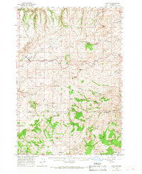
 1955 Bend1964 Print · USGSCentral Oregon was undergoing significant growth in the mid-1960s as irrigation and infrastructure transformed the high desert. Researchers can trace the path of the Oregon Trunk Line, locate old stops like Gateway, and find landmarks like Lava Butte or the Grange.3 unique versions available
 - 1956 Map of The Dalles
 1956 The Dalles1956 Print · USGSThe Columbia River Gorge and the high Cascades are captured in the mid-1950s, showing a vital corridor of rail and road. Researchers can trace the original path of The Old Oregon Trail or locate historical landmarks like the Maryhill Museum and Mount Hood.
 - 1957 Map of Bend
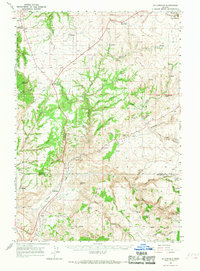
 1957 Bend1957 Print · USGSCentral Oregon in the mid-fifties is a landscape of transition between the high Cascades and the arid volcanic plateau. Local historians can trace the rail corridors of the Oregon Trunk and locate early settlements like Ashwood, Odin Falls, and Camp Sherman.
 - 1957 Map of The Dalles
 1957 The Dalles1957 Print · USGSThe Columbia River Gorge and the high plateaus of the mid-1950s come alive on this detailed survey of northern Oregon and southern Washington. Researchers can trace the path of the Oregon Trail and The Old Barlow Road alongside river towns like The Dalles and Wishram.
 - 1958 Map of Bend
 1958 Bend1958 Print · USGSCentral Oregon in the late fifties was a land of high desert ranching and growing mountain towns. Researchers can trace the rail lines of the Oregon Trunk Railroad, find established settlements like Madras and Sisters, or locate landmarks such as Smith Rock and Lava Butte.
 - 1966 Map of Antelope, 1968 Print
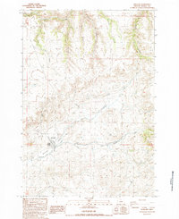
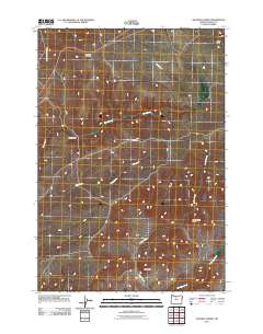
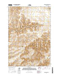
 1966 Antelope1968 Print · USGSIn the mid-1960s, the high plateau of Central Oregon supported a mix of ranching and mining near the settlements of Shaniko and Antelope. Researchers can trace the mineral history of the region at the Oregon King Mine or locate early family markers at the Cemetery and Sorefoot Ranch.
 - 1966 Map of Willowdale, 1968 Print
 1966 Willowdale1968 Print · USGSThe high desert border of Wasco and Jefferson counties comes into focus here during the mid-1960s. Researchers can trace remote ranching outposts like Rooper Ranch, find the Maupin Cemetery, and explore landmarks such as Friends Peak and Willowdale.
 - 1970 Map of Macken Canyon, 1973 Print
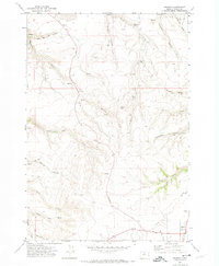
 1970 Macken Canyon1973 Print · USGSThe high desert plateaus along the Wasco and Sherman County line appear here in the early seventies, defined by deep canyons and seasonal springs. Researchers can trace the path of an Old Railroad Grade and locate agricultural landmarks like the lone Grain Elevator and Macken Springs.
 - 1971 Map of Shaniko, 1974 Print
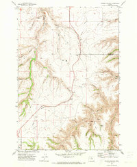
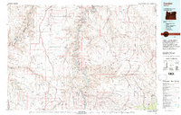
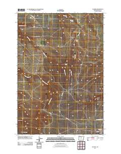
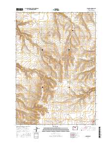
 1971 Shaniko1974 Print · USGSShaniko was an essential hub for Wasco County ranchers and travelers in the early 1970s. Local historians can trace the paths of Bakeoven Road and Jeep Trails to find landmarks like the Hinton-Ward Ranch, the Cem, and Nachter Butte.
 - 1981 Map of Stephenson Mountain, 1997 Print
 1981 Stephenson Mountain1997 Print · USGSThe high-desert ranching and mining heart of North Central Oregon is captured here in the early eighties. Genealogists and historians can trace old settlements and mineral prospects from Shaniko to the Oregon King Mine and the John Day River canyon.
 - 1981 Map of Condon, 1997 Print
 1981 Condon1997 Print · USGSNorth-central Oregon in the early eighties reveals a vast plateau landscape defined by the deep canyons of the John Day and Deschutes rivers. Researchers can trace the rural legacy of the region through small hubs like Condon, Fossil, and the Old Railroad Grade.2 unique versions available
 - 1987 Map of Antelope, 1988 Print
 1987 Antelope1988 Print · USGSAntelope is shown during the late 1980s, situated at the meeting point of high-desert canyons and vital watercourses. Genealogists and local historians can trace the town layout, the nearby settlement of Cold Camp, and local infrastructure like the Antelope Levee.
 - 1987 Map of Shaniko Summit, 1988 Print
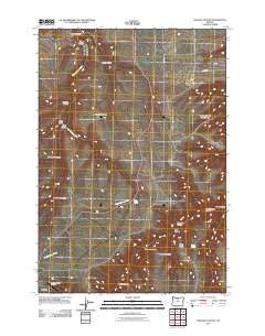
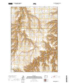
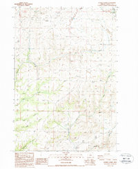 1987 Shaniko Summit1988 Print · USGSWasco County high-desert ranching and canyon lands are captured here in the late twentieth century. Researchers can trace land holdings and natural landmarks like Rooper Ranch, Courthouse Rock, and the historic town site of Shaniko.
 - 2011 Map of Antelope, 2011 Print
 2011 Antelope2011 Print · USGSCovers Shaniko, including Antelope, Wasco County, and other nearby areas
 - 2011 Map of Shaniko Summit, 2011 Print
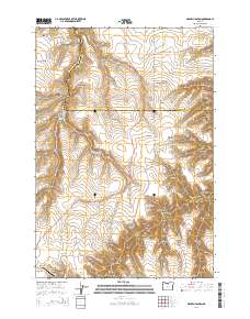
 2011 Shaniko Summit2011 Print · USGSCovers Shaniko, including Wasco County, United States, and other nearby areas
 - 2011 Map of Shaniko, 2011 Print
 2011 Shaniko2011 Print · USGSCovers Shaniko, including Wasco County, United States, and other nearby areas
 - 2011 Map of Macken Canyon, 2011 Print
 2011 Macken Canyon2011 Print · USGSCovers Shaniko, including Wasco County, Sherman County, and other nearby areas
 - 2014 Map of Macken Canyon, 2014 Print
 2014 Macken Canyon2014 Print · USGSCovers Shaniko, including Wasco County, Sherman County, and other nearby areas
 - 2017 Map of Shaniko Summit, 2017 Print
 2017 Shaniko Summit2017 Print · USGSCovers Shaniko, including Wasco County, United States, and other nearby areas
 - 2017 Map of Shaniko, 2017 Print
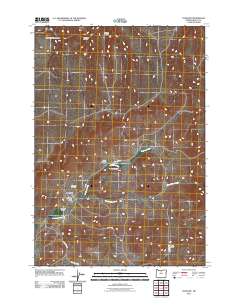
 2017 Shaniko2017 Print · USGSCovers Shaniko, including Wasco County, United States, and other nearby areas
 - 2020 Map of Macken Canyon, 2020 Print
 2020 Macken Canyon2020 Print · USGSCovers Shaniko, including Wasco County, Sherman County, and other nearby areas
 - 2023 Map of Antelope, 2023 Print
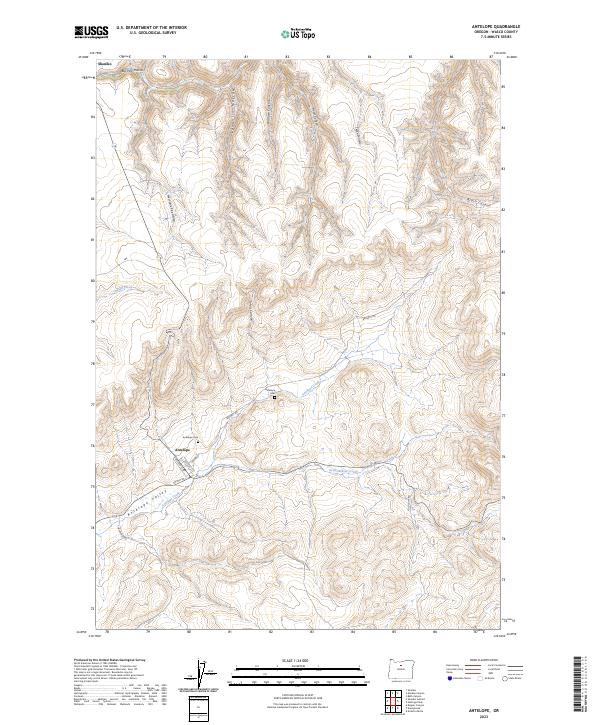 2023 Antelope2023 Print · USGSThe high desert country of Wasco County is documented here during the early twenty-first century, featuring the historic townsites of Antelope and Shaniko. You can trace local genealogy at Antelope Cem or follow the terrain from Antelope Valley through Wallace Canyon.
 - 2023 Map of Shaniko Summit, 2023 Print
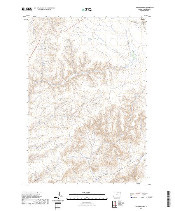 2023 Shaniko Summit2023 Print · USGSThe high desert of Wasco County is captured here in the early twenty-first century, showcasing the rugged plateau around the famous wool-shipping center of Shaniko. Researchers can trace the drainage of Antelope Creek and identify landmarks like Cross Hill and Shaniko Summit.
 - 2023 Map of Macken Canyon, 2023 Print
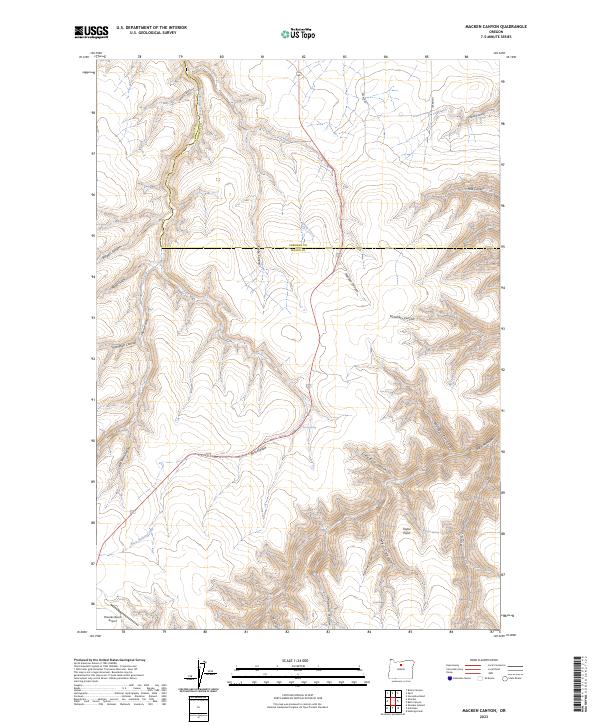 2023 Macken Canyon2023 Print · USGSThe high plateau of Wasco and Sherman counties comes into focus in this recent survey of the North-Central Oregon ranchlands. Genealogists and historians can trace family-named landmarks like Taylor Point or locate remote water sources such as Kelsey Spring and Taylor Springs.
Showing maps 1-25 of 26
Top cities near Shaniko
Frequently asked questions
- What are the different types of historical maps available for Shaniko?
- What is the oldest map of Shaniko?
- Where can I purchase historical maps of Shaniko for my home or office?
- Where can I download high-res historical maps of Shaniko?
- Are there historical topographic maps available for Shaniko?
- Is there historical aerial imagery available for Shaniko?
- Where are historical maps of Shaniko sourced from?