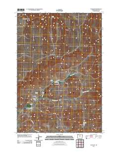
2011 Map of Antelope
USGS Topo · Published 2011About this map
Antelope sits as the primary settlement in this part of Wasco County, situated where the terrain opens into Antelope Valley. The town's layout is centered around the Antelope Post Office, serving as a localized hub for the surrounding ranching and agricultural landscape. To the northeast, the Antelope Cemetery occupies a quiet position overlooking the drainage of Antelope Creek. The geography is defined by a series of steep drainages and hollows, including Laughlin Hollow, West Little Pine Hollow, and Wallace Canyon, which feed into the larger creek systems. Moving southeast, the landscape transitions toward Cold Camp near the intersection of Cold Camp Rd and Grub Hollow Creek. This network of rural roads, such as Bennett Rd and Brogan Rd, provides access to the isolated canyons and family-named landmarks like Johns Canyon that characterize this high-desert region of Oregon.
Find a feature on this map
16 named features on this map. Tap any name to fly to it.
Don’t see what you’re looking for? This feature index may not catch every label — zoom into the map to look around manually.
Map Details
Editions of this 2011 Antelope Map
This is the sole edition of this map. No revisions or reprints were ever made.
Other maps of this area

1953 · The Dalles
USGS Topo · 1:250,000

1955 · Bend
USGS Topo · 1:250,000

1956 · The Dalles
USGS Topo · 1:250,000

1957 · Bend
USGS Topo · 1:250,000

1957 · The Dalles
USGS Topo · 1:250,000

1958 · Bend
USGS Topo · 1:250,000

1966 · Antelope
USGS Topo · 1:62,500

1966 · Willowdale
USGS Topo · 1:62,500

1970 · Macken Canyon
USGS Topo · 1:24,000
1971 · Bath Canyon
USGS Topo · 1:24,000