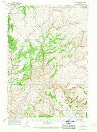
1966 Map of Willowdale
USGS Topo · Published 1968About this map
Willowdale serves as a central point in this high desert landscape, situated where Trout Creek meets the rugged network of canyons that define the border between Wasco and Jefferson counties. The 1960s terrain is marked by a complex system of drainage and geological landmarks, including Friends Peak, Pony Butte, and the distinct formation of Courthouse Rock. This survey records a livestock-driven economy, evidenced by numerous Corral locations and the Rooper Ranch, linked by a web of jeep trails and early roads.
Find a feature on this map
64 named features on this map. Tap any name to fly to it.
Don’t see what you’re looking for? This feature index may not catch every label — zoom into the map to look around manually.
Map Details
Editions of this 1966 Willowdale Map
This is the sole edition of this map. No revisions or reprints were ever made.
Other maps of this area
1928 · Madras
USGS Topo · 1:125,000
1930 · Dufur
USGS Topo · 1:125,000
1931 · Madras
USGS Topo · 1:125,000
1934 · Dufur
USGS Topo · 1:125,000
1953 · The Dalles
USGS Topo · 1:250,000
1955 · Bend
USGS Topo · 1:250,000
1956 · The Dalles
USGS Topo · 1:250,000
1957 · Bend
USGS Topo · 1:250,000
1957 · The Dalles
USGS Topo · 1:250,000
1958 · Bend
USGS Topo · 1:250,000