Old Maps of Elk County, Pennsylvania for Metal Detecting
Plan your next treasure hunt with 200 historic maps of Elk County. Find old homesites, ghost towns, trails, and gathering spots that may be lost to time — perfect for identifying promising metal detecting locations.
- Locate forgotten sites: Uncover places like long-lost settlements, abandoned rail lines, or gathering spots.
- Plan better hunts: Use map overlays combined with LiDAR or satellite views to narrow in on historically rich areas.
- Made for detectorists: Thousands of hobbyists use these maps to discover relics, coins, and hidden history.
Use these historic maps to boost your research and find new opportunities beneath the surface of Elk County.
Elk County, PA maps
(200)- 1918 Map of Loleta
 1918 Loleta1918 Print · USGSThe Pennsylvania timber and rail country comes to life in this late-war tactical survey of the Clarion River valley. Genealogists and researchers can trace the early footprints of Marienville, Clarington, and the now-quiet settlement of Loleta.
 - 1929 Map of Karthaus
 1929 Karthaus1929 Print · USGSThe West Branch Susquehanna River and its steep hollows defined life in Clearfield County during the late twenties. Researchers can trace the riverfront New York Central Railroad and find dozens of rural school sites like Fairview Sch and the community at Frenchville.3 unique versions available
 - 1929 Map of Clearfield
 1929 Clearfield1929 Print · USGSThe riverfront and rail lines of central Pennsylvania come alive in this late 1920s survey of the West Branch Susquehanna River valley. Genealogists and historians can trace the foundations of local society through landmarks like the Leonard Waterford Sch and the rural crossroads of LeContes Mills.2 unique versions available
 - 1929 Map of Penfield, 1954 Print
 1929 Penfield1954 Print · USGSCentral Pennsylvania's rugged plateau and coal regions are mapped here in the late twenties, showing the intersection of major rail lines and isolated mountain communities. Genealogists can locate family landmarks like the Hoover Farm and several vanished rural schoolhouses including Hickory Sch and Laborde Sch.3 unique versions available
 - 1932 Map of Clearfield
 1932 Clearfield1932 Print · USGSClearfield and the West Branch of the Susquehanna are captured here in the early 1930s as a vital hub of rail and river industry. Researchers can trace ancestral locations through numerous rural landmarks like Lecontes Mills, Goshen Ch, and Mt Sinai Sch.4 unique versions available
 - 1932 Map of Penfield
 1932 Penfield1932 Print · USGSClearfield County is shown in the early thirties at a time when mountain railroads and forest management defined the region. Local historians can trace the paths of the Pennsylvania RR through Penfield or locate schools such as Coal Hill Sch and Hickory Sch.3 unique versions available
 - 1932 Map of Karthaus
 1932 Karthaus1932 Print · USGSThe Susquehanna’s West Branch winds through Clearfield and Centre Counties in the late 1920s, a landscape shaped by the rail and timber industries. Genealogists can trace family names through dozens of rural schools and churches like Mignot Sch and Fairview Ch.3 unique versions available
 - 1934 Map of Kane
 1934 Kane1934 Print · USGSThe timber and oil lands of McKean and Elk counties are captured here in the mid-1930s as a network of railroads and pipelines. Researchers can trace family roots in settlements like De Young PO, locate CCC Camp No 7, or find the Greendale Sch.3 unique versions available
 - 1935 Map of Mt. Jewett
 1935 Mt. Jewett1935 Print · USGSElk and McKean counties at the height of the Great Depression reveal a landscape shaped by competing timber and rail interests. Researchers can trace the junction of three major railroads and find vanished operations at Burning Well and Instanter.3 unique versions available
 - 1936 Map of Marienville
 1936 Marienville1936 Print · USGSThe Pennsylvania highlands between the Clarion River and Allegheny National Forest appear here in the mid-1930s. Researchers can trace the Baltimore and Ohio RR through Marienville or locate family landmarks like Donnely Cem and Greenwood Ch.3 unique versions available
 - 1939 Map of Kane
 1939 Kane1939 Print · USGSThe northern Pennsylvania plateau in the late 1930s is a landscape of timber-towns and industrial rail sidings. Genealogists and researchers can trace the old Baltimore and Ohio line through Kane, James City, and the rural Russell City De Young P O.3 unique versions available
 - 1940 Map of Hallton
 1940 Hallton1940 Print · USGSElk and Jefferson Counties appear here in the early 1940s, showing a landscape defined by the Clarion River valley and the growth of the Allegheny National Forest. Researchers can find old industrial sites and rural landmarks like the Empire Tunnel, St Tobias Cem, and the CCC Camp.3 unique versions available
 - 1940 Map of Mt. Jewett
 1940 Mt. Jewett1940 Print · USGSNorthern Pennsylvania’s timber and rail country is captured here during the mid-1930s, showing a landscape defined by industrial development. Researchers can locate vanished rural infrastructure like the Stenstrom Sch, the CCC Camp, and specific rail stops at Dahoga and Instanter.3 unique versions available
 - 1941 Map of Marienville
 1941 Marienville1941 Print · USGSForest, Clarion, and Jefferson counties meet along the winding Clarion River in this pre-war survey of northern Pennsylvania's timberlands. Genealogists can locate numerous rural schoolhouses and social landmarks like Kahletown Hall, Greenwood Ch, and the Downey Cem.3 unique versions available
 - 1941 Map of Benezette, 1952 Print
 1941 Benezette1952 Print · USGSElk County at the start of the 1940s reveals a network of valley settlements defined by the Pennsylvania RR and Sinnemahoning Creek. Researchers can trace rural life through scattered landmarks like Mt Zion Ch, Rathbun Sch, and the high point at Winslow Hill.3 unique versions available
 - 1941 Map of Ridgway, 1956 Print
 1941 Ridgway1956 Print · USGSElk County at the start of the 1940s reveals a landscape shaped by coal mining and heavy rail industry. Genealogists can locate family homes near Dagus Mines or trace the early foundations of Ridgway and St. Marys.2 unique versions available
 - 1943 Map of Hallton
 1943 Hallton1943 Print · USGSThe Clarion River valley and surrounding plateau are captured here just before the mid-century, revealing a network of isolated settlements and forest industry. Researchers can find old sites like the CCC Camp near Croyland, the Empire Tunnel, and small rural schools including Lake City Sch.3 unique versions available
 - 1943 Map of Benezette
 1943 Benezette1943 Print · USGSElk and Cameron counties are captured during the early 1940s, showing a landscape of deep timber-run hollows and active rail corridors. Local historians can locate vanished schoolhouses like Rathbun Sch, mountain churches such as Mt Zion Ch, and the winding tracks of the Pennsylvania railroad.2 unique versions available
 - 1944 Map of Ridgway
 1944 Ridgway1944 Print · USGSElk County at the height of its industrial rail era reveals a landscape of coal mines and mountain settlements. Trace the operations of the Toby Mine and Kyler Mine or find family roots at Decker Chapel and Gardner Hill Sch.3 unique versions available
 - 1945 Map of Driftwood, 1953 Print
 1945 Driftwood1953 Print · USGSCameron County communities thrive along the river bends and rail lines at the end of World War II. Researchers can trace the dual rail paths of the Pennsylvania and Baltimore and Ohio railroads through Driftwood and locate the First Fork Sch.4 unique versions available
 - 1945 Map of Driftwood, 1955 Print
 1945 Driftwood1955 Print · USGSCameron and Elk Counties reveal their mid-century industrial character along the river valleys of the Allegheny Plateau. Researchers can trace the dual influence of the Baltimore and Ohio railroad and isolated mountain burial grounds like Mason Hill Cem and Mix Run Cem.3 unique versions available
 - 1947 Map of Driftwood
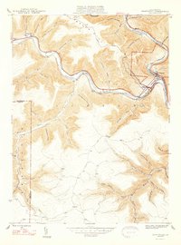 1947 Driftwood1947 Print · USGSCameron County's rugged rail corridors and remote river valleys are captured here just after the war. Researchers can trace historic family burial sites at Mason Hill Cem and Mix Run Cem or locate the old junctions at Driftwood and Castle Garden.2 unique versions available
 - 1948 Map of Crosby, 1952 Print
 1948 Crosby1952 Print · USGSPost-war McKean and Cameron counties appear here as a landscape of mountain rail lines and valley settlements. Trace the Pennsylvania Railroad through Hamlin Sta, locate the Sweets Sch, or find family names near Clermont Cem.3 unique versions available
 - 1948 Map of Wildwood Fire Tower, 1958 Print
 1948 Wildwood Fire Tower1958 Print · USGSThe Pennsylvania high country of Elk and McKean counties comes into focus in the years just after the war, showing a landscape of deep hollows and forest runs. Genealogists and hikers can trace the remote reaches of Wellendorf Station, Devils Hole, and Boy Scout Hollow.5 unique versions available
 - 1948 Map of Crosby, 1965 Print
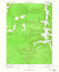 1948 Crosby1965 Print · USGSMcKean County at the end of the 1940s reveals a rugged landscape of narrow valley settlements and high-altitude pipe lines. Local historians can trace the rail sidings at Hamlin Sta and search for family roots at Norwich Cem or the isolated village of Betula.3 unique versions available
Showing maps 1-25 of 200
Top cities of Elk County
- Saint Marys historical maps
- Ridgway historical maps
- Johnsonburg historical maps
- Benezette Township historical maps
- Millstone Township historical maps
Frequently asked questions
- What are the different types of historical maps available for Elk County?
- What is the oldest map of Elk County?
- Where can I purchase historical maps of Elk County for my home or office?
- Where can I download high-res historical maps of Elk County?
- Are there historical topographic maps available for Elk County?
- Is there historical aerial imagery available for Elk County?
- Where are historical maps of Elk County sourced from?