1950s Maps of Colleton County, South Carolina
Explore 8 historic maps of Colleton County from the 1950s. These maps offer a rare glimpse into what life looked like during the 1950s — showing old roads, neighborhoods, homes, and landmarks that have changed or disappeared over time.
Whether you're researching your family's past, planning a metal detecting trip, or studying how Colleton County's landscape evolved across the 1950s, these high-resolution maps are a powerful tool for exploring the history of this region.
- Focus on a specific era: All maps on this page are from the 1950s, giving you a focused view of this time period.
- See what’s changed: Compare century-old streets, trails, and buildings to today's modern landscape using overlays and satellite layers.
- Research with precision: Use these maps for genealogy, historical research, land use analysis, or educational projects.
- View, download, or print: Maps are fully viewable online in high resolution, and can be downloaded or printed for your own records.
Start exploring Colleton County's history through authentic maps from the 1950s. This is your window into the past.
Colleton County, SC maps
(8)- 1954 Map of Augusta
 1954 Augusta1954 Print · USGSThe Savannah River valley and South Carolina Midlands are captured here during a period of post-war growth. Researchers can trace the rail-and-river economy through the Southern RR corridor and locate historic settlements like Aiken, Orangeburg, and Sumter.
 - 1956 Map of Frogmore, 1957 Print
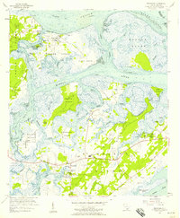 1956 Frogmore1957 Print · USGSCoastal Beaufort County in the mid-fifties is a labyrinth of tidal marsh and island life. Genealogists can trace family heritage through numerous landmarks like Penn Community Services, Brick Ch, and the Scottsville Cem.3 unique versions available
 - 1956 Map of Edisto Beach, 1957 Print
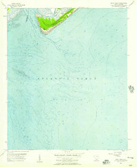 1956 Edisto Beach1957 Print · USGSThe South Carolina coast near Edisto Beach is captured in the mid-1950s, showing the intersection of the South Edisto River and the sea. Researchers can trace the early layout of Edisto Beach State Park and locate landmarks like The Mounds.2 unique versions available
 - 1956 Map of St. Helena Sound, 1957 Print
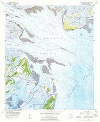 1956 St. Helena Sound1957 Print · USGSCoastal Beaufort County comes alive in the mid-fifties, showing a landscape defined by tidal rivers and the historic plantations of the Sea Islands. Genealogists and historians can trace the foundations of St Helena Island through Coffin Point Cem and the Hunting Island Lighthouse.4 unique versions available
 - 1957 Map of Augusta, 1966 Print
 1957 Augusta1966 Print · USGSThe Savannah River and Santee basins are captured here during a period of massive military and industrial expansion in the late fifties. Genealogists can trace family footprints across Four Hole Swamp or near the Savannah River Plant.3 unique versions available
 - 1957 Map of Savannah, 1967 Print
 1957 Savannah1967 Print · USGSThe Lowcountry and Georgia coastal plain are shown here in the late fifties, prior to modern expansion. Researchers can trace the rail-and-river economy through the Central of Georgia lines and the Ogeechee River wetlands.4 unique versions available
 - 1958 Map of Augusta
 1958 Augusta1958 Print · USGSThe borderlands between Georgia and South Carolina come alive in the 1950s, showing the early footprint of the Savannah River Plant. Genealogists and historians can trace rail-dependent towns and rural landmarks from Orangeburg to the Fort Jackson Military Reservation.
 - 1959 Map of Fort Fremont
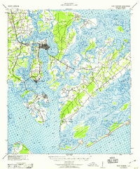 1959 Fort Fremont1959 Print · USGSThe South Carolina Sea Islands are captured here in the mid-twentieth century, emphasizing the deep connection between the tides and local settlement. Genealogists and historians can trace the rail lines to Beaufort Sta, locate the grounds of Ft Fremont, and explore the layout of Parris Island.
End of results
Showing maps 1-8 of 8
Top cities of Colleton County
- Walterboro historical maps
- Cottageville historical maps
- Edisto Beach historical maps
- Smoaks historical maps
- Williams historical maps
- Lodge historical maps
Frequently asked questions
- What are the different types of historical maps available for Colleton County?
- What is the oldest map of Colleton County?
- Where can I purchase historical maps of Colleton County for my home or office?
- Where can I download high-res historical maps of Colleton County?
- Are there historical topographic maps available for Colleton County?
- Is there historical aerial imagery available for Colleton County?
- Where are historical maps of Colleton County sourced from?