1940s Maps of Colleton County, South Carolina
Explore 17 historic maps of Colleton County from the 1940s. These maps offer a rare glimpse into what life looked like during the 1940s — showing old roads, neighborhoods, homes, and landmarks that have changed or disappeared over time.
Whether you're researching your family's past, planning a metal detecting trip, or studying how Colleton County's landscape evolved across the 1940s, these high-resolution maps are a powerful tool for exploring the history of this region.
- Focus on a specific era: All maps on this page are from the 1940s, giving you a focused view of this time period.
- See what’s changed: Compare century-old streets, trails, and buildings to today's modern landscape using overlays and satellite layers.
- Research with precision: Use these maps for genealogy, historical research, land use analysis, or educational projects.
- View, download, or print: Maps are fully viewable online in high resolution, and can be downloaded or printed for your own records.
Start exploring Colleton County's history through authentic maps from the 1940s. This is your window into the past.
Colleton County, SC maps
(17)- 1943 Map of Olar
 1943 Olar1943 Print · USGSThe rural Lowcountry around Olar and Ehrhardt appears here during the early 1940s, showing a landscape shaped by river swamps and rail lines. Genealogists can trace family footprints across dozens of sites like Kearse Chapel, Rizers Chapel, and Folk Sch.2 unique versions available
 - 1943 Map of Cottageville
 1943 Cottageville1943 Print · USGSThe South Carolina Lowcountry in the early forties reveals a landscape of river landings and remote crossroads between the Edisto and the swamps. Genealogists can trace family landmarks and school sites like Rehoboth Sch or locate the old Sullivans Ferry crossing.
 - 1943 Map of Edisto Island
 1943 Edisto Island1943 Print · USGSThe South Carolina Lowcountry is captured here in the early 1940s, showing a landscape of tidal islands and rail-side settlements. Researchers can trace the layout of Freedman Village, find old school sites like Seaside Sch, and locate the docks at Steamboat Landing.
 - 1943 Map of Yemassee
 1943 Yemassee1943 Print · USGSThe South Carolina Lowcountry in the early 1940s is defined by its massive tidal rivers and the vital rail junctions at Yemassee. Genealogists and historians can trace old community lines near McPhersonville, Mt Nevo Ch, and the coastal reaches of Seabrook.3 unique versions available
 - 1943 Map of Green Pond
 1943 Green Pond1943 Print · USGSThe Lowcountry river systems of South Carolina are captured here in the 1940s as they wind toward the Atlantic. Genealogists and historians can trace old community ties at First African Ch or locate the Old Fort and rail stops at Ashepoo Siding.2 unique versions available
 - 1943 Map of Lodge
 1943 Lodge1943 Print · USGSThe South Carolina Lowcountry is captured here in the early 1940s at the junction of four counties. Genealogists can trace family roots through numerous rural landmarks like H & B Junction, Hunters Chapel, and the Little Swamp Sch.
 - 1943 Map of Orangeburg
 1943 Orangeburg1943 Print · USGSCoastal plain settlements and river forks define the South Carolina lowcountry during the early war years. Genealogists can trace family landmarks like Bochette Cem, Hunters Chapel Zion Ch, and unique sites like the Indian Field Camp Grounds.
 - 1943 Map of Cummings
 1943 Cummings1943 Print · USGSColleton County's river-and-rail landscape is captured here during the Second World War, showing a network of rural school districts and crossroads. Genealogists can trace family footprints through dozens of local landmarks like Hudsons Mill, Islandton, and Jerusalem Ch.
 - 1943 Map of Walterboro
 1943 Walterboro1943 Print · USGSSouth Carolina’s coastal plain is captured here in the mid-1940s, centered on the growing hub of Walterboro. Genealogists and historians can trace old family footprints through dozens of rural sites like Catholic Hill, Liveoak Cemetery, and Mashawville Sch.
 - 1943 Map of Ridgeville
 1943 Ridgeville1943 Print · USGSDorchester County and its neighbors are shown here during the early years of the Second World War as the rail-and-timber landscape remained deeply rural. Genealogists can trace family landmarks and rural education hubs like Mudville Sch, Rehoboth Sch, and the Cypress Swamp Camp Meeting Grounds.
 - 1944 Map of Varnville
 1944 Varnville1944 Print · USGSHampton County was a bustling corridor of rail lines and rural community centers in the mid-1940s. Genealogists can trace family footprints through numerous local landmarks like Rock Hill Ch, Millville Sch, and the junction at Fairfax.
 - 1944 Map of Wadmelaw Island
 1944 Wadmelaw Island1944 Print · USGSThe South Carolina Lowcountry islands are captured here in the early twentieth century, showing a landscape of tidal creeks and remote coastal settlements. Genealogists can locate family landmarks such as Rockville, Legareville, and several country schools like Bogle School.2 unique versions available
 - 1944 Map of Fort Fremont
 1944 Fort Fremont1944 Print · USGSCoastal South Carolina during the Second World War shows a strategic shoreline defined by naval history and sea island life. Researchers can trace the layout of the Marine Barracks, locate family-named points like Sams Pt, or find the rail terminus at Port Royal.
 - 1944 Map of St. George
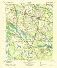 1944 St. George1944 Print · USGSMid-century Dorchester County is anchored here by the railroad junction at St George and the winding Edisto River. Genealogists can trace hundreds of family sites, from the Indian Field Camp Grounds to James Cem and Cattle Creek Sch.
 - 1947 Map of Savannah
 1947 Savannah1947 Print · USGSCoastal Georgia and South Carolina are captured here in the mid-forties, showing the rail-and-river networks of the Lowcountry. Genealogists and researchers can trace old crossroads and river towns from Statesboro to Beaufort, alongside military sites like Camp Stewart and Parris Island.
 - 1948 Map of St. Helena Sound
 1948 St. Helena Sound1948 Print · USGSCoastal South Carolina is captured here in the late 1940s, showing the intricate network of sea islands and tidal sounds before extensive modern development. Researchers can trace the shoreline of Hunting Island, locate the Tower marker, and study the remote marshlands of Otter Island and Fripps Island.2 unique versions available
 - 1948 Map of Savannah
 1948 Savannah1948 Print · USGSThe Georgia and South Carolina Lowcountry comes alive in this post-war survey of the coast and its river-fed hinterlands. Genealogists and historians can trace rail lines like the Central of Georgia RR and find established settlements such as Isle of Hope and Sylvania.
End of results
Showing maps 1-17 of 17
Top cities of Colleton County
- Walterboro historical maps
- Cottageville historical maps
- Edisto Beach historical maps
- Smoaks historical maps
- Williams historical maps
- Lodge historical maps
Frequently asked questions
- What are the different types of historical maps available for Colleton County?
- What is the oldest map of Colleton County?
- Where can I purchase historical maps of Colleton County for my home or office?
- Where can I download high-res historical maps of Colleton County?
- Are there historical topographic maps available for Colleton County?
- Is there historical aerial imagery available for Colleton County?
- Where are historical maps of Colleton County sourced from?