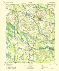
1944 Map of St. George
USGS Topo · Published 1944About this map
The Edisto River winds through the heart of Dorchester County, defining the rural landscape of the mid-1940s. Centered on St George, the map reveals a community structured by the Southern railroad and the historic Augusta Road. This survey documents a deeply established religious and social network, highlighted by the Indian Field Camp Grounds and an exceptional density of small country institutions like Green Pond Ch, Bethany Ch, and Maple Cane Sch.
Find a feature on this map
60 named features on this map. Tap any name to fly to it.
Don’t see what you’re looking for? This feature index may not catch every label — zoom into the map to look around manually.
Map Details
Editions of this 1944 St. George Map
This is the sole edition of this map. No revisions or reprints were ever made.
Other maps of this area

1918 · Walterboro
USGS Topo · 1:62,500

1918 · Cottageville
USGS Topo · 1:62,500

1919 · Ridgeville
USGS Topo · 1:48,000

1919 · Cummings
USGS Topo · 1:62,500

1919 · Lodge
USGS Topo · 1:62,500

1920 · Eutawville
USGS Topo · 1:48,000

1920 · Bowman
USGS Topo · 1:48,000

1920 · Lodge
USGS Topo · 1:48,000

1920 · Ridgeville
USGS Topo · 1:62,500

1920 · Orangeburg
USGS Topo · 1:48,000